Kanton Aigre
| Kanton Aigre | |
|---|---|
| Geografie | |
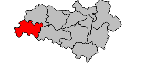 Kanton na mapě arrondissementu Confolens | |
| Hlavní město | Aigre |
| Souřadnice | 45°53′43″ s. š., 0°0′41″ v. d. |
| Rozloha | 197,33 km² |
| Obyvatelstvo | |
| Počet obyvatel | 4 774 (2009) |
| Hustota zalidnění | 24,2 obyv./km² |
| Správa regionu | |
| Stát | Francie Francie Francie |
| Region | Poitou-Charentes |
| Departement | Charente |
| Arrondissement | Confolens |
| Druh celku | Kanton |
| Podřízené celky | Obce (počet: 15) |
| Zánik | 21. března 2015 |
| Některá data mohou pocházet z datové položky. | |
Kanton Aigre (fr. Canton d'Aigre) je francouzský kanton v departementu Charente v regionu Poitou-Charentes. Skládá se z 15 obcí.
Obce kantonu
- Aigre
- Barbezières
- Bessé
- Charmé
- Ébréon
- Fouqueure
- Les Gours
- Ligné
- Lupsault
- Oradour
- Ranville-Breuillaud
- Saint-Fraigne
- Tusson
- Verdille
- Villejésus
 | Tento článek je příliš stručný nebo postrádá důležité informace. Pomozte Wikipedii tím, že jej vhodně rozšíříte. Nevkládejte však bez oprávnění cizí texty. |
| Kantony v departementu Charente | ||
|---|---|---|
| Aigre • Angoulême-Est • Angoulême-Nord • Angoulême-Ouest • Aubeterre-sur-Dronne • Baignes-Sainte-Radegonde • Barbezieux-Saint-Hilaire • Blanzac-Porcheresse • Brossac • Chabanais • Chalais • Champagne-Mouton • Châteauneuf-sur-Charente • Cognac-Nord • Cognac-Sud • Confolens-Nord • Confolens-Sud • La Couronne • Gond-Pontouvre • Hiersac • Jarnac • Mansle • Montbron • Montembœuf • Montmoreau-Saint-Cybard • La Rochefoucauld • Rouillac • Ruelle-sur-Touvre • Ruffec • Saint-Amant-de-Boixe • Saint-Claud • Segonzac • Soyaux • Villebois-Lavalette • Villefagnan |  | |
Portály: Francie


