Liste der Naturschutzgebiete im Landkreis Saalfeld-Rudolstadt
Im Thüringer Landkreis Saalfeld-Rudolstadt gibt es 16 Naturschutzgebiete.
| Name des Gebietes | Bild | Kennung | WDPA | Landkreis / Stadt | Beschreibung / Bemerkungen | Standort | Fläche in Hektar | Datum der Verordnung |
|---|---|---|---|---|---|---|---|---|
| Assberg – Hasenleite |  weitere Bilder | 142 | 14503 | Landkreis Saalfeld-Rudolstadt | Position | 581,4 | 1982 | |
| Bohlen | 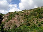 weitere Bilder | 160 | 162484 | Landkreis Saalfeld-Rudolstadt | Position | 22,2 | 1938 | |
| Dissau und Steinberg |  weitere Bilder | 157 | 14499 | Landkreis Saalfeld-Rudolstadt | Position | 143,4 | 1961 | |
| Eichberg und Talgrube | 156 | 318326 | Landkreis Saalfeld-Rudolstadt | Position | 20,1 | 1961 | ||
| Greifenstein |  weitere Bilder | 158 | 163316 | Landkreis Saalfeld-Rudolstadt | Position | 59,9 | 1961 | |
| Hölltal | 139 | 163772 | Landkreis Saalfeld-Rudolstadt | Position | 19,4 | 1982 | ||
| Ilmwand |  weitere Bilder | 182 | 163849 | Landkreis Saalfeld-Rudolstadt | Position | 36,3 | 1989 | |
| Meuraer Heide | 175 | 14501 | Landkreis Saalfeld-Rudolstadt | Position | 291,4 | 1981 | ||
| Pennewitzer Teiche – Unteres Wohlrosetal |  weitere Bilder | 337 | 329571 | Ilm-Kreis, Landkreis Saalfeld-Rudolstadt | Position | 424,6 | 2004 | |
| Schenkenberg |  weitere Bilder | 274 | 165380 | Landkreis Saalfeld-Rudolstadt | Position | 51,2 | 1996 | |
| Schieferbrüche am Bocksberg | 281 | 165386 | Landkreis Saalfeld-Rudolstadt | Position | 60,3 | 1997 | ||
| Schwarzatal |  weitere Bilder | 159 | 14500 | Landkreis Saalfeld-Rudolstadt | Position | 615 | 1961 | |
| Staatsbruch |  weitere Bilder | 285 | 319132 | Landkreis Saalfeld-Rudolstadt | Position | 90,6 | 2001 | |
| Uhlstädter Heide |  weitere Bilder | 176 | 14502 | Landkreis Saalfeld-Rudolstadt, Saale-Orla-Kreis | Position | 1153,5 | 1981 | |
| Wurmbergwiese | 116 | 166377 | Landkreis Saalfeld-Rudolstadt | Position | 6,4 | 1967 | ||
| Wurzelbergfarmde | 118 | 318468 | Landkreis Saalfeld-Rudolstadt, Landkreis Sonneberg | Position | 238,6 | 1961 |
Siehe auch
Quellen
- Thüringer Landesanstalt für Umwelt und Geologie, Landkreis Saalfeld-Rudolstadt
- Common Database on Designated Areas Datenbank, Version 14
Weblinks
Commons: Naturschutzgebiete im Landkreis – Sammlung von Bildern, Videos und Audiodateien
- Karte mit allen Koordinaten:
- OSM
- WikiMap
Listen der Naturschutzgebiete in den Landkreisen und kreisfreien Städten in Thüringen


Naturschutzgebiete in den Landkreisen
Altenburger Land | Eichsfeld | Gotha | Greiz | Hildburghausen | Ilm-Kreis | Kyffhäuserkreis | Nordhausen | Saale-Holzland-Kreis | Saale-Orla-Kreis | Saalfeld-Rudolstadt | Schmalkalden-Meiningen | Sömmerda | Sonneberg | Unstrut-Hainich-Kreis | Wartburgkreis | Weimarer Land
Naturschutzgebiete in den kreisfreien Städten
Erfurt | Gera | Jena | Suhl | Weimar


