Ahuazotepec
Municipality in Puebla, Mexico

Coat of arms

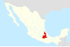
Location of the municipality in Puebla
 Mexico
 (2010)
Ahuazotepec Municipality is a municipality in the Mexican state of Puebla in south-eastern Mexico.[1]
Geography
Climate
| Climate data for Ahuazotepec (1951–2010) | |||||||||||||
|---|---|---|---|---|---|---|---|---|---|---|---|---|---|
| Month | Jan | Feb | Mar | Apr | May | Jun | Jul | Aug | Sep | Oct | Nov | Dec | Year |
| Record high °C (°F) | 29.5 (85.1) | 29.0 (84.2) | 31.0 (87.8) | 34.0 (93.2) | 32.5 (90.5) | 30.5 (86.9) | 29.5 (85.1) | 30.5 (86.9) | 29.5 (85.1) | 29.5 (85.1) | 26.5 (79.7) | 28.0 (82.4) | 34.0 (93.2) |
| Mean daily maximum °C (°F) | 18.3 (64.9) | 19.8 (67.6) | 21.3 (70.3) | 23.0 (73.4) | 23.2 (73.8) | 21.8 (71.2) | 20.2 (68.4) | 20.3 (68.5) | 19.5 (67.1) | 18.7 (65.7) | 19.1 (66.4) | 18.9 (66.0) | 20.3 (68.5) |
| Daily mean °C (°F) | 10.6 (51.1) | 11.6 (52.9) | 13.0 (55.4) | 14.9 (58.8) | 15.5 (59.9) | 15.2 (59.4) | 14.3 (57.7) | 14.1 (57.4) | 13.9 (57.0) | 12.3 (54.1) | 11.6 (52.9) | 11.0 (51.8) | 13.2 (55.8) |
| Mean daily minimum °C (°F) | 2.9 (37.2) | 3.3 (37.9) | 4.7 (40.5) | 6.9 (44.4) | 7.7 (45.9) | 8.6 (47.5) | 8.3 (46.9) | 7.9 (46.2) | 8.4 (47.1) | 6.0 (42.8) | 4.0 (39.2) | 3.0 (37.4) | 6.0 (42.8) |
| Record low °C (°F) | −5.5 (22.1) | −7.0 (19.4) | −5.0 (23.0) | −2.0 (28.4) | 1.0 (33.8) | 0.0 (32.0) | 2.0 (35.6) | 1.5 (34.7) | 0.5 (32.9) | −6.0 (21.2) | −5.5 (22.1) | −7.5 (18.5) | −7.5 (18.5) |
| Average precipitation mm (inches) | 13.9 (0.55) | 20.5 (0.81) | 15.1 (0.59) | 34.3 (1.35) | 53.0 (2.09) | 101.5 (4.00) | 143.9 (5.67) | 100.5 (3.96) | 192.5 (7.58) | 101.7 (4.00) | 21.8 (0.86) | 5.3 (0.21) | 804.0 (31.65) |
| Average precipitation days (≥ 0.1 mm) | 3.3 | 4.7 | 3.7 | 6.6 | 8.6 | 11.6 | 16.4 | 14.1 | 17.7 | 11.2 | 5.7 | 1.9 | 105.5 |
| Source: Servicio Meteorologico Nacional[2][3] | |||||||||||||
References
- ^ "-". Enciclopedia de los Municipios de México. Instituto Nacional para el Federalismo y el Desarrollo Municipal. Archived from the original on April 5, 2007. Retrieved January 4, 2010.
- ^ "Estado de Puebla-Estacion: Ahuazotepec". Normales Climatologicas 1951–2010 (in Spanish). Servicio Meteorologico Nacional. Archived from the original on 3 March 2016. Retrieved 27 April 2015.
- ^ "Extreme Temperatures and Precipitation for Ahuazotepec 1982–2009" (in Spanish). Servicio Meteorológico Nacional. Archived from the original on 3 March 2016. Retrieved 27 April 2015.
- v
- t
- e
 State of Puebla
Puebla (capital)
towns
- Acajete
- Acateno
- Acatzingo
- Acteopan
- Ahuacatlán
- Ahuatlán
- Ahuazotepec
- Ahuehuetitla
- Ajalpan
- Albino Zertuche
- Aljojuca
- Altepexi
- Amixtlán
- Amozoc
- Aquixtla
- Atempan
- Atexcal
- Atlequizayan
- Atlixco
- Atoyatempan
- Atzala
- Atzitzihuacán
- Atzitzintla
- Axutla
- Ayotoxco de Guerrero
- Calpan
- Caltepec
- Camocuautla
- Cañada Morelos
- Caxhuacan
- Coatepec
- Coatzingo
- Cohetzala
- Cohuecán
- Coronango
- Coxcatlán
- Coyomeapan
- Coyotepec
- Cuapiaxtla de Madero
- Cuautempan
- Cuautinchán
- Cuautlancingo
- Cuayuca de Andrade
- Cuetzalan del Progreso
- Cuyoaco
- Chalchicomula de Sesma
- Chapulco
- Chiautla de Tapia
- Chiautzingo
- Chiconcuautla
- Chichiquila
- Chietla
- Chigmecatitlán
- Chignahuapan
- Chignautla
- Chila
- Chila de la Sal
- Chilchotla
- Chinantla
- Domingo Arenas
- Eloxochitlán
- Epatlán
- Esperanza
- Francisco Z. Mena
- General Felipe Angeles
- Guadalupe
- Guadalupe Victoria
- Hermenegildo Galeana
- Honey
- Huaquechula
- Huatlatlauca
- Huauchinango
- Huehuetla
- Huehuetlán el Chico
- Huehuetlán el Grande
- Huejotzingo
- Hueyapan
- Hueytamalco
- Hueytlalpan
- Huitzilan de Serdán
- Huitziltepec
- Ixcamilpa de Guerrero
- Ixcaquixtla
- Ixtacamaxtitlán
- Ixtepec
- Izúcar de Matamoros
- Jalpan
- Jolalpan
- Jonotla
- Jopala
- Juan C. Bonilla
- Juan Galindo
- Juan N. Méndez
- Lafragua
- Libres
- Magdalena Tlatlauquitepec, La
- Mazapiltepec de Juárez
- Mixtla
- Molcaxac
- Naupan
- Nauzontla
- Nealtican
- Nicolás Bravo
- Nopalucan
- Ocotepec
- Ocoyucan
- Olintla
- Oriental
- Pahuatlán
- Palmar de Bravo
- Pantepec
- Petlalcingo
- Piaxtla
- Puebla
- Quecholac
- Quimixtlán
- Rafael Lara Grajales
- Reyes de Juárez, Los
- San Andrés Cholula
- San Antonio Cañada
- San Diego la Meza Tochimiltzingo
- San Felipe Teotlalcingo
- San Felipe Tepatlán
- San Gabriel Chilac
- San Gregorio Atzompa
- San Jerónimo Tecuanipan
- San Jerónimo Xayacatlán
- San José Chiapa
- San José Miahuatlán
- San Juan Atenco
- San Juan Atzompa
- San Juan Raboso
- San Martín Texmelucan
- San Martín Totoltepec
- San Matías Tlalancaleca
- San Miguel Ixitlán
- San Miguel Xoxtla
- San Nicolás Buenos Aires
- San Nicolás de Los Ranchos
- San Pablo Anicano
- San Pedro Cholula
- San Pedro Yeloixtlahuaca
- San Salvador el Seco
- San Salvador el Verde
- San Salvador Huixcolotla
- San Sebastián Tlacotepec
- Santa Catarina Tlaltempan
- Santa Inés Ahuatempan
- Santa Isabel Cholula
- Santiago Miahuatlán
- Santo Tomás Hueyotlipan
- Soltepec
- Tecali de Herrera
- Tecamachalco
- Tecomatlán
- Tehuacán
- Tehuitzingo
- Tenampulco
- Teopantlán
- Teotlalco
- Tepanco de López
- Tepango de Rodríguez
- Tepatlaxco de Hidalgo
- Tepeaca
- Tepemaxalco
- Tepeojuma
- Tepetzintla
- Tepexco
- Tepexi de Rodríguez
- Tepeyahualco
- Tepeyahualco de Cuauhtémoc
- Tetela de Ocampo
- Teteles de Ávila Castillo
- Teziutlán
- Tianguismanalco
- Tilapa
- Tlacotepec de Benito Juárez
- Tlacuilotepec
- Tlachichuca
- Tlahuapan
- Tlaltenango
- Tlanepantla
- Tlaola
- Tlapacoya
- Tlapanalá
- Tlatlauquitepec
- Tlaxco
- Tochimilco
- Tochtepec
- Totoltepec de Guerrero
- Tulcingo
- Tuzamapan de Galeana
- Tzicatlacoyan
- Venustiano Carranza
- Vicente Guerrero
- Xayacatlán de Bravo
- Xicotepec
- Xicotlán
- Xiutetelco
- Xochiapulco
- Xochiltepec
- Xochitlán de Vicente Suárez
- Xochitlán Todos Santos
- Yaonáhuac
- Yehualtepec
- Zacapala
- Zacapoaxtla
- Zacatlán
- Zapotitlán
- Zapotitlán de Méndez
- Zaragoza
- Zautla
- Zihuateutla
- Zinacatepec
- Zongozotla
- Zoquiapan
- Zoquitlán
20°03′N 98°09′W / 20.050°N 98.150°W / 20.050; -98.150


