Anthony Peak
Mountain in northeastern Mendocino County, California (USA)


Anthony Peak
Mendocino County, California, U.S.
(a/k/a FH-7 or County Road 338)
Forest Road M4 →
(a/k/a FS-23N69)
Service Road FS-23N60

Location within Mendocino County (blue) and Mendocino National Forest (yellow)
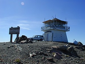
Anthony Peak is a mountain located in the Mendocino National Forest north of Mendocino Pass and is part of the Northern Coast Ranges of Mendocino County, California, approximately 16 miles (26 km) NE of Covelo. The summit is the highest point in Mendocino County,[2] and averages 61.8 inches at peak snow pack depth annually.[5][6][7]
The rare endemic wildflower known as Anthony Peak lupine (Lupinus antoninus) was named for this peak.[8]
The peak was probably named for James Anthony, who owned a farm in the Round Valley district in 1874.[9]
References
- ^ a b "Anthony". NGS Data Sheet. National Geodetic Survey, National Oceanic and Atmospheric Administration, United States Department of Commerce. Retrieved 2009-06-30.
- ^ a b c d "Anthony Peak, California". Peakbagger.com. Retrieved 2009-02-02.
- ^ "Mendocino Pass Quadrangle (1996), California, 7.5 Minute Series Topographic Map" (PDF). USGS Store. 1996. Archived from the original (PDF) on 2019-08-24. Retrieved 2019-08-24.
- ^ a b c McLaughlin, R.J.; Ellen, S.D.; Blake, M.C. Jr.; Jayko, A.S.; Irwin, W.P.; Aalto, K.R.; Carver, G.A.; Clarke, S.H. Jr. (2000). "Geology of the Cape Mendocino, Eureka, Garberville, and Southwestern part of the Hayfork 30 x 60 Minute Quadrangles and Adjacent Offshore Area, Northern California" (PDF). U.S. Geological Survey. pp. 7–8. Archived from the original (PDF) on 2017-02-24. Retrieved 2019-08-24.
- ^ "Subsection M261Ba - Eastern Franciscan". U.S. Forest Service. Archived from the original on 2009-01-20. Retrieved 2009-02-02.
- ^ Schmidt, Tamara (2019-03-01). "February Anthony Peak Snow Survey Numbers". USDA Forest Service - Mendocino National Forest. Retrieved 2019-08-24.
- ^ "CDEC Data Application - Anthony Peak Station (ATP)". California Department of Water Resources - Data Exchange Center. Retrieved 2019-08-24.
- ^ Hickman, James C. (ed.). "L. antoninus Eastw.". The Jepson Manual. University of California, Berkeley. ISBN 978-0-520-08255-7.
- ^ Gudde, Erwin G. (1949). California Place Names. Berkeley: Univ. of California Press. p. 12.
External links
![]() Media related to Anthony Peak at Wikimedia Commons
Media related to Anthony Peak at Wikimedia Commons
- "Anthony Peak". Geographic Names Information System. United States Geological Survey, United States Department of the Interior. Retrieved 2009-06-30.
- v
- t
- e


