Bhatmau
Village in Uttar Pradesh, India
Bhatmau Bhātmau | |
|---|---|
Village | |
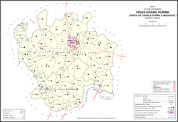 Map showing Bhatmau (#809) in Purwa CD block | |
| 26°22′29″N 80°45′03″E / 26.374838°N 80.750962°E / 26.374838; 80.750962[1] | |
| Country India |  India India |
| State | Uttar Pradesh |
| District | Unnao |
| Area [2] | |
| • Total | 2.298 km2 (0.887 sq mi) |
| Population (2011)[2] | |
| • Total | 1,326 |
| • Density | 580/km2 (1,500/sq mi) |
| Languages | |
| • Official | Hindi |
| Time zone | UTC+5:30 (IST) |
| Vehicle registration | UP-35 |
Bhatmau is a village in Purwa block of Unnao district, Uttar Pradesh, India.[2] It is not connected to major district roads and has one primary school and no healthcare facilities.[2] As of 2011, its population is 1,326, in 309 households.[2]
The 1961 census recorded Bhatmau as comprising 1 hamlet, with a total population of 733 (380 male and 353 female), in 135 households and 131 physical houses.[3] The area of the village was given as 592 acres.[3] It had 1 small cotton processing establishment, 5 tanneries, 1 small manufacturer of either ammunition, fireworks, or other explosives, and 2 small manufacturers of items not otherwise specified.[3]
References
- ^ "Geographic Names Search WebApp". Search for "Bhatmau" here.
- ^ a b c d e "Census of India 2011: Uttar Pradesh District Census Handbook - Unnao, Part A (Village and Town Directory)". Census 2011 India. pp. 348–72. Retrieved 10 July 2021.
- ^ a b c Census 1961: District Census Handbook, Uttar Pradesh (37 - Unnao District) (PDF). Lucknow. 1965. pp. cvi-cvii of section "Purwa Tehsil", cxxvi–cxxvii. Retrieved 10 July 2021.
{{cite book}}: CS1 maint: location missing publisher (link)
- v
- t
- e
Populated places in Unnao district
- Ajgain
- Akampur
- Akthi
- Anwarpur
- Arjunamau
- Asawar
- Asehru
- Asiwan
- Asoha
- Asrenda
- Bachhaura
- Bachhaura
- Badarka
- Baksar
- Bardaha
- Barenda
- Basdeo Khera
- Bathua Shahpur
- Bhatan Khera
- Bhatmau
- Bichhiya
- Bihar
- Bikamau
- Chamrauli
- Chaupai
- Chhulamau
- Dainta
- Darsawan
- Daun
- Deomai
- Dubai
- Fatehganj
- Gulariha
- Harha
- Harnam Khera
- Hasanganj
- Hasnapur
- Hilauli
- Jagat Khera
- Jamipur
- Jangal Khurd
- Jera
- Jhakwasa
- Jhalotar
- Kalu Khera
- Kanchanpur
- Kantha
- Keoni
- Kishan Khera
- Kukri
- Lachhi Khera
- Lakhmademau
- Lawa Singhan Khera
- Lohli
- Lotna
- Magarwara
- Magrayar
- Maharajpur
- Maharamau
- Maharani Khera
- Majharia
- Makhi
- Malauna
- Mawai
- Mirmau
- Mirri Kalan
- Mirri Khurd
- Miyanganj
- Musandi
- Nari Chak
- Nari Khera
- Nawal
- Nimaicha
- Osiyan
- Pahasa
- Panhan
- Para
- Pariyar
- Parsanda
- Parsandan
- Patan
- Pipri
- Poni
- Raghunathpur
- Rampur
- Rasulpur
- Rasulpur
- Rau Karna
- Rawatpur
- Reola
- Rujhai
- Sagauli
- Salindh
- Samadha
- Sandana
- Sangrampur
- Sarai Thakuri
- Sarwan
- Sarwara
- Shukla Khera
- Sikandarpur Karan
- Sikandarpur
- Soho
- Sonik
- Subas Khera
- Surseni
- Terha
- Tikar Kalan
- Tikar Khurd
- Utraura
- Zorawarganj
 | This Unnao district location article is a stub. You can help Wikipedia by expanding it. |
- v
- t
- e


