Bridger, South Dakota
Census-designated place in South Dakota, United States
44°32′32″N 101°54′49″W / 44.54222°N 101.91361°W / 44.54222; -101.91361 (2020)[3]
57748 (Howes)
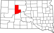
Bridger is an unincorporated community and census-designated place (CDP) in Ziebach County, South Dakota, United States, within the Cheyenne River Indian Reservation. The population was 48 at the 2020 census.[4] It was first listed as a CDP prior to the 2020 census.[2]
It is in the southwest corner of the county, 1 mile (1.6 km) north of the Cheyenne River, which forms the border with Haakon County to the south. Bridger is also 1 mile (1.6 km) east of South Dakota Highway 34, which leads 87 miles (140 km) west to Sturgis and east 86 miles (138 km) to Pierre.
Demographics
| Census | Pop. | Note | %± |
|---|---|---|---|
| 2020 | 48 | — | |
| U.S. Decennial Census[5] | |||
References
- ^ "ArcGIS REST Services Directory". United States Census Bureau. Retrieved October 15, 2022.
- ^ a b c U.S. Geological Survey Geographic Names Information System: Bridger, South Dakota
- ^ "Census Population API". United States Census Bureau. Retrieved October 15, 2022.
- ^ "U.S. Census Bureau: Bridger CDP, South Dakota". www.census.gov. United States Census Bureau. Retrieved June 28, 2022.
- ^ "Census of Population and Housing". Census.gov. Retrieved June 4, 2016.
- v
- t
- e
Municipalities and communities of Ziebach County, South Dakota, United States
County seat: Dupree
territories
- Dupree
- North Ziebach
- South Ziebach
- Bridger
- Cherry Creek
communities
‡This populated place also has portions in an adjacent county or counties
- South Dakota portal
- United States portal
 | This South Dakota state location article is a stub. You can help Wikipedia by expanding it. |
- v
- t
- e


