Brusett, Montana
Unincorporated community in Montana, United States
47°25′31″N 107°16′0″W / 47.42528°N 107.26667°W / 47.42528; -107.2666759318
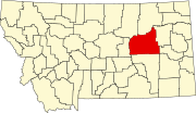
Brusett is an unincorporated tiny rural hamlet in northwestern Garfield County, Montana, United States. It lies about the intersection of Brusett Road and Edwards Road, local roads west of the town of Jordan, the county seat of Garfield County.[1] Its elevation is 2,904 feet (885 m).[2] It has a post office, serving the ZIP code of 59318, and a small school house; and no other businesses or services.[3]
History
The post office opened on May 29, 1916.[4] The town was named for its first postmaster, Alma Brusett Smith.[5][6]
Climate
According to the Köppen Climate Classification system, Brusett has a semi-arid climate, abbreviated "BSk" on climate maps.[7]
References
- ^ Rand McNally. The Road Atlas '08. Chicago: Rand McNally, 2008, p. 61.
- ^ U.S. Geological Survey Geographic Names Information System: Brusett, Montana
- ^ Zip Code Lookup Archived June 15, 2011, at the Wayback Machine
- ^ U.S. Geological Survey Geographic Names Information System: Brusett Post Office
- ^ "Montana Place Names Companion". Montana Historical Society. Retrieved July 29, 2017.
- ^ Carkeek Cheney, Roberta (1983). Names on the Face of Montana. Missoula, Montana: Mountain Press Publishing Company. ISBN 0-87842-150-5.
- ^ Climate Summary for Brusett, Montana
- v
- t
- e
Municipalities and communities of Garfield County, Montana, United States
County seat: Jordan
communities
- Brusett
- Cohagen
- Mosby
- Sand Springs
- Montana portal
- United States portal
 | This Garfield County, Montana state location article is a stub. You can help Wikipedia by expanding it. |
- v
- t
- e


