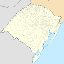
Canela Airport
Airport


CEL
Location in Brazil
Show map of Rio Grande do Sul

CEL
CEL (Brazil)
Show map of Brazil| Direction | Length | Surface | |
|---|---|---|---|
| m | ft | ||
| 06/24 | 1,260 | 4,134 | Asphalt |
Canela Airport (IATA: CEL, ICAO: SSCN), is the airport serving Canela and Gramado, Brazil.
It is operated by Infraero.
History
On July 14, 2024 the State of Rio Grande do Sul signed a contract of operation with Infraero.[3]
Airlines and destinations
| Airlines | Destinations |
|---|---|
| Azul Conecta | Porto Alegre (suspended)[4] |
Access
The airport is located 3 km (2 mi) from downtown Canela and 8 km (5 mi) from downtown Gramado.
See also
References
- ^ "Aeródromos". ANAC (in Portuguese). 22 August 2019. Retrieved 18 November 2020.
- ^ "Canela (SSCN)". DECEA (in Portuguese). Retrieved 20 September 2023.
- ^ "Governo do Estado confirma operação da Infraero para ampliar voos nos aeroportos de Canela e Torres". Governo do Estado do Rio Grande do Sul (in Portuguese). 12 July 2024. Retrieved 14 July 2024.
- ^ "Aeroporto de Porto Alegre suspende todos os voos por tempo indeterminado". Aeroin (in Portuguese). 3 May 2024. Retrieved 5 June 2024.
External links
- Airport information for SSCN at Great Circle Mapper. Source: DAFIF (effective October 2006).
- Current weather for SSCN at NOAA/NWS
- Accident history for CEL at Aviation Safety Network
- v
- t
- e
Airports in Rio Grande do Sul 

- Alegrete
- Bagé
- Canela
- Caxias do Sul
- Erechim
- Ijuí
- Passo Fundo
- Pelotas
- Porto Alegre
- Rio Grande
- Santa Cruz do Sul
- Santa Maria
- Santa Rosa
- Santana do Livramento/Rivera
- Santo Ângelo
- São Borja
- Torres
- Uruguaiana
- Vacaria


