Cow Creek, South Dakota
Unincorporated community in South Dakota, United States
44°33′14″N 100°28′31″W / 44.55389°N 100.47528°W / 44.55389; -100.47528 (2020)[3]
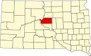
Cow Creek is an unincorporated community and census-designated place in Sully County, South Dakota, United States. Its population was 30 as of the 2010 census.[4] The community is located on the eastern shore of Lake Oahe.
Geography
According to the U.S. Census Bureau, the community has an area of 1.831 square miles (4.74 km2), all land.[4]
Demographics
| Census | Pop. | Note | %± |
|---|---|---|---|
| 2020 | 52 | — | |
| U.S. Decennial Census[5] | |||
References
- ^ "ArcGIS REST Services Directory". United States Census Bureau. Retrieved October 15, 2022.
- ^ a b U.S. Geological Survey Geographic Names Information System: Cow Creek, South Dakota
- ^ "Census Population API". United States Census Bureau. Retrieved October 15, 2022.
- ^ a b "2010 Census Gazetteer Files - Places: South Dakota". U.S. Census Bureau. Retrieved January 28, 2017.
- ^ "Census of Population and Housing". Census.gov. Retrieved June 4, 2016.
- v
- t
- e
Municipalities and communities of Sully County, South Dakota, United States
County seat: Onida
- Cow Creek
- South Dakota portal
- United States portal
 | This South Dakota state location article is a stub. You can help Wikipedia by expanding it. |
- v
- t
- e


