Dörnick
Municipality in Schleswig-Holstein, Germany

Flag

Coat of arms
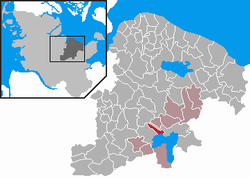
Location of Dörnick within Plön district
54°10′N 10°22′E / 54.167°N 10.367°E / 54.167; 10.367
(2022-12-31)[1]
24326
Dörnick is a municipality in the district of Plön, in Schleswig-Holstein, Germany.
Climate
| Climate data for Dörnick (1991–2020 normals) | |||||||||||||
|---|---|---|---|---|---|---|---|---|---|---|---|---|---|
| Month | Jan | Feb | Mar | Apr | May | Jun | Jul | Aug | Sep | Oct | Nov | Dec | Year |
| Mean daily maximum °C (°F) | 4.0 (39.2) | 4.5 (40.1) | 8.1 (46.6) | 13.2 (55.8) | 17.2 (63.0) | 20.5 (68.9) | 22.8 (73.0) | 22.4 (72.3) | 18.8 (65.8) | 13.2 (55.8) | 8.3 (46.9) | 5.0 (41.0) | 13.2 (55.8) |
| Daily mean °C (°F) | 1.8 (35.2) | 2.1 (35.8) | 4.5 (40.1) | 8.3 (46.9) | 12.2 (54.0) | 15.6 (60.1) | 17.6 (63.7) | 17.4 (63.3) | 14.2 (57.6) | 10.1 (50.2) | 5.8 (42.4) | 3.0 (37.4) | 9.5 (49.1) |
| Mean daily minimum °C (°F) | −0.6 (30.9) | −0.6 (30.9) | 0.8 (33.4) | 3.2 (37.8) | 6.6 (43.9) | 10.0 (50.0) | 12.1 (53.8) | 12.3 (54.1) | 9.7 (49.5) | 6.6 (43.9) | 3.5 (38.3) | 0.7 (33.3) | 5.5 (41.9) |
| Average precipitation mm (inches) | 42.1 (1.66) | 32.7 (1.29) | 42.1 (1.66) | 36.3 (1.43) | 62.9 (2.48) | 62.6 (2.46) | 84.5 (3.33) | 80.1 (3.15) | 51.7 (2.04) | 49.9 (1.96) | 47.5 (1.87) | 44.0 (1.73) | 636.5 (25.06) |
| Average relative humidity (%) | 89.2 | 86.2 | 82.0 | 76.1 | 77.0 | 77.2 | 78.2 | 79.7 | 82.9 | 86.1 | 90.0 | 90.4 | 82.1 |
| Mean monthly sunshine hours | 31.0 | 61.7 | 119.1 | 195.8 | 232.8 | 222.9 | 220.5 | 192.4 | 159.4 | 104.6 | 50.6 | 31.5 | 1,608.7 |
| Source: NOAA[2] | |||||||||||||
References
- ^ "Bevölkerung der Gemeinden in Schleswig-Holstein 4. Quartal 2022" (XLS) (in German). Statistisches Amt für Hamburg und Schleswig-Holstein.
- ^ "Dörnick Climate Normals 1991–2020". National Oceanic and Atmospheric Administration. Archived from the original on 16 September 2023. Retrieved 16 September 2023.
- v
- t
- e
Towns and municipalities in Plön (district)
- Ascheberg
- Barmissen
- Barsbek
- Behrensdorf
- Belau
- Bendfeld
- Blekendorf
- Boksee
- Bönebüttel
- Bösdorf
- Bothkamp
- Brodersdorf
- Dannau
- Dersau
- Dobersdorf
- Dörnick
- Fahren
- Fargau-Pratjau
- Fiefbergen
- Giekau
- Grebin
- Großbarkau
- Großharrie
- Heikendorf
- Helmstorf
- Högsdorf
- Hohenfelde
- Höhndorf
- Hohwacht
- Honigsee
- Kalübbe
- Kirchbarkau
- Kirchnüchel
- Klamp
- Klein Barkau
- Kletkamp
- Köhn
- Krokau
- Krummbek
- Kühren
- Laboe
- Lammershagen
- Lebrade
- Lehmkuhlen
- Löptin
- Lütjenburg
- Lutterbek
- Martensrade
- Mönkeberg
- Mucheln
- Nehmten
- Nettelsee
- Panker
- Passade
- Plön
- Pohnsdorf
- Postfeld
- Prasdorf
- Preetz
- Probsteierhagen
- Rantzau
- Rastorf
- Rathjensdorf
- Rendswühren
- Ruhwinkel
- Schellhorn
- Schillsdorf
- Schlesen
- Schönberg
- Schönkirchen
- Schwartbuck
- Schwentinental
- Selent
- Stakendorf
- Stein
- Stolpe
- Stoltenberg
- Tasdorf
- Tröndel
- Wahlstorf
- Wankendorf
- Warnau
- Wendtorf
- Wisch
- Wittmoldt

Authority control databases | |
|---|---|
| International |
|
| National |
|
 | This Plön district location article is a stub. You can help Wikipedia by expanding it. |
- v
- t
- e


