Doniaga
Village in Friesland, Netherlands
Doniaga Dunegea | |
|---|---|
Village | |
 Bell tower of Doniaga | |
 Location in De Friese Meren municipality | |
52°54′22″N 5°44′50″E / 52.90611°N 5.74722°E / 52.90611; 5.74722 | |
| Country |  Netherlands Netherlands |
| Province |  Friesland Friesland |
| Municipality |  De Fryske Marren De Fryske Marren |
| Area [1] | |
| • Total | 6.84 km2 (2.64 sq mi) |
| Elevation [2] | −0.2 m (−0.7 ft) |
| Population (2021)[1] | |
| • Total | 85 |
| • Density | 12/km2 (32/sq mi) |
| Postal code | 8516[1] |
| Dialing code | 0513 |
Doniaga (West Frisian: Dunegea) is a small village in De Fryske Marren municipality in the province Friesland of the Netherlands and has around 100 citizens (2017).[3]
It is located west of the Tjeukemeer [nl] and named after the Donia family.[4]
History
The village was first mentioned in 1448 as Doyenga.[4] In 1840, it was home to 104 people. It used to have a little village centre with a school, inn, church and library, but only the belfry remains. The church was demolished in the 19th century. The belfry dates from 1901.[5]
Before 2009, Doniaga was part of the Skarsterlân municipality and before 1984 it was part of Doniawerstal.[5]
Gallery
-
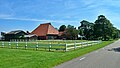 Farm in Doniaga
 -
 Farm in Doniaga
 -
 American wind mill (1955)


References
- ^ a b c "Kerncijfers wijken en buurten 2021". Central Bureau of Statistics. Retrieved 29 March 2022.
- ^ "Postcodetool for 8516DC". Actueel Hoogtebestand Nederland (in Dutch). Het Waterschapshuis. Retrieved 29 March 2022.
- ^ Kerncijfers wijken en buurten 2017 - CBS
- ^ a b "Doniaga - (geografische naam)". Etymologiebank (in Dutch). Retrieved 29 March 2022.
- ^ a b "Doniaga". Plaatsengids (in Dutch). Retrieved 29 March 2022.
External links
![]() Media related to Doniaga at Wikimedia Commons
Media related to Doniaga at Wikimedia Commons
- v
- t
- e
Populated places in the municipality of De Fryske Marren
- Joure
- Lemmer
- Sloten
- Former municipalities: Gaasterlân-Sleat
- Lemsterland
- Skarsterlân
- Akmarijp
- Bakhuizen
- Balk
- Bantega
- Boornzwaag
- Broek
- Delfstrahuizen
- Dijken
- Doniaga
- Echten
- Echtenerbrug
- Eesterga
- Elahuizen
- Follega
- Goingarijp
- Harich
- Haskerhorne
- Idskenhuizen
- Kolderwolde
- Langweer
- Legemeer
- Mirns
- Nijehaske
- Nijemirdum
- Oldeouwer
- Oosterzee
- Oudega
- Oudehaske
- Oudemirdum
- Ouwster-Nijega
- Ouwsterhaule
- Rijs
- Rohel
- Rotstergaast
- Rotsterhaule
- Rottum
- Ruigahuizen
- Scharsterbrug
- Sint Nicolaasga
- Sintjohannesga
- Snikzwaag
- Sondel
- Terherne
- Terkaple
- Teroele
- Tjerkgaast
- Vegelinsoord
- Wijckel
 | This Friesland location article is a stub. You can help Wikipedia by expanding it. |
- v
- t
- e


