El Maragha
26°42′N 31°36′E / 26.700°N 31.600°E / 26.700; 31.600
Place in Sohag, Egypt
El Maragha المراغة ⲧⲁⲗⲙⲁⲣⲁⲅⲉ | |
|---|---|
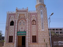 Al-Wahab mosque in Maragha | |
  El Maragha Location in Egypt | |
| Coordinates: 26°42′N 31°36′E / 26.700°N 31.600°E / 26.700; 31.600 | |
| Country |  Egypt Egypt |
| Governorate | Sohag |
| Area [1] | |
| • Total | 55.6 sq mi (144.0 km2) |
| Population (2021)[1] | |
| • Total | 432,678 |
| • Density | 7,800/sq mi (3,000/km2) |
| Time zone | UTC+2 (EST) |
El Maragha (Arabic: المراغة, Coptic: ⲧⲁⲗⲙⲁⲣⲁⲅⲉ[2]) is a city in the Sohag Governorate in Upper Egypt. It is located on the west bank of the Nile.[3]
Etymology
The name of the city is a corruption of Arabic: مغارة, romanized: maghara, lit. 'cave'.[2] This claim is also supported by a Coptic translation of this toponym (Coptic: ⲡⲓⲥⲡⲏⲗⲁⲓⲟⲛ or ⲡⲓⲥⲡⲉⲗⲉⲱⲛ, lit. 'cave').[4]
History
El Maragha witnessed many historical events; the most prominent one is the battle of Barrod, in which a French flotilla was captured and its crew were killed on 3 March 1799.
Notable people
- Mustafa al-Maraghi
References
- ^ a b "Al-Marāghah (Markaz, Egypt) - Population Statistics, Charts, Map and Location". citypopulation.de. Retrieved 17 March 2023.
- ^ a b Carsten Peust, Konstanz (2010). Die Toponyme vorarabischen Ursprungs im modernen Ägypten. Göttingen. p. 61.
{{cite book}}: CS1 maint: location missing publisher (link) - ^ "City profile for strategic urban plan of El Maragha city". unhabitat.org. UN Habitat. Retrieved 11 December 2018.
- ^ Stefan, Timm (1988). Das christlich-koptische Agypten in arabischer Zeit. p. 1586.
- v
- t
- e
Giza, 6th of October City, Sheikh Zayed City, El Hawamdeya, El Badrashein, El Saff, Atfih, El Ayyat, Bawiti, Manshiyat al Qanater, Awsim, Kerdasa, Abu El Numrus
Damanhur, Kafr El Dawwar, Rosetta, Edku, Abu El Matamir, Abu Hummus, El Delengat, El Mahmoudiyah, El Rahmaniya, Itay El Barud, Hosh Issa, Shubra Khit, Koum Hamada, Badr, Wadi El Natrun, New Nubariya
Mansoura, Talkha, Mit Ghamr, Dekernes, Aga, Minyat An-Nasr, El Senbellawein, El Kurdi, Bani Ebaid, El Manzala, Temay El Amdeed, El Gammalia, Sherbin, El Matareya, Dakahlia, Belqas, Mit Salsil, Gamasa, Mahallat Damana, Nabaruh
Kafr El Sheikh, Desouk, Fuwwah, Metoubes, Baltim, El Hamool, Biyala, El Reyad, Sidi Salem, Qallin, Sidi Ghazi, Borg El Burulus
Shibin El Kom, Sadat (city), Menouf, Sirs Al-Layyan, Ashmoun, El Bagour, Quesna, Birket El Sab, Tala, Shuhada
Zagazig, 10th of Ramadan (city), Minya El Qamh, Bilbeis, Mashtool El Souk, Al-Qinayat, Abu Hammad, El Qurein, Hihya, Abu Kebir, Faqous, El Salheya El Gedida, El Ibrahimiya, Diyarb Negm, Kafr Saqr, Awlad Saqr, El Husseiniya, Tanis, Minshat Abu Omar, Qantir
Minya, New Minya, El Idwa, Maghagha, Beni Mazar, Matai, Samalut, Mallawi, Dir Mawas, Aba al-Waqf, Dir Mawas, Dalga, Bahnasa, Idmo, Tuna el-Gebel, Al Madinah Al Fikriyyah
Sohag, New Sohag, Akhmim, New Akhmim, El Balyana, El Maragha, Ptolemais Hermiou, Dar El Salam, Girga, West Juhayna, Saqultah, Tima, Tahta
Capital cities are in bold font.
| ||
|---|---|---|
| Regions |
|  |
| Important sites |
| |
| ||
 | This geography of Egypt article is a stub. You can help Wikipedia by expanding it. |
- v
- t
- e


