Ga-Mokobodi
Place in Limpopo, South Africa
Ga-Mokobodi Booslagte | |
|---|---|
23°34′44″S 29°00′11″E / 23.579°S 29.003°E / -23.579; 29.003 | |
| Country | South Africa |
| Province | Limpopo |
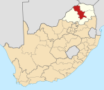
| District | Capricorn |
| Municipality | Blouberg |
| Area [1] | |
| • Total | 1.55 km2 (0.60 sq mi) |
| Elevation | 1,086 m (3,563 ft) |
| Population (2011)[1] | |
| • Total | 1,103 |
| • Density | 710/km2 (1,800/sq mi) |
| Racial makeup (2011) [1] | |
| • Black African | 99.9% |
| • Other | 0.1% |
| First languages (2011) [1] | |
| • Northern Sotho | 97.5% |
| • Other | 2.5% |
| Time zone | UTC+2 (SAST) |
| Postal code (street) | 0748 |
| Area code | +27 (0)15 |
Ga-Mokobodi is a village in Ga-Matlala in the Blouberg Local Municipality of the Capricorn District Municipality of the Limpopo province of South Africa. It is located about 5 km northwest of Tibane.
Education
- Mošibi Mokobodi Primary School.
- Selamodi Secondary School.
References
- ^ a b c d "Main Place Ga-Mokobodi". Census 2011.
- v
- t
- e
Municipalities and communities of Capricorn District Municipality, Limpopo
District seat: Pietersburg (Polokwane)
- Alldays
- Burgerregt
- De Villiersdale
- Eldorado
- Rosenkrantz (Ga-Lamola)
- Indermark (Ga-Letlalo)
- Pinkie (Ga-Sebotse)
- Mamehlabe
- My Darling
- Bochum (Senwabarwana)
- Taaiboschgroet
- Vivo
- Kameelkop
- Dendron (Mogwadi)
- Soekmekaar (Morebeng)
- Chuniespoort
- Eerstegoud
- Kalkspruit (Ga-Maraba)
- Ga-Molepo
- Ceres (Ga-Ngwetšana)
- Vlakfontein (Ga-Ramokadikadi)
- Koloti
- Laaste Hoop
- Mabokelele
- Mankweng
- Moria
- Polokwane
- Solomondale (Sebayeng)
- Seshego
- Setumong
- Tibanefontein (Tibane)


