Gaastmeer
Village in Friesland, Netherlands
Gaastmeer De Gaastmar | |
|---|---|
Village | |
 Gaastmeer, reformed church: de Pieltsjerke | |
 Flag  Coat of arms | |
 Location in the former Wymbritseradiel municipality | |
52°57′54″N 5°32′38″E / 52.96500°N 5.54389°E / 52.96500; 5.54389 | |
| Country |  Netherlands Netherlands |
| Province |  Friesland Friesland |
| Municipality |  Súdwest-Fryslân Súdwest-Fryslân |
| Area [1] | |
| • Total | 6.69 km2 (2.58 sq mi) |
| Elevation [2] | −0.4 m (−1.3 ft) |
| Population (2021)[1] | |
| • Total | 280 |
| • Density | 42/km2 (110/sq mi) |
| Postal code | 8611[1] |
| Dialing code | 0515 |
Gaastmeer (West Frisian: De Gaastmar) is a village in Súdwest-Fryslân in the province of Friesland, the Netherlands. It had a population of 295 in January 2017.[3]
History
The village was first mentioned in 1245 as Gersmere, and used to mean "grassland near water", however erroneously evolved into gaast meaning higher land.[4] Gaastmeer was an isolated village between the Fluessen [nl] and the Groote Gaastmeer [nl]. It was well connected via water, but had no road connections. It used to be a fishing village, and used to specialise in European eel. During the 18th and 19th century, the fishermen of Gaastmeer and neighbouring Heeg used to have their own wharf in London.[5]
Gaastmeer was home to 95 people in 1840.[6] The Protestant Church dates from the 19th century and was rebuilt in 1953. The wooden tower was constructed in 1940.[6] From 1962 onwards, many recreational homes were built in Gaastmeer.[5]
Before 2011, the village was part of the Wymbritseradiel municipality.[6]
Gallery
-
 Monumentaal house
 -
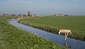 Ditch in the polder landscape near the village


References
- ^ a b c "Kerncijfers wijken en buurten 2021". Central Bureau of Statistics. Retrieved 5 April 2022.
- ^ "Postcodetool for 8611JH". Actueel Hoogtebestand Nederland (in Dutch). Het Waterschapshuis. Retrieved 5 April 2022.
- ^ Kerncijfers wijken en buurten 2017 - CBS Statline
- ^ "Gaastmeer - (geografische naam)". Etymologiebank (in Dutch). Retrieved 5 April 2022.
- ^ a b "Gaastmeer". Friesland Wonderland (in Dutch). Retrieved 5 April 2022.
- ^ a b c "Gaastmeer". Plaatsengids (in Dutch). Retrieved 5 April 2022.
External links
![]() Media related to Gaastmeer at Wikimedia Commons
Media related to Gaastmeer at Wikimedia Commons
- v
- t
- e
Populated places in the municipality of Súdwest-Fryslân
- Abbegea
- Allingawier
- Arum
- Blauwhuis
- Boazum
- Breezanddijk
- Britswert
- Burgwerd
- Cornwerd
- Dearsum
- Dedgum
- Easterein
- Easterwierrum
- Exmorra
- Ferwoude
- Folsgare
- Gaast
- Gaastmeer
- Gauw
- Goënga
- Greonterp
- Hartwerd
- Heeg
- Hemelum
- Hichtum
- Hidaard
- Hieslum
- Hinnaard
- Hommerts
- Idsegahuizum
- Idzega
- Iens
- Indijk
- It Heidenskip
- Itens
- Jutrijp
- Kimswerd
- Kornwerderzand
- Koudum
- Koufurderrige
- Kûbaard
- Lollum
- Longerhouw
- Lytsewierrum
- Makkum
- Molkwerum
- Nijhuizum
- Nijland
- Oosthem
- Oppenhuizen
- Oudega
- Parrega
- Piaam
- Pingjum
- Poppenwier
- Reahûs
- Raerd
- Rien
- Sandfirden
- Scharl
- Scharnegoutum
- Schettens
- Schraard
- Sibrandabuorren
- Smallebrugge
- Tersoal
- Tirns
- Tjalhuizum
- Tjerkwerd
- Uitwellingerga
- Waaksens
- Warns
- Westhem
- Witmarsum
- Wiuwert
- Wolsum
- Wommels
- Wons
- Woudsend
- Ypecolsga
- Ysbrechtum
- Zurich
 | This Friesland location article is a stub. You can help Wikipedia by expanding it. |
- v
- t
- e


