Guayaramerín
You can help expand this article with text translated from the corresponding article in German. (December 2010) Click [show] for important translation instructions.
- View a machine-translated version of the German article.
- Machine translation, like DeepL or Google Translate, is a useful starting point for translations, but translators must revise errors as necessary and confirm that the translation is accurate, rather than simply copy-pasting machine-translated text into the English Wikipedia.
- Do not translate text that appears unreliable or low-quality. If possible, verify the text with references provided in the foreign-language article.
- You must provide copyright attribution in the edit summary accompanying your translation by providing an interlanguage link to the source of your translation. A model attribution edit summary is
Content in this edit is translated from the existing German Wikipedia article at [[:de:Guayaramerín]]; see its history for attribution. - You may also add the template
{{Translated|de|Guayaramerín}}to the talk page. - For more guidance, see Wikipedia:Translation.
City in Beni Department, Bolivia
10°48′S 65°23′W / 10.800°S 65.383°W / -10.800; -65.383 Bolivia
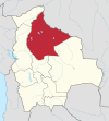
 Beni Department
 (2012)
Guayaramerín is a city within the Bolivian Beni Department. It is the capital of the Guayaramerín Municipality in the Vaca Díez Province. Guayaramerín is located on the west side of the Mamoré River, facing the Brazilian city of Guajará-Mirim. It is a port in which there is a permanent port of the Bolivian Navy. Guayaramerín Airport is south of the city, and served by Ecojet.
Facing the city there is the small island of Suárez, or Guajará-Mirim as it is called by the Brazilian government. The island is disputed by both countries, and treaties in 1867, 1877 and 1958 have failed to clear the matter.
There is a Brazilian vice-consulate in the city.
Climate
| Climate data for Guayaramerín (Guayaramerín Airport), elevation 130 m (430 ft) | |||||||||||||
|---|---|---|---|---|---|---|---|---|---|---|---|---|---|
| Month | Jan | Feb | Mar | Apr | May | Jun | Jul | Aug | Sep | Oct | Nov | Dec | Year |
| Mean daily maximum °C (°F) | 31.9 (89.4) | 31.7 (89.1) | 32.1 (89.8) | 32.1 (89.8) | 31.6 (88.9) | 31.2 (88.2) | 31.9 (89.4) | 33.4 (92.1) | 33.8 (92.8) | 33.6 (92.5) | 32.8 (91.0) | 32.3 (90.1) | 32.4 (90.3) |
| Daily mean °C (°F) | 26.7 (80.1) | 26.6 (79.9) | 26.7 (80.1) | 26.7 (80.1) | 25.8 (78.4) | 24.9 (76.8) | 24.5 (76.1) | 25.9 (78.6) | 26.8 (80.2) | 27.4 (81.3) | 27.0 (80.6) | 26.8 (80.2) | 26.3 (79.4) |
| Mean daily minimum °C (°F) | 21.6 (70.9) | 21.6 (70.9) | 21.5 (70.7) | 21.2 (70.2) | 20.1 (68.2) | 18.6 (65.5) | 17.1 (62.8) | 18.4 (65.1) | 20.0 (68.0) | 21.2 (70.2) | 21.4 (70.5) | 21.6 (70.9) | 20.4 (68.7) |
| Average precipitation mm (inches) | 276.4 (10.88) | 256.9 (10.11) | 235.6 (9.28) | 166.6 (6.56) | 74.8 (2.94) | 26.3 (1.04) | 12.6 (0.50) | 22.6 (0.89) | 69.9 (2.75) | 143.2 (5.64) | 209.8 (8.26) | 249.1 (9.81) | 1,743.8 (68.66) |
| Average precipitation days | 17.5 | 16.1 | 15.6 | 11.4 | 6.1 | 2.6 | 1.5 | 2.4 | 4.9 | 9.6 | 12.8 | 14.9 | 115.4 |
| Average relative humidity (%) | 79.9 | 81.1 | 80.2 | 79.6 | 78.1 | 75.8 | 68.7 | 65.2 | 66.7 | 72.0 | 76.4 | 79.0 | 75.2 |
| Source: Servicio Nacional de Meteorología e Hidrología de Bolivia[1][2] | |||||||||||||
References
- ^ "Base de datos Sistema Meteorológico–SISMET" (in Spanish). Servicio Nacional de Meteorología e Hidrología de Bolivia. Archived from the original on 7 June 2018. Retrieved 12 June 2024.
- ^ "índices climáticos para 149 estaciones meteorológicas en Bolivia" (in Spanish). Servicio Nacional de Meteorología e Hidrología de Bolivia. Retrieved 12 June 2024.
External links
- OpenStreetMap - Guayaramerín
- Google Maps - Guayaramerín
10°48′S 65°23′W / 10.800°S 65.383°W / -10.800; -65.383
- v
- t
- e

Capital: La Santísima Trinidad
and seats
- Baures (Baures)
- Exaltación (Exaltación)
- Guayaramerín (Guayaramerín)
- Huacaraje (Huacaraje)
- Loreto (Loreto)
- Magdalena (Magdalena)
- Puerto Siles (Puerto Siles)
- Reyes (Reyes)
- Riberalta (Riberalta)
- Rurrenabaque (Rurrenabaque)
- San Andrés (San Andrés)
- San Borja (San Borja)
- San Ignacio (San Ignacio)
- San Javier (San Javier)
- San Joaquín (San Joaquín)
- San Ramón (San Ramón)
- Santa Ana (Santa Ana del Yacuma)
- Santa Rosa (Santa Rosa)
- Trinidad (Trinidad)
Authority control databases | |
|---|---|
| International |
|
| National |
|
This Beni Department location article is a stub. You can help Wikipedia by expanding it. |
- v
- t
- e


