Homokszentgyörgy
Village in Southern Transdanubia, Hungary
Homokszentgyörgy Senđuđ (in Croatian) | |
|---|---|
Village | |
 Coat of arms | |
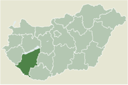 Location of Somogy county in Hungary | |
| 46°07′04″N 17°34′32″E / 46.11777°N 17.57560°E / 46.11777; 17.57560 | |
| Country |  Hungary Hungary |
| Region | Southern Transdanubia |
| County | Somogy |
| District | Barcs |
| RC Diocese | Kaposvár |
| Area | |
| • Total | 49.64 km2 (19.17 sq mi) |
| Population (2017) | |
| • Total | 1,038[1] |
| Demonym(s) | szentgyörgyi, homokszentgyörgyi |
| Time zone | UTC+1 (CET) |
| • Summer (DST) | UTC+2 (CEST) |
| Postal code | 7537 |
| Area code | (+36) 82 |
| Patron Saint | George of Lydda |
| NUTS 3 code | HU232 |
| MP | László Szászfalvi (KDNP) |
| Website | Homokszentgyörgy Online |
Homokszentgyörgy (Croatian: Senđuđ) is a village in Somogy county, Hungary.
History
According to László Szita the settlement was completely Hungarian in the 18th century.[2]
External links
- Street map (Hungarian)
References


 | This Somogy county location article is a stub. You can help Wikipedia by expanding it. |
- v
- t
- e


