Kyeintali
- v
- t
- e
Town in Rakhine State, Myanmar
Kyeintali ကျိန္တလီမြို့ | |
|---|---|
Town | |
| Kyeintali | |
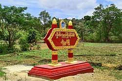 Sign seen upon entering Kyeintali from Yangon. The sign reads: "A warm welcome from Kyeintali." | |
| 18°00′22″N 94°29′24″E / 18.00611°N 94.49000°E / 18.00611; 94.49000 | |
| Country |  Myanmar Myanmar |
| State |  Rakhine State Rakhine State |
| Township | Gwa |
| Population (2014) | |
| • Town | 23,581[1] |
| • Urban | 5,878 |
| Time zone | UTC6:30 (MMT) |
| Postal code | 07182 |
Kyeintali (Burmese: ကျိန္တလီ) is a town located in Gwa Township of Rakhine State, Myanmar (Burma).
Local area
The area in and around Kyeintali contains beaches, plains and mountains. Markets are also present in many places. The area is mainly populated by the Rakhine people.
Kyeintali is 40 km south of Ngapali Beach.
Natural resources
Macrognathus pavo, a species of eel-like fish included in The IUCN Red List of Threatened Species, is only known to exist in the Kyeintali River in the Rakhine Yoma, Myanmar. It is only known from the headwaters of this river and is likely restricted to that basin. Macrognathus pavo was described in 2010 and further information is required on the species' habitat and ecology, as well as its population and distribution. It is currently assessed as Data Deficient.[2][3]
Kyeintali River Bridge

The Kyeintali River Bridge on the Thandwe-Gwa Road in Rakhine State was inaugurated by the Minister for Progress of Border Areas and National Races and Development Affairs Lt-Gen. Maung Thint and SLORC Secretary-1 Lt-Gen. Khin Nyunt. (NLM 1/2)[4]
References
- ^ "Population of Myanmar". Ministry of Immigration and Population (Myanmar) (in Burmese). 2014-03-29. Archived from the original on 22 April 2016. Retrieved 9 April 2016.
- ^ "Macrognathus pavo: Britz, R." IUCN Red List of Threatened Species. 2010. doi:10.2305/IUCN.UK.2010-4.RLTS.T174506A7081279.en.
- ^ "Three new species of spiny eels identified". Archived from the original on 2016-08-26. Retrieved 2016-07-31.
- ^ http://www.ibiblio.org/obl/docs3/95-01.txt [bare URL plain text file]
External links
- Google Map
- Bin Map
Rakhine State | ||
|---|---|---|
Capital: Sittwe | ||
| Kyaukpyu District |
|   |
| Maungdaw District | ||
| Sittwe District | ||
| Thandwe District | ||
| Mrauk-U District | ||
| Main cities and towns | ||
18°00′22″N 94°29′24″E / 18.00611°N 94.49000°E / 18.00611; 94.49000


