Malča
You can help expand this article with text translated from the corresponding article in Serbian. (September 2011) Click [show] for important translation instructions.
- View a machine-translated version of the Serbian article.
- Machine translation, like DeepL or Google Translate, is a useful starting point for translations, but translators must revise errors as necessary and confirm that the translation is accurate, rather than simply copy-pasting machine-translated text into the English Wikipedia.
- Do not translate text that appears unreliable or low-quality. If possible, verify the text with references provided in the foreign-language article.
- You must provide copyright attribution in the edit summary accompanying your translation by providing an interlanguage link to the source of your translation. A model attribution edit summary is
Content in this edit is translated from the existing Serbian Wikipedia article at [[:sr:Малча]]; see its history for attribution. - You may also add the template
{{Translated|sr|Малча}}to the talk page. - For more guidance, see Wikipedia:Translation.
Village in Nišava District, Serbia
Malča Малча | |
|---|---|
Village | |
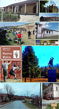 Collage of Malča | |
| Country |  Serbia Serbia |
| District | Nišava District |
| City | Niš |
| Municipality | Pantelej |
| Area [1] | |
| • Total | 14.60 km2 (5.64 sq mi) |
| Elevation | 388 m (1,273 ft) |
| Population (2011)[2] | |
| • Total | 1,030 |
| • Density | 71/km2 (180/sq mi) |
| Time zone | UTC+1 (CET) |
| • Summer (DST) | UTC+2 (CEST) |
Malča (Serbian Cyrillic: Малча) is a village located in the Niš city municipality of Pantelej, Serbia.[3] As of 2011 census, it has a population of 1,030 inhabitants.
References
- ^ "Насеља општине Пантелеј" (PDF). stat.gov.rs (in Serbian). Statistical Office of Serbia. Retrieved 10 January 2020.
- ^ "2011 Census of Population, Households and Dwellings in the Republic of Serbia: Comparative Overview of the Number of Population in 1948, 1953, 1961, 1971, 1981, 1991, 2002 and 2011, Data by settlements" (PDF). Statistical Office of Republic Of Serbia, Belgrade. 2014. ISBN 978-86-6161-109-4. Retrieved 2014-06-27.
- ^ Institut national d'études démographique (INED) Archived 2014-07-02 at the Wayback Machine
- v
- t
- e
Cities, towns and villages in the Nišava District
- Medijana
- Brzi Brod
- Bulevar Nemanjića
- Bulevar Djindjića
- Čair
- Centar
- Duvanište
- Kičevo
- Marger
- Medijana
- Trg Kralja Aleksandra
- Trošarina
- Niška Banja
- Palilula
- Bubanj
- Palilula
- Staro Groblje
- Crni put
- Ledena Stena
- Delijski Vis
- Apelovac
- Kovanluk
- Tutunović Podrum
- Kalac Brdo
- Suvi Do
- Pantelej
- Donja Vrežina
- Jagodin Mala
- Durlan
- Čalije
- Somborska
- Durlan 2
- Durlan 3
- Gornja Vrežina
- Gornji Matejevac
- Donji Matejevac
- Kamenica
- Brenica
- Cerje
- Knez Selo
- Malča
- Pasjača
- Oreovac
- Jasenovik
- Vrelo
- Crveni Krst
- Crveni Krst
- Beograd Mala
- Jagodin Mala
- Šljaka
- Komren
- Ratko Jović
- Berčinac
- Vele Polje
- Vrtište
- Gornja Toponica
- Gornja Trnava
- Gornji Komren
- Donja Toponica
- Donja Trnava
- Donji Komren
- Kravlje
- Leskovik
- Medoševac
- Mezgraja
- Miljkovac
- Paligrace
- Paljina
- Popovac
- Rujnik
- Sečanica
- Supovac
- Trupale
- Hum
- Čamurlija
- Aleksinački Bujmir
- Aleksinački Rudnik
- Bankovac
- Beli Breg
- Belja
- Bobovište
- Bovan
- Bradarac
- Vakup
- Veliki Drenovac
- Vitkovac
- Vrelo
- Vrćenovica
- Vukanja
- Vukašinovac
- Glogovica
- Golešnica
- Gornja Peščanica
- Gornje Suhotno
- Gornji Adrovac
- Gornji Krupac
- Gornji Ljubeš
- Gredetin
- Grejač
- Dašnica
- Deligrad
- Dobrujevac
- Donja Peščanica
- Donje Suhotno
- Donji Adrovac
- Donji Krupac
- Donji Ljubeš
- Draževac
- Žitkovac
- Jakovlje
- Jasenje
- Kamenica
- Katun
- Koprivnica
- Korman
- Kraljevo
- Krušje
- Kulina
- Lipovac
- Loznac
- Loćika
- Lužane
- Ljupten
- Mali Drenovac
- Mozgovo
- Moravac
- Moravski Bujmir
- Nozrina
- Porodin
- Prekonozi
- Prćilovica
- Prugovac
- Radevce
- Rsovac
- Rutevac
- Srezovac
- Stanci
- Stublina
- Subotinac
- Tešica
- Trnjane
- Ćićina
- Crna Bara
- Česta
- Čukurovac
- Šurić
- Beloinje
- Bučum
- Burdimo
- Crnoljevica
- Davidovac
- Drajinac
- Đurinac
- Galibabinac
- Gojmanovac
- Grbavče
- Gulijan
- Guševac
- Izvor
- Kopajkošara
- Labukovo
- Lalinac
- Lozan
- Lukovo
- Manojlica
- Mečji Do
- Merdželat
- Niševac
- Okolište
- Okruglica
- Palilula
- Periš
- Pirkovac
- Plužina
- Popšica
- Prekonoga
- Radmirovac
- Ribare
- Slivje
- Šljivovik
- Tijovac
- Varoš
- Vlahovo
- Željevo
- Aleksandrovo
- Arbanasce
- Azbresnica
- Balajnac
- Baličevac
- Batušinac
- Biljeg
- Brest
- Bučić
- Čubura
- Dešilovo
- Devča
- Donja Rasovača
- Dudulajce
- Gornja Rasovača
- Gradište
- Jovanovac
- Jug Bogdanovac
- Kostadinovac
- Kovanluk
- Krajkovac
- Lepaja
- Mramorsko Brdo
- Oblačina
- Padina
- Rožina
- Braljina
- Cerovo
- Crni Kao
- Čubura
- Grabovo
- Lipovac
- Maćija
- Mađere
- Maletina
- Novi Bračin
- Pardik
- Podgorac
- Poslon
- Praskovče
- Pretrkovac
- Rujište
- Šetka
- Skorica
- Smilovac
- Stari Bračin
- Varoš
- Vitoševac
- Čagrovac
- Ćelije
- Donje Dragovlje
- Donji Barbeš
- Donji Dušnik
- Duga Poljana
- Dukat
- Gare
- Gornje Dragovlje
- Gornje Vlase
- Gornji Barbeš
- Gornji Dušnik
- Grkinja
- Jagličje
- Kaletinac
- Koprivnica (Gadžin Han)
- Krastavče
- Ličje
- Mali Krčimir
- Mali Vrtop
- Marina Kutina
- Miljkovac
- Novo Selo
- Ovsinjinac
- Ravna Dubrava
- Semče
- Sopotnica
- Šebet
- Taskovići
- Toponica
- Veliki Krčimir
- Veliki Vrtop
- Vilandrica
43°19′58″N 22°01′43″E / 43.3328°N 22.0286°E / 43.3328; 22.0286
 | This Nišava District, Serbia location article is a stub. You can help Wikipedia by expanding it. |
- v
- t
- e


