Marcella, Mississippi
Unincorporated community in Mississippi, United States
33°07′46″N 90°17′51″W / 33.12944°N 90.29750°W / 33.12944; -90.2975039169
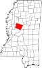
Marcella is an unincorporated community located in Holmes County, Mississippi near the Yazoo River. Marcella is located near Mississippi Highway 12 and is approximately 5 miles (8.0 km) north of Thornton, and approximately 9 miles (14 km) south of Tchula.
Marcella is named for the Marcella plantation.[2]
A post office operated under the name Marcella from 1881 to 1894.[3]
Marion Post Wolcott documented people and scenes from the Marcella plantation in October 1939 as part of her work with the Farm Security Administration.[4]
References
- ^ U.S. Geological Survey Geographic Names Information System: Marcella, Mississippi
- ^ William P. Hustwit (February 5, 2019). Integration Now: Alexander v. Holmes and the End of Jim Crow Education. Chapel Hill, North Carolina: University of North Carolina Press. p. 24. ISBN 978-1-4696-4856-9.
- ^ "Holmes County". Jim Forte Postal History. Retrieved June 3, 2021.
- ^ "Marcella Plantation". Library of Congress. Retrieved June 4, 2021.
- v
- t
- e
Municipalities and communities of Holmes County, Mississippi, United States
County seat: Lexington
communities
- Mississippi portal
- United States portal
 | This Holmes County, Mississippi state location article is a stub. You can help Wikipedia by expanding it. |
- v
- t
- e


