Masindi Airport
Airport in Masindi, Uganda

HUMI
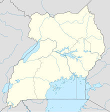
Location of Masindi Airport in Uganda
| Direction | Length | Surface | |
|---|---|---|---|
| m | ft | ||
| 01/19 | 2,042 | 6,700 | Unpaved |
Sources: Great Circle Mapper[1]
Masindi Airport (IATA: KCU, ICAO: HUMI) is an airport in Uganda.
Location
Masindi Airport is in the Kyema suburb of the town of Masindi, Masindi District, Bunyoro sub-region, in the Western Region. It is approximately 199 kilometres (124 mi), by air, north-west of Entebbe International Airport, the country's largest civilian and military airport.[2] This is approximately 10 kilometres (6 mi), by road, directly north of the central business district of the town.[3]
The Masindi non-directional beacon (ident: MS) is within the town, approximately 6 kilometres (3.7 mi) south of the Runway 01 threshold.[4]
See also
 Uganda portal
 Aviation portal
- List of airports in Uganda
- Transport in Uganda
- Civil Aviation Authority of Uganda


References
- ^ Airport information for Masindi Airport - Great Circle Mapper
- ^ "Flight Distance Between Entebbe Airport And Masindi Airport With Map". Distance Calculator. Globefeed.com. Retrieved 2 August 2011.
198.72 km
- ^ "Distance between , and Kyema (Masindi) (Uganda)". distancecalculator.globefeed.com. Retrieved 2018-08-29.
- ^ "SkyVector: Flight Planning / Aeronautical Charts". skyvector.com. Retrieved 2018-08-29.
External links
- Location of Masindi Airport At Google Maps
- Masindi pilot info
- Website of Uganda Civil Aviation Authority
| ||
|---|---|---|
Capital: Masindi | ||
| Towns and villages | 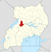 | |
| Geography |
| |
| Economy | ||
| Energy | ||
| Notable landmarks |
| |
| Health | ||
| Transport |
| |
| Notable people | ||


