Mezőfalva
Large village in Fejér, Hungary

Flag

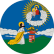
Coat of arms

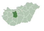
Location of Fejér county in Hungary
 Hungary
 (2004)
2422
Mezőfalva is a village in Fejér county, Hungary.
External links
 Media related to Mezőfalva at Wikimedia Commons
- Official website in Hungarian
- Street map (in Hungarian)
- v
- t
- e
Towns and villages of Dunaújváros District
- Dunaújváros (district seat)

- Előszállás
- Mezőfalva
- Perkáta
 | This Fejér location article is a stub. You can help Wikipedia by expanding it. |
- v
- t
- e


