Mochima National Park
Protected area in Venezuela
10°15′41″N 64°28′48″W / 10.26139°N 64.48000°W / 10.26139; -64.48000
Mochima National Park (/moʊˈtʃiːmə/ moh-CHEE-mə) is located in the States of Anzoátegui and Sucre, on the northeastern coast of Venezuela. The park covers 94,935 hectares and is made up of an exclusively marine area in its western sector (Anzoátegui State), a coastal marine area that includes the Gulf of Santa Fé and Mochima Bay, and a mountainous area that covers the Turimiquire Dam watershed (Sucre State).[1][2] Mochima Park was created to protect the montane forests of the Turimiquire Range and the country's eastern Caribbean Sea marine landscapes.[3]
However, this is one of the most threatened parks in Venezuela. Recently[when?] two large construction projects have altered the park permanently. A new national highway is being constructed between Puerto La Cruz and Cumana running directly through the park deforesting a 70+ meter wide swath of parkland along its entire course. Adding to this dilemma is a new natural gas pipeline being built to the east running virtually parallel to the new highway.[citation needed]
Other threats stem from the fact that when the park was created, many human settlements were included inside park boundaries and The National Park Institute (INPARQUES) has been unable to manage the situation properly. Even though educational policies have improved community relations, INPARQUES is highly deficient in terms of park management and administration.[3][1]
History
Mochima National Park was created on December 19, 1973.[4] Named after the town of Mochima, it is one of a number of national parks along Venezuela's northeast Caribbean coastline.[5] It was the second marine park in Venezuela and encompasses the entire shoreline between Puerto La Cruz and Cumaná plus 32 islands just offshore.[3]
Geography
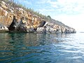
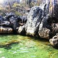
This coast is a mountainous zone with beaches, gulfs and inlets of extraordinary beauty. Because of various micro-climates, some areas have gigantic cliffs nearly devoid of vegetation dropping into the water while others are lush with jungle vegetation and sandy beaches. Many small towns have sprung up along the 50 km between the cities on either side (Puerto La Cruz and Cumaná).[citation needed]
Climate
Year-round temperatures range between 20 and 26 °C.[2] Coastal climate has high temperatures and constant trade winds from November until May, while it is a bit cooler with more humidity from June to October.[citation needed]
Size
The park measures 949 km2 (366 sq mi).[2]
Fauna and flora
Marine waters in the park are rich in cetacean diversities, including such as humpback whales, Bryde's whales, sperm whales, pilot whales,[citation needed] and several species of dolphins.[6]The turtle grass present in Mochima Bay provides a good environment for many gastropods and mollusks such as Eared ark clam, Tiger lucine, Buttonsnail, and Turkey wing clam.[7]
Gallery
-
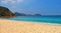
 Beach in Mochima Park
 -
 Long-beaked common dolphins nearby Isla de Plata
 -
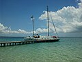
 Boats in Mochima Park
 -

-
 Manzanilla Beach
 -
 Puinare Island
 -
-

-

-

-
-

-

-

-
-

-


References
- ^ a b Entrena, Maria Jose; Arismendi, Jose (1990), El Geopatrimonio en la Caracterización del Parque Nacional Mochima, estados Anzoátegui y Sucre. Venezuela. [Geoheritage in the Characterization of Mochima National Park, Anzoátegui and Sucre states. Venezuela.], INPARQUES, archived from the original on 29 July 2024, retrieved 28 July 2024 – via La Fundación Instituto de Ingeniería para Investigación y Desarrollo Tecnológico
- ^ a b c "Mochima". Sistema Venezolano de Información sobre Diversidad de Biológica (in Spanish). Archived from the original on 19 September 2016. Retrieved 28 July 2024.
- ^ a b c "Mochima National Park". Parks Watch. Archived from the original on 19 September 2018. Retrieved 28 July 2024.
- ^ Rodriguez, Jon Paul; Rojas-Suarez, Franklin (1998). "Las Areas Protegidas Estrictas y La Conservacion de La Fauna Venezolana Amenazada" [Strict Protected Areas and the Conservation of Threatened Venezuelan Fauna]. Acta Cientifica Venezolana (in Spanish). 49 (3). Ecology and Evolutionary Biology Department, Princeton University, Princeton and PROVITA, Caracas, Venezuela. Ecology: 173–178. Retrieved 28 July 2024 – via Research Gate.
- ^ "Mochima National Park". explorra. Retrieved 28 July 2024.
- ^ Molero-Lizarraga, Alimar; Barreto, Guillermo; Cobarrubia-Russo, Sergio (5 January 2022). "Habitat use of common dolphin (Delphinus sp.) in the Mochima National Park, Sucre, Venezuela". Journal of Cetacean Research and Management. 22: 129–146. doi:10.47536/jcrm.v22i1.197. Archived from the original on 27 June 2022. Retrieved 28 July 2024 – via International Whaling Commission.
- ^ Prieto, Antulio; Sant, Sybil; Méndez, Elizabeth; Lodeiros, César (June 2003). "Diversidad y abundancia de moluscos en las praderas de Thalassia testudinum de la Bahía de Mochima, Parque Nacional Mochima, Venezuela" [Diversity and abundance of mollusks in the Thalassia testudinum meadows of Mochima Bay, Mochima National Park, Venezuela]. Revista de Biología Tropical (in Spanish). 51 (2). Costa Rica: 413–426. Archived from the original on 10 February 2022. Retrieved 28 July 2024 – via The Scientific Electronic Library Online.
External links
- http://www.parkswatch.org/parkprofile.php?l=eng&country=ven&park=monp
Authority control databases | |
|---|---|
| International |
|
| National |
|


