Mount Turner
Mountain in Banff NP, Alberta, Canada


Mount Turner
Location of Mount Turner in Alberta
Show map of Alberta
Mount Turner
Mount Turner (Canada)
Show map of CanadaCanadian Rockies
Mount Turner is a 2,806-metre (9,206-foot) mountain summit located in the upper Spray River Valley of southern Banff National Park, in the Canadian Rockies of Alberta, Canada. Mount Turner in not visible from any road in Banff Park, however, it can be seen from Alberta Highway 742, also known as the Smith-Dorrien/Spray Trail in Kananaskis Country. Mount Turner's nearest higher peak is Cone Mountain, 2.91 km (1.81 mi) to the north.[2]
History
Mount Turner was named in 1918 for Sir Richard Ernest William Turner (1871–1961), a Lieutenant-general in the Canadian Army who served during the Second Boer War and the First World War, and was a recipient of the Victoria Cross.[4][5] Earlier in his career, he served in the Royal Canadian Dragoons with Sir Edward Whipple Bancroft Morrison in 1900.[1] Not coincidentally, Mount Morrison is situated two kilometres south of Mount Turner.[3]
The mountain's name was officially adopted in 1924 by the Geographical Names Board of Canada.[3]
Geology
Mount Turner is composed of sedimentary rock laid down during the Precambrian to Jurassic periods and was later pushed east and over the top of younger rock during the Laramide orogeny.[6]
Climate
Based on the Köppen climate classification, Mount Turner is located in a subarctic climate zone with cold, snowy winters, and mild summers.[7] Temperatures can drop below −20 °C with wind chill factors below −30 °C. In terms of favorable weather, June through September are the best months to climb. Precipitation runoff from the mountain drains into Owl Creek and Bryant Creek, which empty into Spray Lakes Reservoir.
Gallery
-
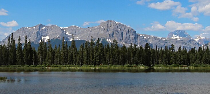
 Mount Turner seen from Watridge Lake
 -
 Mt. Turner centered, with Mt. Assiniboine to right, and Mt. Morrison left


See also
References
- ^ a b c d e "Mount Turner". Bivouac.com. Retrieved 2018-12-27.
- ^ a b "Mount Turner, Alberta". Peakbagger.com. Retrieved 2024-01-08.
- ^ a b c d "Mount Turner". Geographical Names Data Base. Natural Resources Canada. Retrieved 2018-12-28.
- ^ Place-names of Alberta. Ottawa: Geographic Board of Canada. 1928. p. 127.
- ^ "Mount Turner". cdnrockiesdatabases.ca. Retrieved 2024-01-08.
- ^ Gadd, Ben (2008). Geology of the Rocky Mountains and Columbias.
- ^ Peel, M. C.; Finlayson, B. L.; McMahon, T. A. (2007). "Updated world map of the Köppen−Geiger climate classification". Hydrol. Earth Syst. Sci. 11 (5): 1633–1644. Bibcode:2007HESS...11.1633P. doi:10.5194/hess-11-1633-2007. ISSN 1027-5606.
External links
- National Park Service web site: Banff National Park
- Weather forecast: Mount Turner
- v
- t
- e
Places adjacent to Mount Turner
| Continental Divide | Cone Mountain | Goat Range |
| Mount Assiniboine |  | Spray Lakes Reservoir |
| Marvel Peak |  Mount Turner Mount Turner | Mount Engadine |
| Mount Gloria |  | Watridge Lake |
| Mount Byng | Mount Morrison | Mount Shark |


