Mouser, Oklahoma
Unincorporated community in Oklahoma, United States
36°52′14″N 101°24′55″W / 36.87056°N 101.41528°W / 36.87056; -101.41528[1][1]
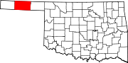
Mouser is an unincorporated community in Texas County, Oklahoma, United States. Mouser is 13.5 miles (21.7 km) north-northeast of Guymon and 11 miles (18 km) west of Hooker. The community of Straight is two miles to the west.[2] The Beaver, Meade and Englewood Railroad (BM&E) reached the locale in the summer of 1928,[3] and two grain elevators in Mouser, the Mouser Grain Elevator and the Mouser Woodframe Grain Elevator/Collingwood Elevator, which were built along the BM&E's tracks, are now listed on the National Register of Historic Places listings in Texas County, Oklahoma.[4]
Transportation
Mouser is just off County Road 7, east of Oklahoma State Highway 136 and west of US Route 64.[5]
Guymon Municipal Airport is about 18 miles south-southwest,[6] while commercial air transportation is available out of Liberal Mid-America Regional Airport in Kansas,[7] approximately 33 miles east-northeast.[8]
References
- ^ a b c "Mouser". Geographic Names Information System. United States Geological Survey, United States Department of the Interior.
- ^ Oklahoma Atlas & Gazeteer, DeLorme, 1st ed., 1998, p. 15 ISBN 0899332838
- ^ "Construction Strategies of Railroads in the Oklahoma Panhandle". Donovan L. Hofsommer, Chronicles of Oklahoma, Vol. 58, No 1, Spring 1980, pp. 82-89. Retrieved December 6, 2021.
- ^ "National Register Information System". National Register of Historic Places. National Park Service. July 9, 2010.
- ^ "Mouser, Oklahoma". Google Maps. Retrieved January 5, 2021.
- ^ "Guymon Municipal Airport to Mouser, Oklahoma". Google Maps. Retrieved January 5, 2021.
- ^ "Liberal Mid-America Regional Airport". City of Liberal. Retrieved September 7, 2020.
- ^ "Liberal Airport to Mouser, Oklahoma". Google Maps. Retrieved January 5, 2021.
- v
- t
- e
Municipalities and communities of Texas County, Oklahoma, United States
County seat: Guymon
communities
- Eva
- Four Corners
- Libbey
- Mouser
- Muncy
- Straight
- Oklahoma portal
- United States portal
 | This Oklahoma state location article is a stub. You can help Wikipedia by expanding it. |
- v
- t
- e


