Nevado El Cisne
Mountain in Colombia

Nevado El Cisne
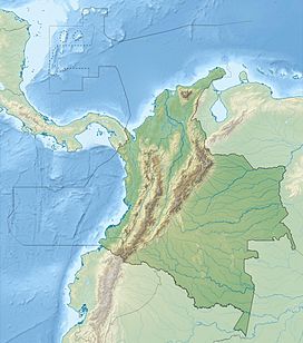
Location of Nevado El Cisne in Colombia
 Colombia
Andes
Andean Volcanic Belt
The Nevado El Cisne or Nevado del Cisne (English: The Snowy Swan), also known as Paramillo el Cisne or Paramillo del Cisne (English: The Little Paramo-like Swan), is a volcano in the Central Ranges of the Andes in Colombia. Its summit is at an altitude of approximately 4,700 metres (15,400 ft). [1]
The mountain belongs to the Cisne-Morro Negro lava dome, a small volcanic complex near Nevado del Ruiz.
Despite the nevado part of the name, indicating a permanently snow-capped mountain, the summit of El Cisne is now below the permanent snow line as a result of global warming, and it is no longer considered a true nevado. Hence it is now commonly referred to as a paramillo.[3]
Geology
Nevado El Cisne is the summit of a small volcanic complex which includes El Cisne's sister peak, Morro Negro, and several subpeaks. They are small stratovolcanoes. The complex has well-preserved morphology with barely eroded lava flows, suggesting recent volcanic activity. [4]
Five emission centers have been identified as generators of lava flows. The lava flows are andesitic and present notably smaller volumes compared to those observed in neighbouring volcanic complexes (Ruiz and Santa Isabel).[4]
The volcano is located over the Palestina Fault, that crosscuts the underlying El Bosque Batholith of Eocene age, dated at 49.1 ± 1.7 Ma.[5][6]
See also
References
- ^ a b "Nevado El Cisne, Colombia". peakbagger.com. Retrieved July 16, 2024.
- ^ "Nevado del Ruiz: Synonyms and Subfeatures", Global Volcanism Program, Smithsonian Institution
- ^ "Ruiz-Tolima Volcanic Massif", US Geological Survey
- ^ a b "Generalidades Volcán Paramillo del Cisne". www.sgc.gov.co. Servicio Geológico Colombiano. Retrieved July 16, 2024.
- ^ Plancha 225, 1998
- ^ González, 2001, p.50
Bibliography
- González, Humberto (2001). Geología de las planchas 206 Manizales y 225 Nevado del Ruiz - 1:100,000 - Memoria explicativa (PDF) (Report). INGEOMINAS. pp. 1–93. Retrieved 2017-06-09.[dead link]
- Mosquera, Darío; Martín, Pedro; Vesga, Carlos; González, Humberto (1998). Plancha 225 - Nevado del Ruiz - 1:100,000 (Map). INGEOMINAS. p. 1. Retrieved 2017-06-06.
- v
- t
- e


- Alto Mellizos
- Las Ánimas
- Bordoncillo
- Cerro Bravo
- Cerro Machín
- Doña Juana
- El Escondido
- Galeras
- Morasurco
- Nevado El Cisne
- Nevado del Huila
- Nevado del Quindío
- Nevado del Ruiz
- Nevado de Santa Isabel
- Nevado del Tolima
- Patascoy
- Petacas
- Puracé
- Romeral
- San Diego
- Sotará
- • "Observatorios Vulcanológicos". Servicio Geológico de Colombia.
 Category • Images
 | This Colombian location article is a stub. You can help Wikipedia by expanding it. |
- v
- t
- e


