Oudebildtzijl
Village in Friesland, Netherlands
Oudebildtzijl Aldebiltsyl | |
|---|---|
Village | |
 Juliana church | |
 Flag  Coat of arms | |
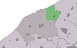 Location in het Bildt municipality | |
53°18′4″N 5°43′6″E / 53.30111°N 5.71833°E / 53.30111; 5.71833 | |
| Country | Netherlands |
| Province | Friesland |
| Municipality | Waadhoeke |
| Area [1] | |
| • Total | 16.29 km2 (6.29 sq mi) |
| Elevation [2] | 1.3 m (4.3 ft) |
| Population (2021)[1] | |
| • Total | 950 |
| • Density | 58/km2 (150/sq mi) |
| Postal code | 9078[1] |
| Dialing code | 0518 |
Oudebildtzijl (Dutch pronunciation: [ˌʌudəˌbɪltˈsɛil], West Frisian: Aldebiltsyl; Bildts: Ouwe-Syl) is a village in Waadhoeke municipality in the province of Friesland, the Netherlands. It had a population of around 690 in January 2017.[3]
It is the starting point from which the Oude Bildtdijk was created. Until 2018, the village was part of the het Bildt municipality.[4]
History
The village was first mentioned after 1570 as niuwe zijl, and means "sluice in the old Bildt. It refers to a sluice from 1505. In 1600, the Nieuwe Bildtdijk was constructed and oude (old) was added to distinguish from Nieuwebildtzijl [nl].[5] In 1504, a deal was struck between George, Duke of Saxony and four noblemen from Holland to polder the Middelzee. In 1505, a dike (Oude Bildtdijk) was constructed.[6] The sluice was renewed in 1906.[7]
In 1806, a Mennonite Church was built in Oudebildtzijl. In 1909, the church was enlarged and a clergy house with tower was added to the front. The Juliana tower is in neoclassic style with an open pavilion.[7] The church was decommissioned in 1997, and nowadays serves as visitor centre for the nature area Aerden Plaats.[4]
Oudebildtzijl was home to 604 people in 1840.[4] In 1948, it became a village.[8]
Notable people
- Gerrit Keizer [fy] (1874-1946), freak show artist, singer and acrobat, because of his height of 80 cm. Performed around the world.[9]
Gallery
-
 Street view
 -
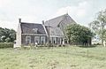 Farm in Oudebildtzijl
 -
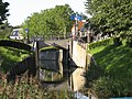 Canal view
 -
![Statue of Gerrit Keizer [fy]](//upload.wikimedia.org/wikipedia/commons/thumb/d/db/Kleine_Gerrit_Keizer_by_Hans_Jouta%2C_Oudebildtzijl%2C_2018_-_1.jpg/90px-Kleine_Gerrit_Keizer_by_Hans_Jouta%2C_Oudebildtzijl%2C_2018_-_1.jpg) Statue of Gerrit Keizer [fy]
Statue of Gerrit Keizer [fy]


![Statue of Gerrit Keizer [fy]](http://upload.wikimedia.org/wikipedia/commons/thumb/d/db/Kleine_Gerrit_Keizer_by_Hans_Jouta%2C_Oudebildtzijl%2C_2018_-_1.jpg/90px-Kleine_Gerrit_Keizer_by_Hans_Jouta%2C_Oudebildtzijl%2C_2018_-_1.jpg)
References
- ^ a b c "Kerncijfers wijken en buurten 2021". Central Bureau of Statistics. Retrieved 4 April 2022.
- ^ "Postcodetool for 9078PM". Actueel Hoogtebestand Nederland (in Dutch). Het Waterschapshuis. Retrieved 4 April 2022.
- ^ Kerncijfers wijken en buurten 2017 - CGB Statline
- ^ a b c "Oudebildtzijl". Plaatsengids (in Dutch). Retrieved 4 April 2022.
- ^ "Oudebildtzijl - (geografische naam)". Etymologiebank (in Dutch). Retrieved 4 April 2022.
- ^ "Sint Jacobiparochie - (geografische naam)". Etymologiebank (in Dutch). Retrieved 4 April 2022.
- ^ a b Ronald Stenvert & Sabine Broekhoven (2000). "Peins" (in Dutch). Zwolle: Waanders. ISBN 90 400 9476 4. Retrieved 4 April 2022.
- ^ "Oudebildtzijl". Friesland Wonderland (in Dutch). Retrieved 4 April 2022.
- ^ "Kleine Gerrit Keizer". Keunstwurk (in Dutch). Retrieved 4 April 2022.
External links
 Media related to Oudebildtzijl at Wikimedia Commons
- website about Oudebildtzijl
- v
- t
- e
Populated places in the municipality of Waadhoeke
- Former municipalities: Franekeradeel
- het Bildt
- Menameradiel
- Achlum
- Alde Leie (small part)
- Baaium
- Berltsum
- Bitgum
- Bitgummole
- Blessum
- Boer
- Boksum
- Deinum
- Dongjum
- Dronryp
- Firdgum
- Herbaijum
- Hitzum
- Ingelum
- Klooster-Lidlum
- Marsum
- Menaam
- Minnertsga
- Nij Altoenae
- Oosterbierum
- Oudebildtzijl
- Peins
- Pietersbierum
- Ried
- Schalsum
- Sexbierum
- Sint Annaparochie
- Sint Jacobiparochie
- Skingen
- Slappeterp
- Spannum
- Tzum
- Tzummarum
- Vrouwenparochie
- Westhoek
- Wier
- Winsum
- Wjelsryp
- Zweins


