Pengxi County
County in Sichuan, China
Pengxi County 蓬溪县 | |
|---|---|
County | |
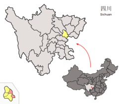 Location of Pengxi County (red) within Suining City (yellow) and Sichuan | |
| Country | China |
| Province | Sichuan |
| Prefecture-level city | Suining |
| County seat | Chicheng Town |
| Area | |
| • Total | 1,251 km2 (483 sq mi) |
| Time zone | UTC+8 (China Standard) |
Pengxi County (Chinese: 蓬溪县; pinyin: Péngxī Xiàn) is a county of Sichuan Province, China, bordering Chongqing to the southeast. It is under the administration of Suining city.
Administrative divisions
Pengxi County comprises 1 subdistrict, 17 towns and 2 townships:[1]
- subdistrict
- Pu'an 普安街道
- towns
- Chicheng 赤城镇
- Xinhui 新会镇
- Wenjing 文井镇
- Mingyue 明月镇
- Changle 常乐镇
- Tianfu 天福镇
- Hongjiang 红江镇
- Baofan 宝梵镇
- Dashi 大石镇
- Jixiang 吉祥镇
- Mingfeng 鸣凤镇
- Renlong 任隆镇
- Sanfeng 三凤镇
- Pengnan 蓬南镇
- Qunli 群利镇
- Jinqiao 金桥镇
- Huaihua 槐花镇
- townships
- Heye 荷叶乡
- Gaosheng 高升乡
Climate
| Climate data for Pengxi, elevation 395 m (1,296 ft), (1991–2020 normals, extremes 1981–2010) | |||||||||||||
|---|---|---|---|---|---|---|---|---|---|---|---|---|---|
| Month | Jan | Feb | Mar | Apr | May | Jun | Jul | Aug | Sep | Oct | Nov | Dec | Year |
| Record high °C (°F) | 19.4 (66.9) | 23.2 (73.8) | 31.6 (88.9) | 34.1 (93.4) | 36.4 (97.5) | 36.4 (97.5) | 39.3 (102.7) | 40.4 (104.7) | 40.6 (105.1) | 31.8 (89.2) | 25.8 (78.4) | 17.5 (63.5) | 40.6 (105.1) |
| Mean daily maximum °C (°F) | 9.3 (48.7) | 12.4 (54.3) | 17.3 (63.1) | 23.1 (73.6) | 26.7 (80.1) | 28.9 (84.0) | 31.6 (88.9) | 31.8 (89.2) | 26.5 (79.7) | 20.9 (69.6) | 16.1 (61.0) | 10.4 (50.7) | 21.3 (70.2) |
| Daily mean °C (°F) | 6.1 (43.0) | 8.7 (47.7) | 12.9 (55.2) | 18.1 (64.6) | 21.8 (71.2) | 24.5 (76.1) | 27.1 (80.8) | 26.9 (80.4) | 22.4 (72.3) | 17.4 (63.3) | 12.6 (54.7) | 7.5 (45.5) | 17.2 (62.9) |
| Mean daily minimum °C (°F) | 3.7 (38.7) | 6.0 (42.8) | 9.7 (49.5) | 14.3 (57.7) | 18.0 (64.4) | 21.2 (70.2) | 23.7 (74.7) | 23.4 (74.1) | 19.7 (67.5) | 15.0 (59.0) | 10.2 (50.4) | 5.3 (41.5) | 14.2 (57.5) |
| Record low °C (°F) | −3.9 (25.0) | −0.9 (30.4) | −0.2 (31.6) | 4.8 (40.6) | 9.1 (48.4) | 13.3 (55.9) | 17.1 (62.8) | 16.2 (61.2) | 12.6 (54.7) | 2.7 (36.9) | 0.8 (33.4) | −4.4 (24.1) | −4.4 (24.1) |
| Average precipitation mm (inches) | 13.9 (0.55) | 16.1 (0.63) | 31.3 (1.23) | 61.7 (2.43) | 104.1 (4.10) | 159.7 (6.29) | 189.0 (7.44) | 177.3 (6.98) | 124.9 (4.92) | 71.1 (2.80) | 26.0 (1.02) | 12.7 (0.50) | 987.8 (38.89) |
| Average precipitation days (≥ 0.1 mm) | 8.2 | 7.7 | 9.3 | 10.9 | 12.7 | 13.7 | 12.9 | 10.7 | 13.3 | 14.3 | 8.4 | 7.1 | 129.2 |
| Average snowy days | 1.0 | 0.4 | 0 | 0 | 0 | 0 | 0 | 0 | 0 | 0 | 0 | 0.5 | 1.9 |
| Average relative humidity (%) | 84 | 79 | 75 | 74 | 73 | 79 | 80 | 77 | 82 | 86 | 85 | 85 | 80 |
| Mean monthly sunshine hours | 47.1 | 52.0 | 92.8 | 128.3 | 136.1 | 120.4 | 162.8 | 173.8 | 97.0 | 64.5 | 59.3 | 39.4 | 1,173.5 |
| Percent possible sunshine | 15 | 17 | 25 | 33 | 32 | 29 | 38 | 43 | 26 | 18 | 19 | 13 | 26 |
| Source: China Meteorological Administration[2][3] | |||||||||||||
References
- ^ 2023年统计用区划代码和城乡划分代码:蓬溪县 (in Simplified Chinese). National Bureau of Statistics of China.
- ^ 中国气象数据网 – WeatherBk Data (in Simplified Chinese). China Meteorological Administration. Retrieved 14 April 2023.
- ^ 中国气象数据网 (in Simplified Chinese). China Meteorological Administration. Retrieved 14 April 2023.
- v
- t
- e
| Ngawa | |
|---|---|
| Garzê | |
| Liangshan |
Authority control databases | |
|---|---|
| International |
|
| National |
|
30°45′43″N 105°42′18″E / 30.76194°N 105.70500°E / 30.76194; 105.70500
 | This Sichuan location article is a stub. You can help Wikipedia by expanding it. |
- v
- t
- e


