Ponca, Arkansas
Census-designated place in Arkansas, United States
36°01′43″N 93°21′50″W / 36.02861°N 93.36389°W / 36.02861; -93.36389[1]
(2020)
72670
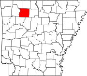
Ponca is an unincorporated community and census-designated place (CDP) in Newton County, Arkansas, United States. Ponca is located on Arkansas Highway 43, 10 miles (16 km) west of Jasper. Ponca has a post office with ZIP code 72670.[2]
Per the 2020 census, the population was 30.[3]
Demographics
| Census | Pop. | Note | %± |
|---|---|---|---|
| 2020 | 30 | — | |
| U.S. Decennial Census[4] 2020[5] | |||
2020 census
| Race / Ethnicity | Pop 2020[5] | % 2020 |
|---|---|---|
| White alone (NH) | 30 | 100.00% |
| Black or African American alone (NH) | 0 | 0.00% |
| Native American or Alaska Native alone (NH) | 0 | 0.00% |
| Asian alone (NH) | 0 | 0.00% |
| Pacific Islander alone (NH) | 0 | 0.00% |
| Some Other Race alone (NH) | 0 | 0.00% |
| Mixed Race/Multi-Racial (NH) | 0 | 0.00% |
| Hispanic or Latino (any race) | 0 | 0.00% |
| Total | 30 | 100.00% |
External links
- Newton County Historical Society
References
- ^ a b U.S. Geological Survey Geographic Names Information System: Ponca, Arkansas
- ^ ZIP Code Lookup
- ^ "Ponca CDP, Arkansas". United States Census Bureau. Retrieved April 15, 2022.
- ^ "Decennial Census of Population and Housing by Decades". US Census Bureau.
- ^ a b "P2 HISPANIC OR LATINO, AND NOT HISPANIC OR LATINO BY RACE – 2020: DEC Redistricting Data (PL 94-171) – Ponca CDP, Arkansas". United States Census Bureau.
- v
- t
- e
Municipalities and communities of Newton County, Arkansas, United States
County seat: Jasper
- Big Creek
- Boston
- Grove
- Hasty
- Hickory Grove
- Hudson
- Jackson
- Jefferson
- Jones
- Kentucky
- Lincoln
- Low Gap
- Marble Falls
- Murray
- Osage
- Pleasant Hill
- Plumlee
- Polk
- Ponca
- Prairie
- Richland
- Van Buren
- White
- Deer
- Mount Judea
- Ponca
- Wayton
communities
- Arkansas portal
- United States portal
 | This article about a location in Newton County, Arkansas is a stub. You can help Wikipedia by expanding it. |
- v
- t
- e


