Ponta de Água
Neighbourhood in Praia, Santiago Island, Cape Verde
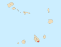
14°56′06″N 23°30′29″W / 14.935°N 23.508°W / 14.935; -23.508 (2010)
7601
Ponta de Água is a subdivision of the city of Praia in the island of Santiago, Cape Verde. Its population was 8,682 at the 2010 census.[1] It is situated 2 km north of the city centre. Adjacent neighbourhoods are Monteagarro to the north, Coqueiro/Castelão to the east, Lem Cachorro to the south, Vila Nova to the southwest and Safende to the west.
References
- ^ "2010 Census results Santiago". Instituto Nacional de Estatística Cabo Verde (in Portuguese). 24 November 2016.
- v
- t
- e
City of Praia
- Achada Grande Frente
- Achada Grande Tras
- Achada Santo António
- Achadinha
- Bairro Craveiro Lopes
- Calabaceira
- Chã de Areia
- Fazenda
- Lem Ferreira
- Palmarejo
- Plateau
- Ponta de Água
- Prainha
- Quebra Canela
- São Francisco
- Terra Branca
- Tira Chapéu
- Várzea
- Vila Nova

- Cape Verdean National Archives (ANCV)
- Museu Etnográfico da Praia
- National Auditorium
- National Library of Cape Verde
- Quintal da Música
- Tabanka
- Capture of Santiago (1585)
- Battle of Porto Praya (1780)
- Cape Verde
- Barlavento
- Santiago
- Praia
Authority control databases | |
|---|---|
| International |
|
| National |
|


