Ponta do Leme Velho
16°35′32″N 22°53′13″W / 16.5921°N 22.887°W / 16.5921; -22.887Location Southeastern Sal, Cape Verde Offshore water bodies Atlantic Ocean Settlements 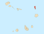
Mountains and hills Points and promontories Lighthouses Other geographical features Other topics
Ponta do Leme Velho is a headland on the southeast coast of the island of Sal, Cape Verde. It is about 2 km east of the town of Santa Maria.
Also referred to as Ponta do Leme Bedj as seen in the map.
References
- v
- t
- e
The island of Sal, Cape Verde
- Espargos
- Murdeira
- Palmeira
- Pedra de Lume
- Santa Maria
- Terra Boa

- Morrinho de Açúcar
- Cagarral
- Monte Curral
- Monte Grande
- Rabo de Junco
- Serra Negra
- Ponta da Fragata
- Ponta do Leme Velho
- Ponta Norte
- Ponta Preta (Northern Sal)
- Ponta Preta (Southern Sal)
- Ponta do Sinó
- Ponta de Vera Cruz


