Rudbar-e Jonubi County
County in Kerman province, Iran
County in Kerman, Iran
Rudbar-e Jonubi County Persian: شهرستان رودبار جنوب | |
|---|---|
County | |
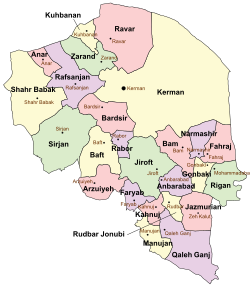 Location of Rudbar-e Jonubi County in Kerman province (bottom center, yellow) | |
 Location of Kerman province in Iran | |
| Coordinates: 27°58′03″N 58°03′08″E / 27.96750°N 58.05222°E / 27.96750; 58.05222[1] | |
| Country | Iran |
| Province | Kerman |
| Capital | Rudbar |
| Districts | Central, Halil Dasht |
| Population (2016)[2] | |
| • Total | 105,992 |
| Time zone | UTC+3:30 (IRST) |
Rudbar-e Jonubi County (Persian: شهرستان رودبار جنوب) is in Kerman province, Iran. Its capital is the city of Rudbar.[3]
History
In 2023, Jazmurian District was separated from the county in the establishment of Jazmurian County. Bizhanabad Rural District was created in the Central District, and Nehzatabad Rural District was separated from it in the formation of Halil Dasht District, which was divided into two rural districts, including the new Abbasabad Rural District.[4]
Demographics
Population
At the time of the 2006 National Census, the county's population was 86,747 in 17,364 households.[5] The following census in 2011 counted 104,421 people in 24,506 households.[6] The 2016 census measured the population of the county as 105,992 in 27,428 households.[2]
Administrative divisions
Rudbar-e Jonubi County's population history and administrative structure over three consecutive censuses are shown in the following table.
| Administrative Divisions | 2006[5] | 2011[6] | 2016[2] |
|---|---|---|---|
| Central District | 50,292 | 62,712 | 62,125 |
| Bizhanabad RD[a] | |||
| Nehzatabad RD | 19,921 | 22,946 | 21,538 |
| Rudbar RD | 22,096 | 27,543 | 25,840 |
| Rudbar (city) | 8,275 | 12,223 | 14,747 |
| Halil Dasht District[a] | |||
| Abbasabad RD[a] | |||
| Nehzatabad RD | |||
| Jazmurian District[b] | 36,455 | 41,709 | 43,867 |
| Jazmurian RD | 32,020 | 36,625 | 31,642 |
| Kuhestan RD | 4,435 | 5,084 | 5,390 |
| Zeh-e Kalut (city) | 6,835 | ||
| Total | 86,747 | 104,421 | 105,992 |
| RD = Rural District | |||
See also
![]() Media related to Rudbar-e Jonubi County at Wikimedia Commons
Media related to Rudbar-e Jonubi County at Wikimedia Commons
Notes
- ^ a b c Established after the 2016 census[4]
- ^ Transferred to Jazmurian County after the 2016 census[4]
References
- ^ OpenStreetMap contributors (8 July 2023). "Rudbar-e Jonubi County" (Map). OpenStreetMap (in Persian). Retrieved 8 July 2023.
- ^ a b c "Census of the Islamic Republic of Iran, 1395 (2016)". AMAR (in Persian). The Statistical Center of Iran. p. 08. Archived from the original (Excel) on 20 October 2020. Retrieved 19 December 2022.
- ^ Aref, Mohammad Reza (11 May 1384). "Divisional changes and reforms in Kerman province". Qavanin (in Persian). Ministry of Interior, Defense Political Commission of the Government Board. Archived from the original on 5 May 2023. Retrieved 9 July 2023.
- ^ a b c Mokhbar, Mohammad (24 December 1401). "Letter of approval regarding the country divisions of Kerman province". Qavanin (in Persian). Ministry of Interior, Council of Ministers. Archived from the original on 7 July 2023. Retrieved 7 July 2023.
- ^ a b "Census of the Islamic Republic of Iran, 1385 (2006)". AMAR (in Persian). The Statistical Center of Iran. p. 08. Archived from the original (Excel) on 20 September 2011. Retrieved 25 September 2022.
- ^ a b "Census of the Islamic Republic of Iran, 1390 (2011)". Syracuse University (in Persian). The Statistical Center of Iran. p. 08. Archived from the original (Excel) on 29 March 2023. Retrieved 19 December 2022.
- v
- t
- e
Kerman province, Iran

and cities
- Arg-é Bam
- Bardsir citadel
- Carpet Museum, Kerman
- Dinosaur remnants, Zarand
- Dousari waterfall
- Ganjali Khan Complex
- Hajagha-ali historical complex
- Ibrahim Khan's school
- Jamé Mosque of Kerman
- Kerman's grand Bazzar
- Kerman's museum of industry
- Khanqah of Sheykh Saeid
- Konar Sandal
- Meymand
- Naderi Milestone, Fahraj
- Pid-e Nekooieh
- Presidential museum of Rafsanjan
- Rayen Castle
- Shazdeh Garden
- Sirjan's Yakhchals
- Torang cave
- Shah Nematollah Vali Shrine
- Vakil bath, Kerman
 Rudbar-e Jonubi County Rudbar-e Jonubi County | |||||||||||||
|---|---|---|---|---|---|---|---|---|---|---|---|---|---|
| Capital | |||||||||||||
| Districts |
| ||||||||||||


