Shaft County
County in Gilan province, Iran
County in Gilan, Iran
Shaft County Persian: شهرستان شفت | |
|---|---|
County | |
 Location of Shaft County in Gilan province (center left, purple) | |
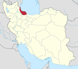 Location of Gilan province in Iran | |
| Coordinates: 37°07′N 49°22′E / 37.117°N 49.367°E / 37.117; 49.367[1] | |
| Country |  Iran Iran |
| Province | Gilan |
| Capital | Shaft |
| Districts | Central, Ahmadsargurab |
| Population (2016)[2] | |
| • Total | 54,226 |
| Time zone | UTC+3:30 (IRST) |
| Shaft County can be found at GEOnet Names Server, at this link, by opening the Advanced Search box, entering "9207013" in the "Unique Feature Id" form, and clicking on "Search Database". | |
Shaft County (Persian: شهرستان شفت) is in Gilan province, Iran. Its capital is the city of Shaft.[3]
Demographics
Population
At the time of the 2006 National Census, the county's population was 63,375 in 16,466 households.[4] The following census in 2011 counted 58,543 people in 17,790 households.[5] The 2016 census measured the population of the county as 54,226 in 18,416 households.[2]
Administrative divisions
Shaft County's population history and administrative structure over three consecutive censuses are shown in the following table.
| Administrative Divisions | 2006[4] | 2011[5] | 2016[2] |
|---|---|---|---|
| Central District | 35,319 | 33,887 | 32,403 |
| Jirdeh RD | 16,565 | 15,724 | 13,211 |
| Molla Sara RD | 12,596 | 11,630 | 11,008 |
| Shaft (city) | 6,158 | 6,533 | 8,184 |
| Ahmadsargurab District | 28,056 | 24,656 | 21,823 |
| Ahmadsargurab RD | 12,988 | 11,577 | 9,642 |
| Chubar RD | 12,845 | 10,733 | 10,053 |
| Ahmadsargurab (city) | 2,223 | 2,346 | 2,128 |
| Total | 63,375 | 58,543 | 54,226 |
| RD = Rural District | |||
See also
![]() Media related to Shaft County at Wikimedia Commons
Media related to Shaft County at Wikimedia Commons
 Iran portal
References
- ^ OpenStreetMap contributors (8 October 2023). "Shaft County" (Map). OpenStreetMap (in Persian). Retrieved 8 October 2023.
- ^ a b c "Census of the Islamic Republic of Iran, 1395 (2016)". AMAR (in Persian). The Statistical Center of Iran. p. 01. Archived from the original (Excel) on 4 December 2020. Retrieved 19 December 2022.
- ^ Habibi, Hassan (22 July 1374). "Divisional Reforms in Gilan Province". Lamtakam (in Persian). Ministry of Interior, Political-Defense Commission of the Government Board. Archived from the original on 14 December 2023. Retrieved 14 December 2023.
- ^ a b "Census of the Islamic Republic of Iran, 1385 (2006)". AMAR (in Persian). The Statistical Center of Iran. p. 01. Archived from the original (Excel) on 20 September 2011. Retrieved 25 September 2022.
- ^ a b "Census of the Islamic Republic of Iran, 1390 (2011)". Syracuse University (in Persian). The Statistical Center of Iran. p. 01. Archived from the original (Excel) on 8 October 2023. Retrieved 19 December 2022.
- v
- t
- e

- Alshaytan Mountain
- Anzali Lagoon
- Astarachay
- Anzali Maritime Museum
- Laton Waterfall
- Astara Cactus museum
- Emarat-i Kulah Farangi Rasht
- Estil Lagoon
- Ghaziayan bridge
- Heyran road
- Heyran Gondola lift
- Rasht Municipality (city hall)
- Roudkhan Castle
- Sajiran waterfall
- Lunak waterfall
- Marlik royal cemetery
- Masouleh
- Moin Mausoleum
- Muhtasham garden
- Kull ancient castle
- Rasht museum
- Sheitankoh
- Tea Museum of Lahijan
- Zahed Gilani's Shrine
- Tea museum
 | This Gilan province location article is a stub. You can help Wikipedia by expanding it. |
- v
- t
- e


