Spring Valley Colony, South Dakota
Census-designated place in South Dakota, United States
44°02′23″N 98°53′20″W / 44.03972°N 98.88889°W / 44.03972; -98.88889 (2020)[3]
57382 (Wessington Springs)
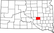
Spring Valley Colony is a Hutterite colony[4] and census-designated place (CDP) in Jerauld County, South Dakota, United States. It was first listed as a CDP prior to the 2020 census.[2]
It is in the western part of the county, on the north side of a west-flowing tributary of Crow Creek, which in turn flows west to the Missouri River at Lake Francis Case. The colony is 19 miles (31 km) by road west-southwest of Wessington Springs, the Jerauld county seat.
Demographics
| Census | Pop. | Note | %± |
|---|---|---|---|
| 2020 | 0 | — | |
| U.S. Decennial Census[5] | |||
References
- ^ "ArcGIS REST Services Directory". United States Census Bureau. Retrieved October 15, 2022.
- ^ a b c U.S. Geological Survey Geographic Names Information System: Spring Valley Colony, South Dakota
- ^ "Census Population API". United States Census Bureau. Retrieved October 15, 2022.
- ^ Friesen, Bert (May 2021). "Spring Valley Hutterite Colony (Wessington Springs, South Dakota, USA)". Global Anabaptist Mennonite Encyclopedia Online. Retrieved September 16, 2021.
- ^ "Census of Population and Housing". Census.gov. Retrieved June 4, 2016.
- v
- t
- e
Municipalities and communities of Jerauld County, South Dakota, United States
County seat: Wessington Springs
- Spring Valley Colony
community
- Alpena
- Anina
- Blaine
- Chery
- Crow
- Crow Lake
- Franklin
- Harmony
- Logan
- Marlar
- Pleasant
- Viola
- Wessington Springs
- South Dakota portal
- United States portal
 | This South Dakota state location article is a stub. You can help Wikipedia by expanding it. |
- v
- t
- e


