Srednja Kanomlja
Place in Inner Carniola, Slovenia
46°1′24.86″N 13°59′21.24″E / 46.0235722°N 13.9892333°E / 46.0235722; 13.9892333 Slovenia
 (2002)
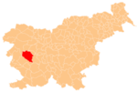
Srednja Kanomlja (pronounced [ˈsɾeːdnja kaˈnoːmlja], German: Mitterkanomla;[2] literally, 'middle Kanomlja'; cf. Spodnja Kanomlja 'lower Kanomlja') is a dispersed settlement in the Kanomljica Valley (along Kanomljica Creek, a small tributary of the Idrijca River named after Kanomlja) west of Spodnja Idrija in the Municipality of Idrija, Slovenia.[3] The village formerly included the hamlet of Kanomeljsko Razpotje (literally, 'Kanomlja crossroads'),[4] now Razpotje.
References
- ^ Statistical Office of the Republic of Slovenia
- ^ Leksikon občin kraljestev in dežel zastopanih v državnem zboru, vol. 6: Kranjsko. 1906. Vienna: C. Kr. Dvorna in Državna Tiskarna, p. 124.
- ^ Idrija municipal site
- ^ Savnik, Roman (1968). Krajevni leksikon Slovenije, vol. 1. Ljubljana: Državna založba Slovenije. p. 79.
External links
- Srednja Kanomlja on Geopedia
- v
- t
- e
Municipality of Idrija
Administrative seat: Idrija
| Current |
|
|---|---|
| Former |
- Črni Vrh Observatory
- Holy Trinity Church
- Gewerkenegg Castle
- Idrija Lace School
- Idrija Mine
- Idrija Museum
- Idrijca River
- Kenda Manor
- Mary on the Rock Parish Church
- St. Joseph's Parish Church
- Vojko's Plaque
- Wild Lake


