Sreenagar Upazila
Upazila in Dhaka, Bangladesh
Sreenagar শ্রীনগর | |
|---|---|
Upazila | |
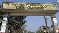 House of Jagadish Chandra Bose | |
 | |
| Coordinates: 23°32′10″N 90°17′30″E / 23.5361°N 90.2917°E / 23.5361; 90.2917 | |
| Country |  Bangladesh Bangladesh |
| Division | Dhaka |
| District | Munshiganj |
| Area | |
| • Total | 203.00 km2 (78.38 sq mi) |
| Population (2011) | |
| • Total | 259,887 |
| • Density | 1,300/km2 (3,300/sq mi) |
| Time zone | UTC+6 (BST) |
| Website | sreenagar |
Sreenagar (Bengali: শ্রীনগর) is an upazila of Munshiganj District[1] in the Division of Dhaka, Bangladesh. Division of Dhaka
Geography
Sreenagar is located at 23°32′10″N 90°17′30″E / 23.5361°N 90.2917°E / 23.5361; 90.2917. It has 57,111 households and total area 203.00 km2.
Demographics
| Religions in Sreenagar upazila (2011)[2] | ||||
|---|---|---|---|---|
| Religion | Percent | |||
| Islam | 89.68% | |||
| Hinduism | 10.29% | |||
| Other or not stated | 0.03% | |||
According to the 2011 Bangladesh census, Sreenagar Upazila had 57,111 households and a population of 259,887 of which 54,839 (21.10%) were under 10 years of age. Sreenagar had a literacy rate (age 7 and over) of 57.27%, compared to the national average of 51.8%, and a sex ratio of 1040 females per 1000 males. 14,862 (5.72%) lived in urban areas.[2][3]
As of the 1991 Bangladesh census, Sreenagar has a population of 205,797. Males constitute 49.88% of the population, and females 50.12%. This Upazila's eighteen up population is 99514. Sreenagar has an average literacy rate of 39.1% (7+ years), and the national average of 32.4% literate.[4]
Administration
Sreenagar Upazila is divided into 14 Union Parishads: Atpara, Baghra, Baraikhali, Bhagyakul, Birtara, Hasara, Kolapara, Kukutia, Patabhog, Rarikhal, Sholaghar, Shyamsiddhi, Sreenagar, and Tantar. The union parishads are subdivided into 102 mauzas and 147 villages.[2]
See also
References
- ^ Md. Mosarraf Hossain Sarker (2012), "Sreenagar Upazila", in Sirajul Islam and Ahmed A. Jamal (ed.), Banglapedia: National Encyclopedia of Bangladesh (Second ed.), Asiatic Society of Bangladesh
- ^ a b c "Bangladesh Population and Housing Census 2011 Zila Report – Munshiganj" (PDF). bbs.gov.bd. Bangladesh Bureau of Statistics.
- ^ "Community Tables: Munshiganj district" (PDF). bbs.gov.bd. Bangladesh Bureau of Statistics. 2011.
- ^ "Population Census Wing, BBS". Archived from the original on 2005-03-27. Retrieved November 10, 2006.


 | This Dhaka Division location article is a stub. You can help Wikipedia by expanding it. |
- v
- t
- e


