Taboye
Commune and village in Gao Region, Mali
16°42′53″N 0°15′31″W / 16.71472°N 0.25861°W / 16.71472; -0.25861 Mali
Mali[1]
(2009 Census)[2]
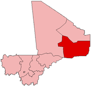
Taboye is a rural commune and village in the Cercle of Bourem in the Gao Region of south-eastern Mali. The commune is crossed by the River Niger and includes the villages of Bia, Dagha, Ha, Moudakane, Ouani, Tondibi and Taboye. In the 2009 census the commune had a population of 20,503.
References
- ^ Schéma Directeur de Lutte Contre L’ensablement dans le Nord Du Mali (6ème Et 7ème Régions): Monographie de la Commune de Taboye (PDF) (in French), Ministère de l’Environnement et de L’assainissement, République du Mali, 2004, archived from the original (PDF) on 2011-10-06.
- ^ Resultats Provisoires RGPH 2009 (Région de Gao) (PDF) (in French), République de Mali: Institut National de la Statistique.
External links
- Plan de Sécurité Alimentaire Commune de Taboye 2005-2009 (PDF) (in French), Commissariat à la Sécurité Alimentaire, République du Mali, USAID-Mali, 2005, archived from the original (PDF) on 2012-05-13.
- v
- t
- e
Communes and towns of Gao RegionCapital: Gao
- Ansongo (Ansongo)
- Bara (Bara)
- Bourra (Tassiga)
- Ouattagouna (Ouattagouna)
- Talataye (Talataye)
- Tessit (Tessit)
- Tin-Hama (Tin-Hama)
 | This Gao Region location article is a stub. You can help Wikipedia by expanding it. |
- v
- t
- e


