Tarkeshwar Rural Municipality
Gaupalika in Bagmati Province, Nepal
Tarakeshwar Gaupalika तारकेश्वर गाउँपालिका | |
|---|---|
Gaupalika | |
 Shree Bhamara Basic School, Tarkeshwor Gaupalika, Ward-6 | |
| Country |  Nepal Nepal |
| Province | Bagmati Province |
| District | Nuwakot District |
| Established | 11 March 2018 |
| Government | |
| • Chairman | Shiva Adhikari (NC) |
| • Vice Chairman | Hari Prasad Rimal (CPN) |
| Area | |
| • Total | 72.62 km2 (28.04 sq mi) |
| Population (2011 Nepal census) | |
| • Total | 15,719 |
| • Density | 220/km2 (560/sq mi) |
| Time zone | UTC+5:45 (NST) |
| Website | www.tarakeshwormunnuwakot.gov.np |
Tarakeshwar Rural Municipality is a Gaunpalika in Nuwakot District in Bagmati Province of central Nepal that was established in 11 March 2018 by merging the former Village Development Committees Khadga Bhanjyang(Ward no. 1 and 3), Gorsyang, Taruka and Dangsing. The headquarters of Tarkeshwor Gaupalika is located in Dangsing.
As it is located on the banks of the Trishuli River and has an on-site observation of the China-Nepal Railway from here, there is a good chance of prosperity if the opportunity is used properly.
It also has a high chance of tourist potential due to its historical, cultural and natural heritages, such as Taruka's Bull fighting, Dhiki-Jato Chulo and other site to make a name for itself in the National and International arena.
The Gaupalika is divided into 6 Wards.The total area of this Gaupalika is 72.62 square kilometer and the total population is 15,719 [1] as per the 2011 Nepal census.
Etymology
The Gaupalika is named as Tarakeshwor because of the Lord Shiva Temple located at Taruka which is known as Tarakeshwar.
Boundaries
- East: Bidur Municipality
- West: Nilkantha Municipality(Dhading District)
- North: Myagang Rural Municipality
- South: Belkotgadhi Municipality
Gallery
-
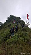
 The view from Dhiki-Jato Chuli
 -
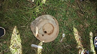
 Dhiki-Jato Chuli
 -
 Jato of Dhiki-Jato Chuli
 -
 Bullfight in Taruka
 -
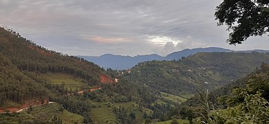 View of Khadga Bhanjyang from Tarkeshwar-6


References
- ^ "Nepal Census 2001", Nepal's Village Development Committees, Digital Himalaya, archived from the original on 12 October 2008, retrieved 15 November 2009.
External links
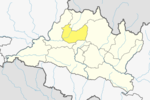
- UN map of the municipalities of Nuwakot District
- v
- t
- e
Headquarters: Bidur
- Kakani
- Panchkanya
- Likhu
- Dupcheshwor
- Shivapuri
- Tadi
- Suryagadhi
- Tarkeshwar
- Kispang
- Myagang
- Bageshwari Chokadi
- Balkumari
- Barsunchet
- Belkot
- Beteni
- Bhadratar
- Bhalche
- Budhasing
- Bungtang
- Charghare
- Chaturale
- Chaughada
- Chauthe
- Chhap
- Dangsing
- Deurali
- Duipipal
- Ganeshthan
- Gaunkharka
- Gerkhu
- Ghyangphedi
- Gorsyang
- Jiling
- Kakani
- Kalibas
- Kalikahalde
- Kalyanpur
- Kaule
- Khadag Bhanjyang
- Kharanitar
- Kholegaun Khanigaun
- Kintang
- Kumari
- Lachyang
- Likhu
- Madanpur
- Mahakali
- Manakamana
- Narjamandap
- Okharpauwa
- Panchkanya
- Phikuri
- Ralukadevi
- Ratmate
- Rautbesi
- Salme
- Samari, Nepal
- Samundradevi
- Samundratar
- Shikharbesi
- Sikre
- Sundaradevi
- Sunkhani
- Suryamati
- Talakhu
- Taruka
- Thanapati
- Thansing
- Thaprek
- Tupche
- Urleni
 | This article about a location in Nuwakot District, Nepal is a stub. You can help Wikipedia by expanding it. |
- v
- t
- e


