Tha Sai, Nonthaburi
Subdistrict in Thailand
Tha Sai Subdistrict ตำบลท่าทราย | |
|---|---|
Subdistrict | |
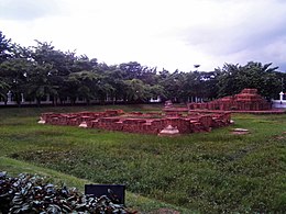 Buddhist Site of Choeng Tha–Na Bot | |
| Country |  Thailand Thailand |
| Province | Nonthaburi |
| District | Mueang Nonthaburi |
| Area [1] | |
| • Total | 8 km2 (3 sq mi) |
| Population (2020)[2] | |
| • Total | 69,827 |
| • Density | 8,728.38/km2 (22,606.4/sq mi) |
| Time zone | UTC+7 (ICT) |
| Postal code | 11000 |
| TIS 1099 | 120105 |
Tha Sai (Thai: ท่าทราย, pronounced [tʰâː sāːj]) is one of the ten subdistricts (tambon) of Mueang Nonthaburi District, in Nonthaburi Province, Thailand. The subdistrict is bounded by (clockwise from north) Bang Talat, Thung Song Hong, Bang Khen, Bang Kraso, and across the Chao Phraya River, Tha It subdistricts. The whole area of the subdistrict is covered by Nonthaburi City Municipality (เทศบาลนครนนทบุรี).[1] In 2020 it had a total population of 69,827 people.[2]
References
- ^ a b Nonthaburi City Municipality (2021). ข้อมูลทั่วไป [General Information]. Nonthaburi City Municipality (in Thai). Retrieved 28 November 2021.
- ^ a b "Population statistics 2020" (in Thai). Department of Provincial Administration. Retrieved 28 November 2021.
External links
- Website of Nonthaburi City Municipality
- v
- t
- e
 | This Nonthaburi Province location article is a stub. You can help Wikipedia by expanding it. |
- v
- t
- e


