Thorpe Park No 1 Gravel Pit
| Site of Special Scientific Interest | |
 | |
| Location | Surrey |
|---|---|
| Grid reference | TQ 027 681[1] |
| Interest | Biological |
| Area | 42.5 hectares (105 acres)[1] |
| Notification | 1999[1] |
| Location map | Magic Map |
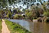
Thorpe Park No 1 Gravel Pit is a 42.5-hectare (105-acre) biological Site of Special Scientific Interest (SSSI) east of Virginia Water in Surrey.[1][2] It is part of the Thorpe Park theme park.
Ecology
This former gravel pit has been designated an SSSI because it is nationally important for wintering gadwall. There are also several other species of wintering wildfowl, such as goldeneyes and smew.[3]

History
The gravel pits at Thorpe Park were developed by Ready Mixed Concrete Ltd in the 1930s for the extraction of both sand and gravel for use in construction. They were intentionally flooded in the 1970s when the site was re-purposed for recreational use.[4][5]
The British Trust for Ornithology noted a Wetlands Advisory Service report of 2003 that suggested recreational activities at the site might have contributed to a decline in recorded gadwall numbers.[6] The site is used for waterskiing but the activity is prohibited between 1 October - 31 March, which is the period when the gadwalls use it for feeding. At other times of the year, the number of participants is restricted.[7]
References
- ^ a b c d "Designated Sites View: Thorpe Park No 1 Gravel Pit". Sites of Special Scientific Interest. Natural England. Retrieved 22 December 2018.
- ^ "Map of Thorpe Park No 1 Gravel Pit". Sites of Special Scientific Interest. Natural England. Retrieved 22 December 2018.
- ^ "Thorpe Park No 1 Gravel Pit citation" (PDF). Sites of Special Scientific Interest. Natural England. Retrieved 22 December 2018.
- ^ Nagle, Garrett (1999). Britain's Changing Environment. Nelson Thornes. p. 58. ISBN 978-0-17490-023-8.
- ^ Arbogast, Belinda F.; Knepper, Daniel H.; Langer, William H. (2000). The Human Factor in Mining Reclamation. U.S. Geological Survey Circular. Vol. 1191. U.S. Geological Survey. p. 16. ISBN 978-0-60793-275-1.
- ^ "BTO Research Report No. 361: South West London Waterbodies SPA Wildfowl Population Analysis" (PDF). British Trust for Ornithology. pp. 9, 19. Retrieved 20 April 2015.
- ^ "Appropriate Assessment Report" (PDF). Runnymede Council. March 2014. pp. 7–8. Retrieved 20 April 2015.
Further reading
- Brigg, Brian (2007). The use of waterbodies in South-West London by Gadwall and Shoveler; implications for nature conservation (PDF) (PhD). University of Oxford.
Wikimedia Commons has media related to Thorpe Park No 1 Gravel Pit.
51°24′11″N 0°31′30″W / 51.403°N 0.525°W / 51.403; -0.525
- v
- t
- e

- Ash to Brookwood Heaths
- Banstead Downs
- Basingstoke Canal
- Blackheath
- Blindley Heath
- Bookham Commons
- Broadmoor to Bagshot Woods and Heaths
- Charleshill
- Charterhouse to Eashing
- Chiddingfold Forest
- Chipstead Downs
- Chobham Common
- Colony Bog and Bagshot Heath
- Colyers Hanger
- Combe Bottom
- Devil's Punch Bowl
- Dumsey Meadow
- Epsom and Ashtead Commons
- Esher Commons
- Glover's Wood
- Godstone Ponds
- Gong Hill
- Hackhurst and White Downs
- Hankley Farm
- Hedgecourt
- Horsell Common
- Kempton Park Reservoirs
- Knight and Bessborough Reservoirs
- Langham Pond
- Leith Hill
- Lingfield Cernes
- Mole Gap to Reigate Escarpment
- Moor Park
- Ockham and Wisley Commons
- Papercourt
- Puttenham and Crooksbury Commons
- Quarry Hangers
- Ranmore Common
- Reigate Heath
- Sheepleas
- Smart's and Prey Heaths
- Staffhurst Wood
- Staines Moor
- Stones Road Pond
- Thorpe Hay Meadow
- Thorpe Park No 1 Gravel Pit
- Thursley, Hankley and Frensham Commons
- Titsey Woods
- Vann Lake and Ockley Woods
- Wey Valley Meadows
- Whitmoor Common
- Windsor Forest and Great Park
- Woldingham and Oxted Downs
- Wraysbury Reservoir
| ||
|---|---|---|
| Main rivers |
|  |
| Canals and navigations | ||
| Ordinary watercourses | ||
| Lakes, ponds and wetlands |
| |
| Reservoirs | ||
Categories: Rivers, Canals | ||


