Vorotnavan
Place in Syunik, Armenia
Vorotnavan Որոտնավան | |
|---|---|
 | |
39°29′19″N 46°08′29″E / 39.48861°N 46.14139°E / 39.48861; 46.14139 | |
| Country | Armenia |
| Province | Syunik |
| Municipality | Sisian |
| Area | |
| • Total | 18.24 km2 (7.04 sq mi) |
| Population (2011)[2] | |
| • Total | 263 |
| • Density | 14/km2 (37/sq mi) |
| Time zone | UTC+4 (AMT) |
| Vorotnavan at GEOnet Names Server | |
Vorotnavan (Armenian: Որոտնավան) is a village in the Sisian Municipality of the Syunik Province in Armenia. The Vorotnaberd fortress is located near the village.
Demographics
The Statistical Committee of Armenia reported its population was 282 in 2010,[3] down from 283 at the 2001 census.[4]
Gallery
-
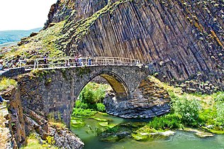 Melik Tangi bridge
 -
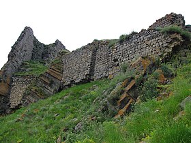 Vorotnaberd fortress
 -
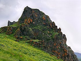 Vorotnaberd fortress
 -
 Scenery around Vorotnaberd
 -
 Scenery
 -
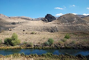
 Vorotan river


References
Wikimedia Commons has media related to Vorotan, Syunik.
- ^ "Syunik regional e-Governance System" (in Armenian). Syunik Province provincial government. Click on link entitled "Համայնքներ" (community) and search for the place by Armenian name.
- ^ Statistical Committee of Armenia. "The results of the 2011 Population Census of Armenia" (PDF).
- ^ "Marzes of Armenia and Yerevan City in Figures, 2010" (PDF). Statistical Committee of Armenia.
- ^ Report of the results of the 2001 Armenian Census, Statistical Committee of Armenia
- v
- t
- e

Capital: Kapan

- Achanan
- Agarak
- Aghvani
- Antarashat
- Arajadzor
- Artsvanik
- Bargushat
- Chakaten
- Chapni
- Davit Bek
- Ditsmayri
- Dzorastan
- Geghanush
- Gomaran
- Kaghnut
- Khdrants
- Khordzor
- Nerkin Hand
- Nerkin Khotanan
- Norashenik
- Okhtar
- Sevakar
- Shikahogh
- Shishkert
- Shrvenants
- Srashen
- Syunik
- Sznak
- Tandzaver
- Tavrus
- Tsav
- Uzhanis
- Vanek
- Vardavank
- Verin Khotanan
- Yegheg
- Yeghvard
- Erkenants [hy]
Portal:
 Geography

 | This article about a location in Syunik Province, Armenia is a stub. You can help Wikipedia by expanding it. |
- v
- t
- e


