Yamaga, Kumamoto
City in Kyūshū, Japan
Yamaga  Flag  Seal | |
|---|---|
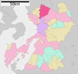
 Location of Yamaga in Kumamoto Prefecture | |
 | |
| Symbols | |
| Bird | Japanese bush warbler |
| Flower | Rhododendron |
| Tree | Osmanthus fragrans |


Yamaga (山鹿市, Yamaga-shi) is a city in Kumamoto Prefecture, Japan. As of 31 July 2024[update], the city had an estimated population of 48,181 in 21996 households, and a population density of 160 persons per km2.[1] The total area of the city is 299.69 km2 (115.71 sq mi).
Geography
Yamaga is located in the northern inland area of Kumamoto Prefecture, about 30 kilometers north of Kumamoto City. The city borders Fukuoka Prefecture from the north to the northeast, and Oita Prefecture to the east. The area from the urban center, which is slightly south of the geographic center, to the southern part (former Kikuka Town) is a basin. The northern to northeastern part of the city near the prefectural border is part of the Kyushu Mountains. The Kikuchi River flows through the center of the city.
Surrounding municipalities
Kumamoto Prefecture
- Gyokutō
- Kikuchi
- Kumamoto
- Nagomi
Fukuoka Prefecture
- Yame
Ōita Prefecture
- Hita
Climate
Yamaga has a humid subtropical climate (Köppen climate classification Cfa) with hot, humid summers and cool winters. There is significant precipitation throughout the year, especially during June and July. The average annual temperature in Yamaga is 14.9 °C (58.8 °F). The average annual rainfall is 2,177.9 mm (85.74 in) with July as the wettest month. The temperatures are highest on average in August, at around 26.3 °C (79.3 °F), and lowest in January, at around 3.5 °C (38.3 °F).[2] The highest temperature ever recorded in Yamaga was 36.9 °C (98.4 °F) on 21 August 2013 and 8 August 2015; the coldest temperature ever recorded was −10.1 °C (13.8 °F) on 19 February 1977.[3]
| Climate data for Kahoku, Yamaga (1991−2020 normals, extremes 1977−present) | |||||||||||||
|---|---|---|---|---|---|---|---|---|---|---|---|---|---|
| Month | Jan | Feb | Mar | Apr | May | Jun | Jul | Aug | Sep | Oct | Nov | Dec | Year |
| Record high °C (°F) | 22.0 (71.6) | 23.3 (73.9) | 26.0 (78.8) | 30.1 (86.2) | 35.3 (95.5) | 34.9 (94.8) | 36.8 (98.2) | 36.9 (98.4) | 35.8 (96.4) | 32.3 (90.1) | 26.3 (79.3) | 24.0 (75.2) | 36.9 (98.4) |
| Mean daily maximum °C (°F) | 9.7 (49.5) | 11.4 (52.5) | 15.2 (59.4) | 20.7 (69.3) | 25.3 (77.5) | 27.3 (81.1) | 30.6 (87.1) | 32.0 (89.6) | 28.9 (84.0) | 23.7 (74.7) | 17.6 (63.7) | 11.9 (53.4) | 21.2 (70.2) |
| Daily mean °C (°F) | 3.5 (38.3) | 4.9 (40.8) | 8.4 (47.1) | 13.6 (56.5) | 18.4 (65.1) | 22.1 (71.8) | 25.7 (78.3) | 26.3 (79.3) | 22.9 (73.2) | 17.0 (62.6) | 10.9 (51.6) | 5.4 (41.7) | 14.9 (58.9) |
| Mean daily minimum °C (°F) | −1.5 (29.3) | −0.9 (30.4) | 2.1 (35.8) | 6.8 (44.2) | 11.9 (53.4) | 17.7 (63.9) | 22.0 (71.6) | 22.0 (71.6) | 18.2 (64.8) | 11.4 (52.5) | 5.3 (41.5) | 0.2 (32.4) | 9.6 (49.3) |
| Record low °C (°F) | −8.8 (16.2) | −10.1 (13.8) | −6.7 (19.9) | −3.9 (25.0) | 0.9 (33.6) | 6.3 (43.3) | 12.7 (54.9) | 13.7 (56.7) | 6.2 (43.2) | −0.7 (30.7) | −3.7 (25.3) | −7.4 (18.7) | −10.1 (13.8) |
| Average precipitation mm (inches) | 59.3 (2.33) | 84.8 (3.34) | 136.3 (5.37) | 158.7 (6.25) | 196.7 (7.74) | 449.0 (17.68) | 452.5 (17.81) | 233.2 (9.18) | 167.2 (6.58) | 86.4 (3.40) | 87.8 (3.46) | 66.1 (2.60) | 2,177.9 (85.74) |
| Average precipitation days (≥ 1.0 mm) | 7.8 | 8.6 | 10.9 | 10.5 | 10.1 | 14.2 | 14.1 | 11.5 | 9.6 | 6.8 | 7.9 | 7.9 | 119.9 |
| Mean monthly sunshine hours | 119.5 | 128.6 | 162.2 | 186.2 | 196.4 | 124.6 | 157.2 | 190.2 | 169.8 | 179.8 | 143.4 | 126.6 | 1,884.6 |
| Source: Japan Meteorological Agency[3][2] | |||||||||||||
Demography
Per Japanese census data, the population of Yamaga is as shown below,[4]
| Year | Pop. | ±% |
|---|---|---|
| 1960 | 76,209 | — |
| 1970 | 64,029 | −16.0% |
| 1980 | 62,839 | −1.9% |
| 1990 | 62,150 | −1.1% |
| 2000 | 59,491 | −4.3% |
| 2010 | 55,391 | −6.9% |
| 2020 | 49,025 | −11.5% |
History
The area of Yamaga was part of ancient Higo Province. There are many burial mounds dating from the Kofun period within the city limitsm and the name "Yamaga" appears in early 8th century records. During the Kamakura period, the area developed as a hot spring town and in the Muromachi period it developed into a commercial settlement and a post town on the Buzen Kaido highway, and was noted for its production of umbrellas. During the Edo Period it was part of the holdings of Kumamoto Domain. It was the site of a battle during the 1877 Satsuma rebellion. After the Meiji restoration, the town of Yamaga was established with the creation of the modern municipalities system on April 1, 1889. On January 15, 2005, Yamaga absorbed the towns of Kahoku, Kamoto, Kaō and Kikuka (all from Kamoto District) to create the new and expanded city of Yamaga.
Government
Yamaga has a mayor-council form of government with a directly elected mayor and a unicameral city council of 20 members. Yamaga contributes two members to the Kumamoto Prefectural Assembly. In terms of national politics, the city is part of the Kumamoto 3rd district of the lower house of the Diet of Japan.
Economy
The local economy is based on agriculture and light manufacturing.
Education
Yamaga has 15 public elementary schools and six public junior high schools operated by the city government, and three public high schools operated by the Kumamoto Prefectural Board of Education. There is also one private high school. The prefecture also operates a special education school for the handicapped.
Transportation
Railways
Yamaga has no passenger railway services. The nearest train stations are Shin-Tamana Station on the Kyushu Shinkansen or either Tamana Station or Ueki Station on the JR Kyushu Kagoshima Main Line.
Highways
The Kyushu Expressway passes through the western part of the city, but there are no interchanges within the city


Local attractions

Attractions include the Kumamoto Prefectural Ancient Burial Mound Museum.
- Yamaga Bon-dancing Lantern Festival, every August event[citation needed]
- Yachioza Traditional Theater[citation needed]
National Historic Sites
- Kikuchi Castle ruins
- [Katōda Higashibaru Site]]
- Benkei-ga-ana Kofun
- Nabeta Cave Tombs
- Iwabaru Kofun cluster
- Chibusan-Obusan Kofun
- Kumabe clan residence site
Notable people from Yamaga
- Kiyoura Keigo, politician
- Raizō Matsuno, politician
- Yorihisa Matsuno, politician
- Ikuo Kabashima, politician
- Shin'ichi Etō, baseball player
- Kōhei Miyazaki, football player
- Sō Kawahara, football player
- Chiyohakuhō Daiki, sumo wrestler
- Daiki Inaba, professional wrestler
- Mayumi Aoki, swimmer
- Ryōtarō Araki, football player
References
External links
Wikimedia Commons has media related to Yamaga, Kumamoto.
- Official website
 (in Japanese)
- v
- t
- e

| Wards |
|---|

Authority control databases | |
|---|---|
| International |
|
| National |
|
| Geographic |
|
| Academics |
|
 | This Kumamoto Prefecture location article is a stub. You can help Wikipedia by expanding it. |
- v
- t
- e


