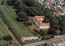
Zalaszentgrót
Place in Zala County, Hungary

Flag

Coat of arms

Location of Zala county in Hungary
46°56′25″N 17°04′53″E / 46.94040°N 17.08138°E / 46.94040; 17.08138
 Hungary
 (2019)
8790
Zalaszentgrót is a town in Zala County, Hungary. The settlement incorporates the suburbs Kisszentgrót, Tüskeszentpéter, Csáford, Zalakoppány, Zalaudvarnok and Aranyod.
Twin towns – sister cities

Zalaszentgrót is twinned with:
 Germersheim, Germany
External links

Wikimedia Commons has media related to Zalaszentgrót.
Wikivoyage has a travel guide for Zalaszentgrót.
- Street map (in Hungarian)
- [1]
- [2]
- v
- t
- e
Zala County
- Nagykanizsa
- Zalaegerszeg (county seat)


- Alibánfa
- Almásháza
- Alsónemesapáti
- Alsópáhok
- Alsórajk
- Alsószenterzsébet
- Babosdöbréte
- Baglad
- Bagod
- Bak
- Baktüttös
- Balatongyörök
- Balatonmagyaród
- Bánokszentgyörgy
- Barlahida
- Batyk
- Bázakerettye
- Becsehely
- Becsvölgye
- Belezna
- Belsősárd
- Bezeréd
- Bocfölde
- Bocska
- Böde
- Bödeháza
- Bókaháza
- Boncodfölde
- Borsfa
- Börzönce
- Búcsúszentlászló
- Bucsuta
- Csapi
- Csatár
- Cserszegtomaj
- Csertalakos
- Csesztreg
- Csöde
- Csömödér
- Csonkahegyhát
- Csörnyeföld
- Dióskál
- Dobri
- Döbröce
- Dobronhegy
- Dötk
- Egeraracsa
- Egervár
- Eszteregnye
- Esztergályhorváti
- Felsőpáhok
- Felsőrajk
- Felsőszenterzsébet
- Fityeház
- Fűzvölgy
- Gáborjánháza
- Galambok
- Garabonc
- Gellénháza
- Gelse
- Gelsesziget
- Gétye
- Gombosszeg
- Gősfa
- Gosztola
- Gutorfölde
- Gyűrűs
- Hagyárosbörönd
- Hahót
- Hernyék
- Homokkomárom
- Hosszúvölgy
- Hottó
- Iborfia
- Iklódbördőce
- Kacorlak
- Kallósd
- Kálócfa
- Kányavár
- Karmacs
- Kávás
- Kehidakustány
- Kemendollár
- Keménfa
- Kerecseny
- Kerkabarabás
- Kerkafalva
- Kerkakutas
- Kerkaszentkirály
- Kerkateskánd
- Kilimán
- Kisbucsa
- Kiscsehi
- Kisgörbő
- Kiskutas
- Kispáli
- Kisrécse
- Kissziget
- Kistolmács
- Kisvásárhely
- Kozmadombja
- Külsősárd
- Kustánszeg
- Lakhegy
- Lasztonya
- Lendvadedes
- Lendvajakabfa
- Lickóvadamos
- Ligetfalva
- Lispeszentadorján
- Liszó
- Lovászi
- Magyarföld
- Magyarszentmiklós
- Magyarszerdahely
- Maróc
- Márokföld
- Miháld
- Mihályfa
- Mikekarácsonyfa
- Milejszeg
- Misefa
- Molnári
- Murakeresztúr
- Murarátka
- Muraszemenye
- Nagybakónak
- Nagygörbő
- Nagykapornak
- Nagykutas
- Nagylengyel
- Nagypáli
- Nagyrada
- Nagyrécse
- Nemesapáti
- Nemesbük
- Nemeshetés
- Nemesnép
- Nemespátró
- Nemesrádó
- Nemessándorháza
- Nemesszentandrás
- Németfalu
- Nova
- Óhíd
- Oltárc
- Orbányosfa
- Ormándlak
- Orosztony
- Ortaháza
- Ozmánbük
- Padár
- Páka
- Pakod
- Pálfiszeg
- Pat
- Pethőhenye
- Petrikeresztúr
- Petrivente
- Pókaszepetk
- Pölöske
- Pölöskefő
- Pördefölde
- Pórszombat
- Pötréte
- Pusztaapáti
- Pusztaederics
- Pusztamagyaród
- Pusztaszentlászló
- Ramocsa
- Rédics
- Resznek
- Rezi
- Rigyác
- Salomvár
- Sand
- Sárhida
- Sármellék
- Semjénháza
- Sénye
- Söjtör
- Sormás
- Sümegcsehi
- Surd
- Szalapa
- Szécsisziget
- Szentgyörgyvár
- Szentgyörgyvölgy
- Szentkozmadombja
- Szentliszló
- Szentmargitfalva
- Szentpéterfölde
- Szentpéterúr
- Szepetnek
- Szijártóháza
- Szilvágy
- Teskánd
- Tilaj
- Tófej
- Tormafölde
- Tornyiszentmiklós
- Tótszentmárton
- Tótszerdahely
- Türje
- Újudvar
- Valkonya
- Vállus
- Várfölde
- Várvölgy
- Vasboldogasszony
- Vaspör
- Vindornyafok
- Vindornyalak
- Vindornyaszőlős
- Vöckönd
- Zajk
- Zalaapáti
- Zalabaksa
- Zalabér
- Zalaboldogfa
- Zalacsány
- Zalacséb
- Zalaháshágy
- Zalaigrice
- Zalaistvánd
- Zalakomár
- Zalaköveskút
- Zalamerenye
- Zalasárszeg
- Zalaszabar
- Zalaszántó
- Zalaszentbalázs
- Zalaszentgyörgy
- Zalaszentiván
- Zalaszentjakab
- Zalaszentlászló
- Zalaszentlőrinc
- Zalaszentmárton
- Zalaszentmihály
- Zalaszombatfa
- Zalatárnok
- Zalaújlak
- Zalavár
- Zalavég
- Zebecke
- History
- Geography
- Government
- Economy
- Culture
- Tourism
 | This Zala location article is a stub. You can help Wikipedia by expanding it. |
- v
- t
- e


