Liste des volcans de Papouasie-Nouvelle-Guinée


Cet article est une ébauche concernant la Papouasie-Nouvelle-Guinée et le volcanisme.
Vous pouvez partager vos connaissances en l’améliorant (comment ?) selon les recommandations des projets correspondants.
Cet article recense les volcans de Papouasie-Nouvelle-Guinée.
Liste
Nouvelle-Guinée
| Nom | Forme | Altitude | Dernière éruption | Coordonnées |
|---|---|---|---|---|
| Crater Mountain | Stratovolcan | ? | 6° 35′ S, 145° 05′ E | |
| Doma | Stratovolcan | ? | 5° 54′ S, 143° 09′ E | |
| Mont Giluwe | ? | ~ 220 000 ans | 6° 03′ S, 143° 53′ E | |
| Hagen | ? | ~ 210 000 ans | 5° 45′ S, 144° 02′ E | |
| Chaîne des Hydrographes | Stratovolcan | ? | 9° 00′ S, 148° 22′ E | |
| Koranga | Maar | ? | 7° 20′ S, 146° 42′ E | |
| Mont Lamington | Stratovolcan | 1956 | 8° 57′ S, 148° 09′ E | |
| Madilogo | Cône pyroclastique | ? | 9° 12′ S, 147° 34′ E | |
| Managlase | Champ volcanique | ? | 9° 05′ S, 148° 20′ E | |
| Musa River | Champ hydrothermal | ? | 9° 18′ S, 148° 08′ E | |
| Sessagara | Cônes pyroclastiques | ? | 9° 29′ S, 149° 08′ E | |
| Victory | Stratovolcan | 1935 | 9° 12′ S, 149° 04′ E | |
| Waiowa | Cône pyroclastique | 1944 | 9° 34′ S, 149° 04′ E | |
| Yelia | Stratovolcan | ? | 7° 03′ S, 145° 51′ E |
Îles de l'Amirauté
| Nom | Forme | Altitude | Dernière éruption | Coordonnées |
|---|---|---|---|---|
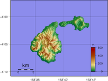
| Baluan | Stratovolcan | Holocène | 2° 34′ S, 147° 17′ E | |
| Détroit de Saint-Andrew | Volcan complexe | 1957 | 2° 23′ S, 147° 21′ E |
Bougainville
| Nom | Forme | Altitude | Dernière éruption | Coordonnées |
|---|---|---|---|---|
| Bagana | Cône de lave | 2006 | 6° 08′ S, 155° 12′ E | |
| Balbi | Stratovolcan | Holocène | 5° 55′ S, 154° 59′ E | |
| Billy Mitchell | Bouclier pyroclastique | 1580 | 6° 06′ S, 155° 13′ E | |
| Loloru | Bouclier pyroclastique | 1050 av. J.-C. | 6° 31′ S, 155° 37′ E | |
| Takuan | Complexe volcanique | Holocène | 6° 27′ S, 155° 36′ E | |
| Tore | Cône de lave | Holocène | 5° 50′ S, 154° 56′ E |
Îles d'Entrecasteaux
| Nom | Forme | Altitude | Dernière éruption | Coordonnées |
|---|---|---|---|---|
| Détroit de Dawson | Champ volcanique | 1350 | 9° 37′ S, 150° 53′ E | |
| Goodenough | Champ volcanique | Holocène | 9° 29′ S, 150° 21′ E | |
| Iamalele | Dômes de lave | Holocène | 9° 31′ S, 150° 32′ E |
Nouvelle-Bretagne
| Nom | Forme | Altitude | Dernière éruption | Coordonnées |
|---|---|---|---|---|
| Bamus | Stratovolcan | 1886 | 5° 12′ S, 151° 14′ E | |
| Bola | Stratovolcan | Holocène | 5° 09′ S, 150° 02′ E | |
| Dakataua | Caldeira | 1895 | 5° 03′ S, 150° 06′ E | |
| Garbuna | Stratovolcans | ? | 5° 27′ S, 150° 02′ E | |
| Garove | Stratovolcan | Holocène | 4° 42′ S, 149° 30′ E | |
| Garua | Champ volcanique | ? | 5° 18′ S, 150° 04′ E | |
| Hargy | Stratovolcan | 950 | 5° 20′ S, 151° 06′ E | |
| Langila | Volcan complexe | 2021 | 5° 32′ S, 148° 25′ E | |
| Lolo | Stratovolcan | ? | 5° 28′ S, 150° 30′ E | |
| Lolobau | Caldeira | 1912 | 4° 55′ S, 151° 09′ E | |
| Mundua | Volcan complexe | Holocène | 4° 38′ S, 149° 21′ E | |
| Narage | ? | Pleistocene | 4° 33′ S, 149° 08′ E | |
| Pago | Caldeira | 2003 | 5° 35′ S, 150° 31′ E | |
| Rabaul | Bouclier pyroclastique | 2006 | 4° 16′ S, 152° 12′ E | |
| Sulu | Stratovolcans | ? | 5° 30′ S, 150° 57′ E | |
| Tavui | Caldeira | 5150 av. J.-C. | 4° 07′ S, 152° 12′ E | |
| Ulawun | Stratovolcan | 2005 | 5° 03′ S, 151° 20′ E |
Nouvelle-Irlande
| Nom | Forme | Altitude | Dernière éruption | Coordonnées |
|---|---|---|---|---|
| Ambitle | Stratovolcan | 350 av. J.-C. | 4° 05′ S, 153° 39′ E | |
| Lihir | Complexe volcanique | Holocène | 3° 08′ S, 152° 39′ E |
Autres îles
| Nom | Forme | Altitude | Dernière éruption | Coordonnées |
|---|---|---|---|---|
| Bam | Stratovolcan | 1960 | 3° 37′ S, 144° 49′ E | |
| Blup Blup | Stratovolcan | ? | 3° 30′ S, 144° 36′ E | |
| Boisa | Stratovolcan | ? | 4° 00′ S, 144° 58′ E | |
| Kadovar | Stratovolcan | 2018 | 3° 38′ S, 144° 38′ E | |
| Karkar | Stratovolcan | 1979 | 4° 39′ S, 145° 58′ E | |
| Long Island | Volcan complexe | 1993 | 5° 21′ S, 147° 07′ E | |
| Manam | Stratovolcan | 2006 | 4° 05′ S, 145° 02′ E | |
| Nouvelle-Hanovre | ? | ? | ? | 2° 30′ S, 150° 15′ E |
| Ritter | Stratovolcan | 1974 | 5° 31′ S, 148° 07′ E | |
| Sakar | Stratovolcan | ? | 5° 25′ S, 148° 06′ E | |
| Umboi | Volcan complexe | Holocène | 5° 35′ S, 147° 53′ E | |
| Volcan sans nom | Volcan sous-marin | − | ? | 3° 02′ S, 147° 47′ E |
| Yomba | Volcan sous-marin ? | ? | 4° 54′ S, 146° 45′ E |
Annexes
Articles connexes
Liens externes
- (en) Volcanoes of Melanesia and Australia (Global Volcanism Program)
 Portail du volcanisme
  Portail de la Papouasie-Nouvelle-Guinée


