County Dorchester, Maryland
38°25′N 76°05′W / 38.42°N 76.08°W / 38.42; -76.08
| Dorchester County, Maryland | ||
|---|---|---|
 Dorchester County Courthouse | ||
| ||
 Lokasi di negara bagian Maryland | ||
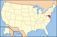 Lokasi negara bagian Maryland di Amerika Serikat | ||
| Didirikan | 1669 | |
| Asal nama | Edward Sackville, Earl Dorset | |
| Seat | Cambridge | |
| Kota terbesar | Cambridge | |
| Wilayah | ||
| • Keseluruhan | 98.292 sq mi (254.575 km2) | |
| • Daratan | 55.754 sq mi (144.402 km2) | |
| • Perairan | 42.538 sq mi (110.173 km2), 43.28% | |
| Populasi | ||
| • (2010) | 32.618 | |
| • Kepadatan | 58/sq mi (22,5/km²) | |
| Distrik kongres | 1st | |
| Zona waktu | Timur: UTC-5 (EST) / -4 (EDT) | |
| Situs web | www | |

County Dorchester adalah county yang terletak di Negara Bagian Maryland. Berdasarkan Sensus 2010, jumlah penduduk di county ini mencapai 32,618 jiwa.[1] County seat dari county ini berada di Cambridge.[2] Nama County ini diambil dari Edward Sackville, Earl Dorset sahabat dari Keluarga Calvert yang mendirikan Maryland.[3]
Referensi
- ^ "State & County QuickFacts". United States Census Bureau. Diarsipkan dari versi asli tanggal 2011-07-06. Diakses tanggal August 20, 2013.
- ^ "Find a County". National Association of Counties. Diakses tanggal 2011-06-07.
- ^ Gannett, Henry (1905). The Origin of Certain Place Names in the United States. Govt. Print. Off. hlm. 108.
- l
- b
- s
 Negara bagian Maryland
Annapolis (ibu kota)
- Cities
- Government
- History
- People
- Congressional Delegations
- Congressional Maps
- Economy
- List of Maryland-related topics
- Visitor Attractions
- Allegheny Mountains
- Atlantic Coastal Plain
- Baltimore‑Washington Metro Area
- Blue Ridge
- Chesapeake
- Cumberland Valley
- Delaware Valley
- Delmarva Peninsula
- Eastern Shore
- Piedmont
- Ridge and Valley
- Southern Maryland
- Western Maryland
- Western Shore
- Aberdeen
- Annapolis
- Baltimore
- Bowie
- College Park
- Cumberland
- Frederick
- Gaithersburg
- Greenbelt
- Hagerstown
- Laurel
- Rockville
- Salisbury
- Takoma Park
- Westminster
- Adelphi
- Arbutus
- Arnold
- Aspen Hill
- Ballenger Creek
- Bel Air North
- Bel Air South
- Bethesda
- Brooklyn Park
- Calverton
- Camp Springs
- Carney
- Catonsville
- Chesapeake Ranch Estates-Drum Point
- Chillum
- Clinton
- Cockeysville-Hunt Valley
- Colesville
- Columbia
- Coral Hills
- Crofton
- Damascus
- Dundalk
- East Riverdale
- Edgewood
- Eldersburg
- Elkridge
- Ellicott City
- Essex
- Fairland
- Ferndale
- Forestville
- Fort Washington
- Friendly
- Germantown
- Glen Burnie
- Glenn Dale
- Greater Landover
- Greater Upper Marlboro
- Green Haven
- Green Valley
- Halfway
- Hillcrest Heights
- Joppatowne
- Kettering
- Lake Shore
- Langley Park
- Lanham-Seabrook
- Lansdowne-Baltimore Highlands
- Lexington Park
- Linganore-Bartonsville
- Lochearn
- Lutherville-Timonium
- Mays Chapel
- Middle River
- Milford Mill
- Montgomery Village
- North Bethesda
- North Laurel
- North Potomac
- Ocean Pines
- Odenton
- Olney
- Overlea
- Owings Mills
- Oxon Hill-Glassmanor
- Parkville
- Parole
- Pasadena
- Perry Hall
- Pikesville
- Potomac
- Randallstown
- Redland
- Reisterstown
- Riviera Beach
- Rosaryville
- Rosedale
- Rossville
- St. Charles
- Savage-Guilford
- Severn
- Severna Park
- Silver Spring
- South Gate
- South Laurel
- Suitland-Silver Hill
- Towson
- Waldorf
- Walker Mill
- Wheaton-Glenmont
- White Oak
- Woodlawn
 | Artikel bertopik Amerika Serikat ini adalah sebuah rintisan. Anda dapat membantu Wikipedia dengan mengembangkannya. |
- l
- b
- s


