Senarai Tapak Warisan Dunia di Afrika

Pertubuhan Pendidikan, Sains dan Kebudayaan Pertubuhan Bangsa-Bangsa Bersatu (UNESCO) telah menetapkan 147 Tapak Warisan Dunia di Afrika.[a] Tapak-tapak ini terletak di 46 negara (juga dipanggil "negara pihak").
Tapak Warisan Dunia Terpilih
Habsyah mendahului dengan sebelas tapak; diikuti oleh Afrika Selatan dengan sepuluh, Maghribi dan Tunisia menjadi rumah kepada sembilan tapak; kemudian Algeria, Mesir, Senegal dan Tanzania tujuh. Sembilan negara hanya mempunyai satu tapak setiap satu. Empat tapak dikongsi antara dua negara: Taman Maloti-Drakensberg (Lesotho dan Afrika Selatan), Rizab Alam Semula Jadi Ketat Gunung Nimba (Côte d'Ivoire dan Guinea), Bulatan Batu Senegambia (Gambia dan Senegal ), dan Mosi-oa-Tunya / Air Terjun Victoria (Zambia dan Zimbabwe). Dua tapak dikongsi antara tiga negara: Trinasional Sangha (Republik Afrika Tengah, Cameroon dan Congo) dan Kompleks W-Arly-Penjari (Benin, Burkina Faso dan Niger).[1]
Tapak-tapak pertama di benua itu telah diberikan inskripsi pada tahun 1978, apabila Pulau Gorée Senegal dan Gereja Tarah Batu dan Taman Negara Simien di Ethiopia telah dipilih semasa senarai itu dimulakan.[2] [3]
Sehingga September 2017, Somalia tidak mempunyai Tapak Warisan Dunia rasmi kerana kerajaan Somalia bukan ahli Konvensyen Warisan Dunia 1972. Namun, terdapat—sekurang-kurangnya—sekitar sepuluh tapak arkeologi di negara itu yang dipercayai mempunyai peluang untuk mempunyai status Warisan Dunia.[4]
Setiap tahun, Jawatankuasa Warisan Dunia UNESCO boleh memasukkan tapak baharu dalam senarai atau menyahsenarai tapak yang tidak lagi memenuhi kriterianya. Terdapat sepuluh kriteria untuk dipilih: enam untuk warisan budaya (i–vi) dan empat untuk warisan semula jadi (vii–x).[5] Sesetengah tapak, yang ditetapkan sebagai "tapak campuran", adalah kedua-dua warisan budaya dan semula jadi. Di Afrika, terdapat 91 tapak budaya, 50 semula jadi dan 6 tapak campuran.[1]
Beberapa usaha telah dibuat untuk menambahkan bilangan tapak dan memelihara warisan tapak-tapak sedia ada di benua itu; contohnya, pada 5 Mei 2006, Dana Warisan Dunia Afrika telah dilancarkan oleh UNESCO untuk menyasarkan rantau Afrika Sub-Sahara. Ia berancang untuk melindungi tapak-tapak tersebut dengan menyediakan kakitangan untuk negara-negara pihak demi menyelenggara inventori-inventori nasional tapak yang sedia ada, serta "menyediakan dokumen pencalonan untuk dimasukkan ke dalam Senarai Warisan Dunia." Geran juga dipersiapkan untuk membantu "[pemuliharaan] dan pengurusan harta-harta warisan secara umumnya" dan memulihkan yang sedang terancam.[6]
Kempen itu pada mulanya dibiayai oleh Afrika Selatan dengan AS$ 3.5 juta,[6] dan setakat Mac 2011, telah mengumpul $4.7 juta dari pelbagai negara, dengan $4.1 juta lagi dalam bentuk aku cagar yang belum selesai.[7] UNESCO juga telah cuba meningkatkan kesedaran tentang tapak-tapak asal manusia Afrika di Habsyah, dengan matlamat untuk memulihara dan melindungi kawasan tersebut daripada menjadi lebih terbengkalai dan rosak.[8]
Jawatankuasa Warisan Dunia juga boleh menentukan jika satu-satu tapak itu terancam, bahawa mengalami "keadaan yang mengancam ciri-ciri yang mana harta itu telah tercatat dalam Senarai Warisan Dunia".[9] Di samping Tapak-tapak Warisan Dunia yang lain, tapak dalam bahaya tertakluk kepada penilaian semula oleh pihak jawatankuasa setiap tahun dalam "sesi biasa" mereka.[10][11] Afrika mempunyai 21 tapak dalam senarai bahaya, 14% daripada semua tapak di Afrika dan 40% daripada 52 tapak terancam di seluruh dunia. Libya mempunyai 5 tapak dalam senarai bahaya, yang kedua tertinggi daripada mana-mana negara di dunia.[b][12]
Tapak-tapak di Afrika telah dilabelkan sedemikian kerana pelbagai sebab, seperti penebangan hutan dan pemburuan,[13][14] perang saudara,[15] ugutan terhadap kakitangan tanah rizab dan penyanderaan,[16] projek-projek minyak dan gas serta perlombongan,[17] kemerosotan biokepelbagaian,[18] dan kerosakan struktur bangunan.[19] Sepuluh tapak pernah diisytiharkan terancam tetapi telah hilang status itu; contohnya Kawasan Pemuliharaan Ngorongoro (1984–1989),[20] Taman Negara Pergunungan Rwenzori (1999–2004),[21] dan Tipasa (2002–2006).[22] Taman Negara Garamba dan Timbuktu juga telah kehilangan status tersebut, pada tahun 1992 dan 2005, tetapi memperolehnya semula pada tahun 1996 dan 2012.[23][24] Walaupun terdapat banyak tapak terancam dan isu yang berkisar mengenainya, Tapak-tapak Warisan Dunia Afrika tidak pernah dilucutkan gelarannya, yang hanya pernah berlaku tiga kali.
Tapak Warisan Dunia
Petunjuk
Senarai di bawah mengabaikan takrifan geopolitik UNESCO bagi Afrika dan memasukkan tapak-tapak di "Negara-negara Arab".[25] Mesir termasuk sebagai sebahagian daripada Afrika Utara. Senarai juga terdiri daripada beberapa tapak yang mana negara pihak berada di luar tanah besar, tetapi tapak itu sendiri terletak di dalam Afrika; empat tapak sedemikian terletak di Kepulauan Canaria (milik Sepanyol), satu di Madeira (milik Portugal), satu di Réunion (milik Perancis), dan satu di kepulauan Tristan da Cunha (milik United Kingdom).
Jadual boleh diisih mengikut lajur dengan mengklik  di kepala lajur; mengikut abjad angka untuk lajur Tapak, Kawasan dan Tahun; mengikut negara pihak diikuti oleh wilayah atau rantau untuk lajur Lokasi; dan mengikut jenis kriteria diikuti oleh negara untuk lajur Kriteria.
 di kepala lajur; mengikut abjad angka untuk lajur Tapak, Kawasan dan Tahun; mengikut negara pihak diikuti oleh wilayah atau rantau untuk lajur Lokasi; dan mengikut jenis kriteria diikuti oleh negara untuk lajur Kriteria.
- Tapak – dinamakan sempena gelaran rasmi oleh Jawatankuasa Warisan Dunia[1]
- Lokasi – diisih mengikut negara, diikuti dengan wilayah pada peringkat rantau atau wilayah. Untuk tapak-tapak multinasional atau berbilang wilayah, nama diisih mengikut abjad.
- Kriteria – seperti yang ditakrifkan oleh Jawatankuasa Warisan Dunia[5]
- Keluasan – dalam hektar dan ekar, tidak mengira zon penampan. Nilai "—" menandakan bahawa tiada data diterbitkan oleh UNESCO
- Tahun - apabila tapak itu telah memasuki Senarai Warisan Dunia
- Penerangan – maklumat ringkas tapak, termasuk sebab ia layak menjadi tapak terancam, jika berkaitan
 Terancam
 * Tapak yang merentas sempadan
Tapak
| Tapak | Imej | Lokasi | Kriteria | Keluasan ha (ekar) | Tahun | Huraian |
|---|---|---|---|---|---|---|
| Aapravasi Ghat | 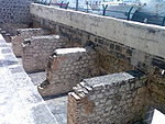 | Daerah Port Louis, 20°09′31″S 57°30′11″E / 20.158611°S 57.503056°E / -20.158611; 57.503056 (Aapravasi Ghat) | Budaya: (vi) | 7003160000000000000♠0.16 (0.40) | 2006 | Selepas British menghapuskan perhambaan di Mauritius, Aapravasi Ghat telah dipilih oleh kerajaan British untuk menerima buruh kontrak India ke negara itu untuk bekerja di ladang dan estet gula. Antara tahun 1834 dan 1920, hampir setengah juta pekerja kontrak melalui Port Louis dari India, untuk bekerja di Mauritius ataupun berpindah ke tanah jajahan British yang lain.[26] |
| Abu Mena |  | Abusir, 30°50′28″N 29°39′47″E / 30.84098°N 29.663117°E / 30.84098; 29.663117 (Abu Mena) | Budaya: (iv) | 7006182000000000000♠182 (450) | 1979 | Runtuhan bekas kota suci Kristian ini mempunyai gereja, baptisteri, basilika, bangunan awam, jalan, biara, rumah, dan bengkel, yang dibina di atas makam Menas dari Alexandria.[27] Jawatankuasa Warisan Dunia menetapkan Abu Mena sebagai tapak terancam pada tahun 2001, kerana keruntuhan di kawasan tersebut disebabkan oleh tanah liat di permukaan, yang menjadi separa cecair apabila bertemu dengan "air berlebihan".[28] |
| Rizab Semula Jadi Air dan Ténéré |  | Bahagian Arlit, 18°N 9°E / 18°N 9°E / 18; 9 (Rizab Semula Jadi Air dan Ténéré) | Semula Jadi: (vii), (ix), (x) | 7010773600000000000♠7,736,000 (19,120,000) | 1991 | Kawasan perlindungan terbesar di Afrika, terletak di padang pasir Sahara Ténéré, terdiri daripada batu gunung berapi Aïr dan poket-poket kecil Sahil terpencil dengan flora dan fauna unik.[29] Rizab alam semula jadi ini diletakkan dalam Senarai Warisan Dunia dalam Bahaya UNESCO pada tahun 1992, kerana peningkatan konflik ketenteraan dan pengambilan tebusan enam kakitangan rizab pada bulan Februari. Penghapusannya daripada senarai ini dipertimbangkan pada tahun 1999, tetapi sehingga tahun 2011, posisinya masih tidak berubah.[30][31] |
| Aksum |  | Wilayah Tigray, 14°07′49″N 38°43′07″E / 14.130190°N 38.718605°E / 14.130190; 38.718605 (Aksum) | Budaya: (i), (iv) | — | 1980 | Runtuhan kota Aksum, yang bertarikh dari abad ke-1 hingga ke-13, menandakan pusat tamadun kuno Ethiopia. Ia termasuk tugu obelisk, stele gergasi, makam diraja, dan runtuhan istana lama.[32] |
| Al Qal'a Beni Hammad | 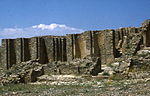 | Maadid, 35°49′06″N 4°47′13″E / 35.818440°N 4.786840°E / 35.818440; 4.786840 (Al Qal'a dari Beni Hammad) | Budaya: (iii) | 7006150000000000000♠150 (370) | 1980 | Ibu kota pertama amir-amir Hammadi yang dibentengi awalnya dibina pada tahun 1007 dan dirobohkan pada tahun 1152. Ia menampilkan masjid dengan 8 ruang dan 13 lorong, iaitu antara yang terbesar di Algeria.[33] |
| Atol Aldabra |  | Aldabra Group,
| Semula Jadi: (vii), (ix), (x) | 7008350000000000000♠35,000 (86,000) | 1982 | Atol Aldabra terdiri daripada empat pulau karang besar dan sebuah lagun, dikelilingi oleh terumbu karang. Pulau-pulau itu rumah kepada populasi kura-kura gergasi terbesar di dunia.[34] |
| Perani El Jem |  | El Djem, 35°17′47″N 10°42′25″E / 35.296390°N 10.706940°E / 35.296390; 10.706940 (Amphitheatre of El Jem) | Budaya: (iv), (vi) | 7004137000000000000♠1.37 (3.4) | 1979 | Perani El Jem, yang dibina pada abad ke-3, adalah perani terbesar di Afrika Utara, dan yang terbesar dibina di luar Itali, dengan kapasiti 35,000 penonton, dan "menggambarkan keagungan dan keluasan Rom Imperial".[35] |
| Tapak Metalurgi Ferus Purba Burkina Faso | Douroula, Tiwêga, Yamané, Kindibo, Békuy,
| Budaya: (iii), (iv), (vi) | 7006122300000000000♠122.3 (302) | 2019 | Satu siri lima lokasi arkeologi yang tersebar di seluruh negara, diiktiraf kerana kepentingan sejarahnya dalam pembangunan dan amalan teknologi peleburan besi di Afrika. Setiap tapak mengandungi sisa-sisa relau dan ciri-ciri lain yang berkaitan dengan proses pengeluaran besi, mempamerkan inovasi teknologi dan kemahiran penduduk di rantau ini.[36] | |
| Ksour Purba Ouadane, Chinguetti, Tichitt dan Oualata |  | Chinguetti, dan Tichitt, 20°55′44″N 11°37′25″W / 20.928890°N 11.623610°W / 20.928890; -11.623610 (Ancient Ksour of Ouadane, Chinguetti, Tichitt and Oualata) | Budaya: (iii), (iv), (v) | — | 1996 | Ksour Purba Ouadane, Chinguetti, Tichitt dan Oualata |
| Thebes Purba dengan Nekropolisnya |  | Luxor,
| Budaya: (i), (iii), (vi) | 7007739000000000000♠7,390 (18,300) | 1979 | Bekas ibu kota Mesir dan kota dewa Mesir Amun, mengandungi relik dari kemuncak Mesir Purba. Kuil-kuil, istana, dan nekropolis Lembah Raja-raja dan Lembah Permaisuri mempunyai "kesaksian yang menakjubkan kepada tamadun Mesir".[37] |
| Tapak Arkeologi Carthage | 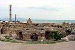 | Tunis,
| Budaya: (ii), (iii), (vi) | 7006498000000000000♠498 (1,230) | 1979 | Diasaskan pada abad ke-9 SM, Carthage telah dibangunkan menjadi sebuah empayar perdagangan yang merangkumi Mediterranean dan, menurut UNESCO, "rumah kepada sebuah tamadun yang cemerlang". Bandar ini telah dimusnahkan pada 146 SM dalam Perang Punik di tangan orang Rom, tetapi kemudiannya dibina semula oleh mereka.[38] |
| Tapak Arkeologi Cyrene |  | Jebel Akhdar,
| Budaya: (ii), (iii), (vi) | 7006132000000000000♠132 (330) | 1982 | Tanah jajahan Yunani yang dahulunya telah diromanisasikan dan diubah menjadi ibu kota, sehinggalah ia dimusnahkan oleh gempa bumi 365 Crete. Runtuhan berusia ribuan tahun kekal terkenal sejak abad ke-18. Kesemua lima tapak di Libya, termasuk Cyrene, diletakkan dalam Senarai Warisan Dunia dalam Bahaya UNESCO pada 2016, disebabkan konflik yang berterusan di negara itu.[39] |
| Tapak Arkeologi Leptis Magna |  | Khoms,
| Budaya: (i), (ii), (iii) | 7006387000000000000♠387 (960) | 1982 | The Roman city of Leptis Magna was enlarged by Emperor Septimius Severus, who was born there. Public monuments, a harbour, a marketplace, storehouses, shops, and homes were among the reasons for its induction into the list.[40] All five sites in Libya, including Leptis Magna, were placed on UNESCO's List of World Heritage in Danger in 2016, due to ongoing conflict in the country.[41] |
| Tapak Arkeologi Sabratha |  | Sabratha,
| Budaya: (iii) | 7005910000000000000♠91 (220) | 1982 | "A Phoenician trading-post that served as an outlet for the products of the African hinterland, Sabratha was part of the short-lived Numidian Kingdom of Massinissa before being Romanized and rebuilt in the 2nd and 3rd centuries."[42] All five sites in Libya, including Sabratha, were placed on UNESCO's List of World Heritage in Danger in 2016, due to ongoing conflict in the country.[43] |
| Tapak Arkeologi Volubilis |  | Meknes,
| Budaya: (ii), (iii), (iv), (vi) | 7005420000000000000♠42 (100) | 1997 | The important Roman outpost of Volubilis was founded in the 3rd century BCE to become the capital of Mauretania. It contained many buildings, the remains of which have survived extensively to this day.[44] |
| Tapak-tapak Arkeologi Island of Meroe |  | Meroë,
| Budaya (ii), (iii), (iv), (v) | 7007235700000000000♠2,357 (5,820) | 2011 | The site was the centre of the Kingdom of Kush, a major force active from the 8th century BCE to the 4th century CE. It is home to pyramids, temples, and domestic buildings, among other vestiges.[45] |
| Asante Traditional Buildings | Kumasi,
| Budaya:Asa (v) | — | 1980 | The site, north-east of Kumasi, hosts the final intact remains of the Ashanti Empire, which peaked in the 18th century. The dwellings, which are made of earth, wood, and straw, are susceptible to the damages caused by the "onslaught of time and weather".[46] | |
| Asmara: A Modernist African City[c] |  | Maekel,
| Budaya:Asm (ii)(iv) | 7006481000000000000♠481 (1,190) | 2017 | Located at over 2000 metres above sea level, the capital of Eritrea developed from the 1890s onwards as a military outpost for the Italian colonial power. After 1935, Asmara underwent a large scale programme of construction applying the Italian rationalist idiom of the time to governmental edifices, residential and commercial buildings, churches, mosques, synagogues, cinemas, hotels, etc.[47] |
| Barberton Makhonjwa Mountains |  | SouMpumalanga,
| Semula Jadi:SouBar (viii) | 7009113137000000000♠113,137 (279,570) | 2018 | The mountains contain the world's oldest geological structures and are known to have preserved volcanic and sedimentary rocks estimated to be between 3.6 and 3.25 billion years old.[48] |
| Banc d'Arguin National Park |  | MauritaniaAzefal and Nouadhibou, | Semula Jadi:MauBan (ix), (x) | 7010120000000000000♠1,200,000 (3,000,000) | 1989 | The park consists of sand dunes, coastal swamps, small islands, and shallow bodies of water, all bordering the coast of the Atlantic Ocean. Birds are often found to migrate in the area, accompanied by various species of sea turtles and dolphins, whose presence fishermen often use to attract fish.[49] |
| Bassari Country: Bassari, Fula and Bedik Budaya Landscapes |  |  Senegal Senegal 12°35′36″N 12°50′45″W / 12.593333°N 12.845833°W / 12.593333; -12.845833 (Bassari Country: Bassari, Fula and Bedik Cultural Landscapes) | Budaya:Bas (iii), (v), (vi) | 7008503090000000000♠50,309 (124,320) | 2012 | This area stands out for its Budaya diversity and the preservation of traditional lifestyles, deeply intertwined with the natural environment. The communities maintain unique Budaya identities, practices, and structures, reflecting their adaptation to the landscape. Their traditional practices, including agriculture, architecture, and religious ceremonies.[50] |
| Bwindi Impenetrable National Park | 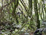 | Kabale District, Kisoro District, and Rukungiri District,
| Semula Jadi: (vii), (x) | 7008320920000000000♠32,092 (79,300) | 1994 | Located on the border of plains and mountain forests, the park in south-western Uganda is home to over 160 species of trees, over a hundred species of ferns, and various species of birds and butterflies. Many endangered species are within its boundaries as well, including the mountain gorilla.[51] |
| Cape Floral Region Protected Areas | 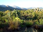 | Eastern Cape and Western Cape, | Semula Jadi: (ix), (x) | 7010109474200000000♠1,094,742 (2,705,170) | 2004[d] | The site consists of eight protected areas that are among the richest in plant life worldwide, containing nearly 20% of Africa's total flora. Its scientific value is demonstrated by the presence of fire and radiation adaptivity in plants and seed dispersal by insects.[52] |
| Chongoni Rock-Art Area |  | Dedza District,
| Budaya:MalawiCho (iii), (vi) | 7008126400000000000♠12,640 (31,200) | 2006 | The 127-site area contains the richest concentration of rock art in Central Africa, ranging from Stone Age paintings to contemporary work from farmers. The symbols depicted in the rock art are strongly centred around women and retain a Budaya significance for the Chewa.[53] |
| Cidade Velha, Historic Centre of Ribeira Grande |  | Ribeira Grande,
| Budaya: (ii), (iii), (vi) | 7006209000000000000♠209 (520) | 2009 | The town, in the south of the island of Santiago, was the first European colonial outpost in the tropics, with remains dating back to the 16th century. Two churches, a royal fortress, and Pillary Square help comprise the tropical town's original street layout.[54] |
| Cliff of Bandiagara (Land of the Dogons) |  | Bandiagara Cercle,
| Mixed:MaliCli (v), (vii) | 7009327390000000000♠327,390 (809,000) | 1989 | The sandy plateau and cliffs of Bandiagara outline the site, featuring houses, granaries, altars, sanctuaries, and Togu-Na meeting-places. Age-old social traditions such as masks, feasts, rituals, and ancestral worship also add to its Budaya significance.[55] |
| Comoé National Park | 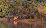 | Zanzan,
| Semula Jadi:Com (ix), (x) | 7010115000000000000♠1,150,000 (2,800,000) | 1983 | Among the largest protected sites of West Africa, the park features the Comoé River and the unique flora which accompanies it.[56] The site was placed on UNESCO's List of World Heritage in Danger in 2003, due to unrest in Côte d'Ivoire, and various other factors such as poaching, wildfires, lack of proper management of the site, and overgrazing.[57] It was later removed from the list in 2017 following successful efforts to fight poaching, leading to increases in populations of fauna such as elephants and chimpanzees.[58] |
| Dja Faunal Reserve |  | CameDja-et-Lobo and Haut-Nyong, | Semula Jadi:CameDja (ix), (x) | 7009526000000000000♠526,000 (1,300,000) | 1987 | Among Africa's largest and best-protected rain forests, the Cameroonian reserve is almost completely surrounded by the Dja River and contains 107 mammal species, of which five are threatened.[59] |
| Djémila |  | Sétif,
| Budaya:Dje (iii), (iv) | 7005300000000000000♠30 (74) | 1982 | The ruins of a Roman town in a mountainous location, including a forum, temples, basilicas, triumphal arches, and houses, each adapted to a location 900 m (3,000 ka) above sea level.[60] |
| Djoudj National Bird Sanctuary |  | Saint-Louis Region,
| Semula Jadi:Djo (vii), (x) | 7008160000000000000♠16,000 (40,000) | 1981 | The Senegal River delta wetland area consists of streams, lakes, ponds, and backwaters. It is the home to 1.5 million birds, including the great white pelican, the purple heron, the African spoonbill, the great egret, and cormorants. The sanctuary also features crocodiles, African manatees, and other typical Sahelian species.[61] The site was previously on the danger list from 1984 to 1988 due to potential impact from a dam[62][63] and again from 2000 to 2006 due to invasive species.[64][65] |
| Dougga / Thugga |  | Béja Governorate,
| Budaya: (ii), (iii) | 7005750000000000000♠75 (190) | 1997 | The site features the ruins of Dougga, a former capital of a Libyan–Punic state, which flourished under Ancient Rome and the Byzantine Empire, but declined in the Islamic period.[66] |
| Ecosystem and Relict Budaya Landscape of Lopé-Okanda |  | GabOgooué-Ivindo and Ogooué-Lolo, | Mixed:GabLop (iii), (iv), (ix), (x) | 7009491291000000000♠491,291 (1,214,010) | 2007 | The park features well-preserved tropical rain forests and savanna, resulting in a diverse ecosystem consisting of endangered, large mammals.[67] |
| Ennedi Massif: Natural and Budaya Landscape |  |  Chad Chad 17°02′30″N 21°51′46″E / 17.04167°N 21.86278°E / 17.04167; 21.86278 (Ennedi Massif: Natural and Cultural Landscape) | Mixed:ChaEnn (iii), (vii), (ix) | 7010244120000000000♠2,441,200 (6,032,000) | 2016 | [68] |
| Fasil Ghebbi, Gondar Region |  | Amhara Region,
| Budaya: (ii), (iii) | — | 1979 | The fortress was the residence of the Ethiopian emperors during the 16th and 17th century. The city remains, which feature buildings with Hindu and Arab influences, were later remodelled with Baroque-style architecture by Jesuit missionaries.[69] |
| Fort Jesus, Mombasa |  | Mombasa,
| Budaya: (ii), (iv) | 7004236000000000000♠2.36 (5.8) | 2011 | Fort Jesus is a Portuguese fort built from 1593 to 1596 on Mombasa Island to guard the old port of Mombasa, Kenya. The site's layout follows the Renaissance ideal that the human body is perfectly proportionate.[70] |
| Forts and Castles, Volta, Greater Accra, Central and Western Regions | 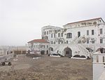 | Central Region, Greater Accra, Volta Region, and Western Region, | Budaya: (vi) | — | 1979 | The site features the remains of fortified trading posts, built along the Ghanaian coast between 1482 and 1786.[71] |
| Fossil Hominid Sites of South Africa |  | Gauteng, Limpopo, and North West,
| Budaya: (iii), (vi) | — | 1999[e] | The various fossil sites contain traces of human occupation and evolution dating 3.3 million years.[72] |
| French Austral Lands and Seas |  | FranceCrozet Islands, Kerguelen Islands, Île Saint-Paul, Île Amsterdam | Semula Jadi: (vii), (ix), (x) | 7011672969000000000♠67,296,900 (166,294,000) | 2019 | [73] |
| Garajonay National Park | 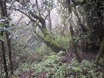 | La Gomera,
| Semula Jadi:Gara (vii), (ix) | 7007398400000000000♠3,984 (9,840) | 1986 | Most of the park, in the middle of the island of La Gomera of the Canary Islands, is covered with a lush laurel forest.[74] |
| Garamba National Park | 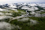 | Orientale,
| Semula Jadi:Gar (vii), (x) | 7009500000000000000♠500,000 (1,200,000) | 1980 | The park has vast savannas, grasslands, and woodlands, featuring elephants, giraffes, hippopotamuses, and the white rhinoceros.[75] Garamba was deemed to be endangered following the diminution of the white rhinoceros population in the area,[76] but it was removed from the list in 1991.[77] However, it later regained the status in 1996, when three rangers were killed and the population of white rhinoceros fell once again.[78][79] |
| Gebel Barkal and the Sites of the Napatan Region | 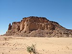 | SudMeroë,
| Budaya: (i), (ii), (iii), (iv), (vi) | 7006183000000000000♠183 (450) | 2003 | The five sites in the Nile Valley feature temples that are testimonial to the Napatan and Meroitic cultures.[80] |
| Gough and Inaccessible Islands | 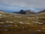 | Saint Helena,
| Semula Jadi: (vii), (x) | 7007790000000000000♠7,900 (20,000) | 1995[f] | The site represents one of the least-disrupted islands and marine ecosystems in the South Temperate Zone. The cliffs are free of introduced mammals and feature one of the world's largest colonies of seabirds.[81] |
| Great Zimbabwe National Monument |  | ZimMasvingo Province,
| Budaya:ZimGre (i), (iii), (vi) | 7006722000000000000♠722 (1,780) | 1986 | The city, now in ruins, was an important trading centre between the 11th and 15th centuries and was capital of the Bantu civilization.[82] |
| Harar Jugol, the Fortified Historic Town |  | Harari Region,
| Budaya:Har (ii), (iii), (iv), (v) | 7005480000000000000♠48 (120) | 2006 | The city is on a plateau and surrounded by gorges and savanna. It contains 82 mosques, 102 shrines, and unique interior design in the townhouses. It is said to be the fourth-holiest city of Islam.[83] |
| Historic Cairo[g] | 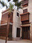 | Cairo,
| Budaya:His (i), (v), (vi) | 7006524000000000000♠524 (1,290) | 1979 | One of the world's oldest Islamic cities and in the middle of urban Cairo, the site dates from the 10th century and reached its golden age in the 14th century. It contains mosques, madrasahs, hammams, and fountains.[84] |
| Historic Centre of Agadez |  | Tchirozerine Department,
| Budaya: (ii), (iii) | 7005780000000000000♠78 (190) | 2013 | [85] |
| Historic City of Meknes | 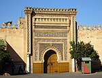 | Meknes,
| Budaya:His (iv) | — | 1996 | The former capital was founded in the 11th century and turned into a city with Spanish-Moorish influence during the 17th and 18th centuries.[86] |
| Historic Town of Grand-Bassam | 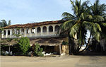 | Sud-Comoé,
| Budaya:Sud (iii), (iv) | 7006110000000000000♠110 (270) | 2012 | A colonial town built during the 19th and 20th centuries, Grand-Bassam was the first Ivorian capital following French rule in the region. Its quarters, which specialised in commerce, administration and general housing, helped the city become the economic and judicial hub of the country, in addition to being its most important port.[87] |
| Ichkeul National Park | 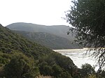 | BiBizerte,
| Semula Jadi:Ich (x) | 7008126000000000000♠12,600 (31,000) | 1980 | Ichkeul Lake and the surrounding wetlands is a destination for hundreds of thousands of migrating birds, including ducks, geese, storks, and pink flamingos. It was once part of a chain that extended across North Africa.[88] Previously, the World Heritage Committee had designated Ichkeul National Park as an endangered site in 1996, due to construction of dams that increased the salinity of the lake and reduced its ability to support bird populations.[89] In 2006 it was removed from the endangered list as the lake was no longer used for agriculture, reducing salinity and allowing birds to return.[90] |
| iSimangaliso Wetland Park[h] | 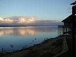 | KwaZulu-Natal,
| Semula Jadi: (vii), (ix), (x) | 7009239566000000000♠239,566 (591,980) | 1999 | The park features a variety of landforms, including coral reefs, long sandy beaches, coastal dunes, lake systems, and papyrus wetland, caused by fluvial, marine, and aeolian processes.[91] |
| Island of Gorée |  | Dakar Region,
| Budaya: (vi) | — | 1978 | The island was the largest slave-trading centre on the African coast from the 15th to the 19th century.[92] |
| Island of Mozambique |  | Nampula,
| Budaya:Isl (iv), (vi) | 7005960000000000000♠96 (240) | 1991 | The fortified former Portuguese trading post has used the same architectural techniques, style, and materials since the 16th century.[93] |
| Island of Saint-Louis | 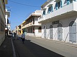 | Saint-Louis Region,
| Budaya: (ii), (iv) | — | 2000 | The French colonial settlement from the 17th century is on an island in the mouth of the Sénégal River. It played an important role in the culture and economy of West Africa.[94] |
| Ivindo National Park |  |  Gabon Gabon 0°24′22″N 12°38′27″E / 0.406111°N 12.640833°E / 0.406111; 12.640833 (Ivindo National Park) | Semula Jadi: (ix), (x) | 7009298758000000000♠298,758 (738,250) | 2021 | The park spans a significant area characterized by a mosaic of ecosystems, including rainforests, rivers, and waterfalls, most notably Kongou and Djidji waterfalls. This protected area is home to a veriety of wildlife, including endangered species such as forest elephants, lowland gorillas, and chimpanzees. The park's rivers are vital habitats for freshwater species and play a crucial role in the conservation of aquatic biodiversity in the region.[95] |
| Kahuzi-Biega National Park |  | Maniema and South Kivu, | Semula Jadi: (x) | 7009600000000000000♠600,000 (1,500,000) | 1980 | The park is dominated by two extinct volcanoes, Kahuzi and Biega. It also has abundant fauna, including the graueria gorillas.[96] The park was deemed to be endangered in 1997 when deforestation and hunting became a major problem. Militia groups and illegal settlers were also settling in the park, while fire and poaching helped justify the World Heritage Committee's decision.[97] |
| Kairouan | 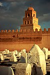 | Kairouan Governorate,
| Budaya:Kai (i), (ii), (iii), (v), (vi) | 7005680000000000000♠68 (170) | 1988 | The former capital was founded in 670 and flourished in the 9th century. Its heritage includes the Mosque of Uqba and the Mosque of the Three Gates.[98] |
| Kasbah of Algiers |  | Algiers,
| Budaya:Kas (ii), (v) | 7005600000000000000♠60 (150) | 1992 | A unique Islamic city on the Mediterranean coast, the former site overlooks the Carthaginian trading posts of the 4th century BCE. It contains remains of a citadel, old mosques, and Ottoman-style palaces.[99] |
| Kenya Lake System in the Great Rift Valley | 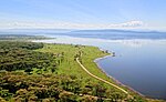 | Rift Valley Province,
| Semula Jadi:Lak (vii), (ix), (x) | 7008320340000000000♠32,034 (79,160) | 2011 | Located in the Great Rift Valley, Kenya, the site features three lakes: Lake Bogoria, Lake Nakuru, and Lake Elementaita. A highly diverse population of birds, including thirteen threatened species, frequent the area.[100] |
| Khami Ruins National Monument |  | Matabeleland,
| Budaya:ZimKha (iii), (iv) | — | 1986 | The city was built after the mid-16th century and was an important trading centre.[101] |
| ǂKhomani Budaya Landscape | SouthNorthern Cape,
| Budaya:ZimKha (v), (vi) | 7009959100000000000♠959,100 (2,370,000) | 2017 | "The ǂKhomani Budaya Landscape is located at the border with Botswana and Namibia in the northern part of the country, coinciding with the Kalahari Gemsbok National Park (KGNP). The large expanse of sand contains evidence of human occupation from the Stone Age to the present and is associated with the culture of the formerly nomadic ǂKhomani San people and the strategies that allowed them to adapt to harsh desert conditions."[102] | |
| Kilimanjaro National Park |  | Kilimanjaro Region, Templat:Country data Tanzania, United Republic of 3°04′00″S 37°22′00″E / 3.066670°S 37.366670°E / -3.066670; 37.366670 (Kilimanjaro National Park) | Semula Jadi: (vii) | 7008755750000000000♠75,575 (186,750) | 1987 | The volcanic massif Mount Kilimanjaro is Africa's highest point at 5,895 meter (19,341 ka) and is surrounded by a park with savanna and forest featuring numerous mammals.[103] |
| Kondoa Rock-Art Sites |  | Kondoa district, Templat:Country data Tanzania, United Republic of 4°43′28″S 35°50′02″E / 4.724444°S 35.833889°E / -4.724444; 35.833889 (Kondoa Rock-Art Sites) | Budaya:Kon (iii), (vi) | 7009233600000000000♠233,600 (577,000) | 2006 | Two millennia of rock carvings, many of high artistic value, have been found at 150 shelters in the site. They tell the tale of socio-economic development from hunter-gatherer to agro-pastoralism.[104] |
| Konso Budaya Landscape | 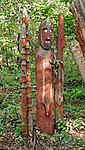 | Southern Nations, Nationalities, and People's Region,
| Budaya:Kon (iii), (v) | 7008230000000000000♠23,000 (57,000) | 2011 | The site features 55 kilometer (34 Batu|bt) of stonewalled terraces and fortified settlements in the Konso highlands of Ethiopia.[105] |
| Koutammakou, the Land of the Batammariba | 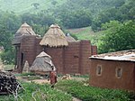 | TogKara Region,
| Budaya:TogKou (v), (vi) | 7008500000000000000♠50,000 (120,000) | 2004 | The Batammariba's mud tower houses have become a symbol of Togo. They range up to two stories and feature spherical granaries.[106] |
| Ksar of Ait-Ben-Haddou | 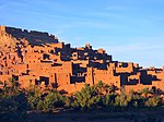 | Aït Benhaddou,
| Budaya:Ksa (iv), (v) | 7004300000000000000♠3 (7.4) | 1987 | The ksar is an example of a traditional pre-Saharan habitat, surrounded by high walls and reinforced with corner towers.[107] |
| Kunta Kinteh Island and Related Sites[i] |  | Banjul, Lower Niumi, and Upper Niumi,
| Budaya:Jam (iii), (vi) | 7004800000000000000♠8 (20) | 2003 | The site is a testimony to the encounters between Africa and Europe from pre-colonial times to independence along the Gambia River.[108] |
| Lake Malawi National Park |  | MalawiCentral Region and Southern Region, | Semula Jadi:MalawiLak (vii), (ix), (x) | 7007940000000000000♠9,400 (23,000) | 1984 | Lake Malawi contains hundreds of fish species, mostly endemic.[109] |
| Lakes of Ounianga | 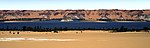 | ChadEnnedi Region,
| Semula Jadi:ChadOun (vii) | 7008628080000000000♠62,808 (155,200) | 2012 | The Lakes of Ounianga are a series of 18 lakes located in the Sahara desert, in North-Eastern Chad. They exhibit a variety of sizes, depths, chemical compositions, and colourations, and some of them are home to aquatic fauna.[110] |
| Lake Turkana National Parks |  | Lake Turkana,
| Semula Jadi:Lak (viii), (x) | 7009161485000000000♠161,485 (399,040) | 1997[j] | Turkana, as Africa's largest saline lake, is an important area for the study of fauna and flora. It is a breeding ground for the Nile crocodile, hippopotamus, and several venomous snakes.[111] The site was placed the List of World Heritage in Danger in 2018, primarily due to the potential impact of Ethiopia's Gilgel Gibe III Dam.[112] |
| Lamu Old Town |  | Lamu,
| Budaya:Lam (ii), (iv), (vi) | 7005160000000000000♠16 (40) | 2001 | The town is the oldest Swahili settlement and is built in coral stone and mangrove timber. It features inner courtyards, verandas, and elaborate wooden doors.[113] |
| Laurisilva of Madeira |  | PorMadeira,
| Semula Jadi:PorLau (ix), (x) | 7008150000000000000♠15,000 (37,000) | 1999 | The site is the largest surviving area of laurel forest. It consists of approximately 90% old-growth forest and is home to endemic species such as the Madeiran long-toed pigeon.[114] |
| Le Morne Budaya Landscape | 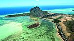 | MauritiusRivière Noire District,
| Budaya:MauritiusLem (iii), (vi) | 7006349000000000000♠349 (860) | 2008 | The rugged mountain that juts into the ocean was used as a shelter by runaway slaves through the 18th and early 19th centuries. They formed small settlements in the caves and on its summit.[115] |
| Lower Valley of the Awash |  | Afar Region,
| Budaya:Low (ii), (iii), (iv) | — | 1980 | Palaeontological findings from at least four million years ago, such as Lucy, give evidence of human evolution.[116] |
| Lower Valley of the Omo | 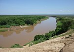 | Southern Nations, Nationalities, and People's Region,
| Budaya:Low (iii), (iv) | — | 1980 | The prehistoric site near Lake Turkana is the location of many fossil findings, such as Homo gracilis.[117] |
| M'Zab Valley |  | Ghardaïa,
| Budaya:MZa (ii), (iii), (v) | 7006665000000000000♠665 (1,640) | 1982 | The intact, traditional human habitat was built around five ksour in the 10th century by the Ibadites.[118] |
| Maloti-Drakensberg Park |  | LesothXQacha's Nek District,
| Mixed:SouthUkh (i), (iii), (vii), (x) | 7009249313000000000♠249,313 (616,070) | 2000 | The park features incisive dramatic cutbacks, golden sandstone ramparts, and the largest concentration of cave art in Sub-Saharan Africa.[119] |
| Mana Pools National Park, Sapi and Chewore Safari Areas | 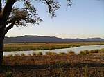 | ZimMashonaland West,
| Semula Jadi:ZimMan (vii), (ix), (x) | 7009676600000000000♠676,600 (1,672,000) | 1984 | The park, located on the banks of the Zambezi River, features a variety of wild animals, such as buffalo, leopards, cheetahs, and Nile crocodiles.[120] |
| Manovo-Gounda St Floris National Park | CenBamingui-Bangoran,
| Semula Jadi:CenMan (ix), (x) | 7010174000000000000♠1,740,000 (4,300,000) | 1988 | The park features vast savannas with a wealth of flora and fauna, such as black rhinoceros, elephants, cheetahs, leopards, wild dogs, red-fronted gazelles, and buffalo.[121] The site was placed on the List of World Heritage in Danger in 1997 due to grazing and poaching that is thought to have claimed 80% of the wildlife in the park. Also cited was the shooting of four park staff and "a general state of deteriorating security".[122] | |
| Mapungubwe Budaya Landscape | 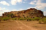 | Limpopo,
| Budaya:Map (ii), (iii), (iv), (v) | 7008281680000000000♠28,168 (69,600) | 2003 | The open savanna landscape lies at the confluence of the Limpopo and Shashe Rivers. It was the heart of the Mapungubwe Kingdom until the 14th century, when the area was abandoned, leaving untouched remains of palaces and settlements.[123] |
| Matobo Hills |  | ZimMatabeleland South,
| Budaya:ZimMat (iii), (v), (vi) | 7009205000000000000♠205,000 (510,000) | 2003 | The large boulders have been used as natural shelters since the early Stone Age and feature a collection of rock paintings.[124] |
| Mbanza Kongo, Vestiges of the Capital of the former Kingdom of Kongo |  | ANGZaire Province,
| Budaya:MedinaofMarra (iii), (iv) | 7005892900000000000♠89.29 (220.6) | 2017 | The town of Mbanza Kongo, located on a plateau at an altitude of 570 metres, was the political and spiritual capital of the Kingdom of Kongo, one of the largest constituted states in Southern Africa from the 14th to 19th centuries.[125] |
| Medina of Essaouira (formerly Mogador) |  | Essaouira,
| Budaya:Ess (ii), (iv) | 7005570000000000000♠57 (140) | 2001 | The fortified seaport built during the late 18th century has a mix of North African and European architecture and was a major trading hub between the Sahara and Europe.[126] |
| Medina of Fez | 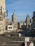 | Fez,
| Budaya:MedinaofFez (ii), (v) | 7006280000000000000♠280 (690) | 1981 | The former capital was founded in the 9th century and features the world's oldest university. The urban fabric and main monuments date from the 13th and 14th centuries.[127] |
| Medina of Marrakesh | 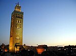 | Marrakesh,
| Budaya:MedinaofMarra (i), (ii), (iv), (v) | 7007110700000000000♠1,107 (2,740) | 1985 | The town was founded in the 1070s and remained a political, economic, and Budaya centre for a long time. Monuments from that period include the Koutoubia Mosque, the kasbah, and the battlements. The city also holds newer features, including palaces.[128] |
| Medina of Sousse | 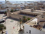 | Sousse Governorate,
| Budaya: (iii), (iv), (v) | 7005320000000000000♠32 (79) | 1988 | A prime example of a town from the early Islamic period, the city was an important port during the 9th century.[129] |
| Medina of Tétouan (formerly known as Titawin) | 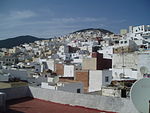 | Tétouan,
| Budaya: (ii), (iv), (v) | 7004700000000000000♠7 (17) | 1997 | Morocco's most complete medina served as the main point of contact between Morocco and Andalusia during the 8th century. The town was rebuilt by Andalusian refugees following the reconquista.[130] |
| Medina of Tunis |  | Tunis,
| Budaya: (ii), (iii), (v) | 7006296000000000000♠296 (730) | 1979 | The medina holds 700 monuments, including palaces, mosques, mausoleums, madrasahs, and fountains, testifying to Tunis's golden age from the 12th to the 16th century.[131] |
| Memphis and its Necropolis – the Pyramid Fields from Giza to Dahshur |  | Giza,
| Budaya: (i), (iii), (vi) | 7008163580000000000♠16,358 (40,420) | 1979 | The former capital features funerary monuments, like rock tombs, mastabas, temples, and pyramids. It is one of the Seven Wonders of the Ancient World.[132] |
| Mosi-oa-Tunya / Victoria Falls |  | Livingstone District and Matabeleland North, | Semula Jadi: (vii), (viii) | 7007686000000000000♠6,860 (17,000) | 1989 | The falls of the Zambezi River, which is more than 2 km (1.2 bt) wide, plunge down various basalt gorges resulting in a colourful mist.[133] |
| Mount Kenya National Park/Natural Forest |  | Central Province and Eastern Province, | Semula Jadi: (vii), (ix) | 7009202334000000000♠202,334 (499,980) | 1997[k] | The park surrounds the 5,199 m (17,057 ka) Mount Kenya and features twelve glaciers.[134] |
| Mount Nimba Strict Nature Reserve | 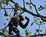 | Lola Prefecture,
| Semula Jadi: (ix), (x) | 7008175400000000000♠17,540 (43,300) | 1981[l] | The reserve features Mount Nimba, its slopes covered in dense forest and grassy mountain pastures.[135] In 1992, the park was inscribed on the World Heritage Committee's danger list, citing a proposed iron and ore mining concession inside the park's boundaries and the apparition of refugees. The state party later stated that there was an error with the proposed mining site's boundaries and that it was not in the reserve.[136] However, as of 2019, the site remains on the list due to mining activity near the site.[137] |
| Namib Sand Sea |  |  Namibia Namibia 24°53′07″S 15°24′28″E / 24.885278°S 15.407778°E / -24.885278; 15.407778 (Namib Sand Sea) | Semula Jadi: (vii), (viii), (ix), (x) | 7010307770000000000♠3,077,700 (7,605,000) | 2013 | Characterized by dynamic and extensive dune fields, which are among the oldest and largest in the world. The Namib Sand Sea is notable for its unique ecosystem, which has adapted to extreme arid conditions, including a variety of endemic species that rely on fog as a primary source of moisture. [138] |
| Ngorongoro Conservation Area |  | Arusha Region, Templat:Country data Tanzania, United Republic of 3°11′14″S 35°32′27″E / 3.187220°S 35.540830°E / -3.187220; 35.540830 (Ngorongoro Conservation Area) | Mixed:Ngo (iv)[m], (vii), (viii), (ix), (x) | 7009809440000000000♠809,440 (2,000,200) | 1979 | The site features a concentration of wild animals in a crater beside the active volcano Oldonyo Lengai.[139] Ngorongoro was previously on the danger list from 1984 to 1989 due to decreased conservation and poor management.[140][141] |
| Niokolo-Koba National Park |  | Kédougou Region and Tambacounda Region, | Semula Jadi:Nio (x) | 7009913000000000000♠913,000 (2,260,000) | 1981 | The forests and savannas bordering the Gambia River have a diverse fauna, including Derby eland, chimpanzees, lions, birds, reptiles, and amphibians.[142] The park was listed as being endangered in 2007 for low mammal populations, the construction of a dam, and management problems.[143] |
| Nubian Monuments from Abu Simbel to Philae | 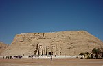 | Aswan,
| Budaya:Nub (i), (iii), (vi) | 7006374000000000000♠374 (920) | 1979 | Located along the Nile, the site contains monuments such as the Temple of Ramesses II and the Sanctuary of Isis.[144] |
| Okapi Wildlife Reserve |  | Orientale,
| Semula Jadi:Oka (x) | 7010137262500000000♠1,372,625 (3,391,830) | 1996 | Covering a fifth of the Ituri Rainforest in the Congo River basin, the reserve contains many threatened species of primates and birds. It is inhabited by the nomadic pygmy Mbuti and Efé tribes.[145] In 1997, looting, the killing of elephants, and the departure of reserve staff led the World Heritage Committee to place the reserve on its List of World Heritage in Danger, only a year following its inscription as a natural heritage site.[146] |
| Okavango Delta |  | Bot Okavango,
| Semula Jadi:Oka (vii), (ix), (x) | 7010202359000000000♠2,023,590 (5,000,400) | 2014 | One of the world's largest inland deltas and a UNESCO World Heritage site. Formed where the Okavango River empties onto a basin in the Kalahari Desert, creating a unique wetland system that supports a rich diversity of fauna and flora. This dynamic ecosystem is characterized by seasonal flooding, which transforms the landscape into a mosaic of water channels, lagoons, and islands. The delta is home to an exceptional variety of wildlife, including elephants, lions, rhinos, and hundreds of bird species, making it a crucial habitat for conservation and a hotspot for biodiversity.[147] |
| Old Towns of Djenné | 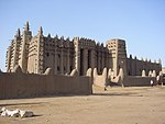 | iDjenné,
| Budaya: (iii), (iv) | — | 1988 | Inhabited since 250 BCE, the city was an important link in the trans-Saharan gold trade. It contains 2,000 traditional houses.[148] Djenné was placed on UNESCO's List of World Heritage in Danger in 2016, due to deterioration, urbanization, and erosion of the site.[149] |
| Old Town of Ghadamès |  | Ghadames,
| Budaya: (v) | 7005380000000000000♠38 (94) | 1986 | Located in an oasis, dames is one of the oldest pre-Saharan cities and represents a traditional architecture with vertical division of functions.[150] All five sites in Libya, including Ghadames, were placed on UNESCO's List of World Heritage in Danger in 2016, due to ongoing conflict in the country.[151] |
| Osun-Osogbo Sacred Grove |  | Osogbo,
| Budaya:Osu (ii), (iii), (vi) | 7005750000000000000♠75 (190) | 2005 | The dense forests are one of the final remnants of high forests in southern Nigeria. It is the last sacred grove of the Yoruba culture.[152] |
| Pitons, cirques and remparts of Reunion Island |  | FraLa Réunion,
| Semula Jadi:Por (vii), (x) | 7009105838000000000♠105,838 (261,530) | 2010 | Outstanding terrain and biodiversity, as part of La Réunion National Park.[153] |
| Portuguese City of Mazagan (El Jadida) |  | El Jadida,
| Budaya:Por (ii), (iv) | 7004800000000000000♠8 (20) | 2004 | The fortification, akin to Renaissance military design from the early 16th century, was taken over by Morocco in 1769. Surviving buildings include the cistern and a Gothic church.[154] |
| Punic Town of Kerkuane and its Necropolis |  | Nabeul Governorate,
| Budaya:Pun (iii) | 7003110000000000000♠0.11 (0.27) | 1985[n] | The city was abandoned in 250 BCE during the First Punic War and is the only surviving example of a Phoenicio–Punic settlement.[155] |
| Rabat, Modern Capital and Historic City: a Shared Heritage |  | Rabat-Salé-Zemmour-Zaer,
| Budaya:Rab (ii), (iv) | 7006349000000000000♠349 (860) | 2012 | Rebuilt under the direction of the French from 1912 to the 1930s, the city blends historic and modern features, such as botanical gardens, the Hassan Mosque, and the remnants of Moorish and Andalusian settlements from the 17th century.[156] |
| Rainforests of the Atsinanana |  | Eastern Madagascar,
| Semula Jadi:Rai (ix), (x) | 7009479660000000000♠479,660 (1,185,300) | 2007 | The site consists of six national parks and protects the island's unique biodiversity, which has evolved in isolation for 60 million years.[157] The park was deemed to be in danger in 2010, when logging and hunting activities continued to escalate, despite a ban by Madagascar on exporting illegal timber.[158] |
| Richtersveld Budaya and Botanical Landscape |  | Northern Cape,
| Budaya: (iv), (v) | 7009160000000000000♠160,000 (400,000) | 2007 | The mountainous desert sustains the semi-nomadic livelihood of the Nama, which includes seasonal migrations that have gone unchanged for two millennia.[159] |
| Risco Caido and the Sacred Mountains of Gran Canaria Budaya Landscape |  | SpainRisco Caído,
| Budaya: (iii), (v) | 7007942500000000000♠9,425 (23,290) | 2019 | [160] |
| Robben Island |  | Western Cape,
| Budaya:Rob (iii), (vi) | 7006475000000000000♠475 (1,170) | 1999 | Between the 17th and 20th century, the island was used as a prison, including for political prisoners, a hospital for socially unacceptable groups, and a military base.[161] |
| Rock-Art Sites of Tadrart Acacus | 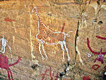 | Fezzan,
| Budaya:Roc (iii) | 7010392396100000000♠3,923,961 (9,696,320) | 1985 | Thousands of cave paintings are visible in different styles, dating from 12,000 BCE to 100 CE.[162] All five sites in Libya, including Tadrart Acacus, were placed on UNESCO's List of World Heritage in Danger in 2016, due to ongoing conflict in the country.[163] |
| Rock-Hewn Churches, Lalibela | 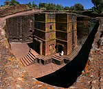 | Amhara Region,
| Budaya:Roc (i), (ii), (iii) | — | 1978 | The site contains eleven medieval cave churches from the 13th century.[164] |
| Royal Hill of Ambohimanga |  | Antananarivo,
| Budaya:Roy (iii), (iv), (vi) | 7005590000000000000♠59 (150) | 2001 | The royal city and burial site is a spiritual and sacred site which has created strong feelings of national identity for several centuries.[165] |
| Royal Palaces of Abomey |  | Zou Department,
| Budaya:Roy (iii), (iv) | 7005480000000000000♠48 (120) | 1985 | The city held the seat of twelve kings who ruled the Kingdom of Dahomey between 1625 and 1900. All but one king built their palace within the area.[166] The site was originally classified as endangered from its inception in 1985 due to extensive damage caused by a tornado,[167] but was later removed from the list in 2007.[168] |
| Ruins of Kilwa Kisiwani and Ruins of Songo Mnara |  | Kilwa District, Templat:Country data Tanzania, United Republic of 8°57′28″S 39°31′22″E / 8.957780°S 39.522780°E / -8.957780; 39.522780 (Ruins of Kilwa Kisiwani and Ruins of Songo Mnara) | Budaya:Rui (iii) | — | 1981 | The site features the remains of two ports used extensively for trade across the Indian Ocean from the 13th through 16th centuries.[169] It was placed onto the List of World Heritage in Danger by the World Heritage Committee in 2004, citing "the continuing deterioration and the serious threats affecting the property of the Ruins of Kilwa Kisiwani and Songo Mnara".[170] Conditions subsequently improved and the site was removed from the World Heritage in Danger list in 2014.[171] |
| Ruins of Loropéni |  | BurLoropéni,
| Budaya:BurRui (iii) | 7004110000000000000♠1.1 (2.7) | 2009 | More than a thousand years old, Loropéni is the best-preserved of ten fortresses in Lobi, which were part of about a hundred stone enclosures built during the trans-Saharan gold trade.[172] |
| Rwenzori Mountains National Park |  | UgandaBundibugyo District, Kabarole District, and Kasese District,
| Semula Jadi:UgandaRuw (vii), (x) | 7008996000000000000♠99,600 (246,000) | 1994 | Covering most of the Rwenzori Mountains, including Mount Margherita, Africa's third-highest peak, the park features glaciers, waterfalls, and lakes in an alpine landscape. It also features various endangered species and unusual flora.[173] The park was previously listed as endangered from 1999 through 2004 due to general lack of security and conservation.[174][175] |
| Sacred Mijikenda Kaya Forests |  | Coast Province,
| Budaya:Sac (iii), (v), (vi) | 7007153800000000000♠1,538 (3,800) | 2008 | The site comprises eleven forests spread 200 km (120 bt) along the coast of Kenya. They hold the remains of villages built during the 16th century by the Mijikenda and are now considered sacred sites.[176] |
| Saint Catherine Area | 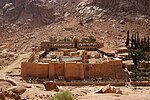 | South Sinai Governorate,
| Budaya:Sai (i), (iii), (iv), (vi) | 7008601000000000000♠60,100 (149,000) | 2002 | The orthodox monastery from the 6th century is positioned near Mount Horeb where, according to the Old Testament, Moses received the Tablets of the Law. The region is sacred for Christians, Muslims, and Jews.[177] |
| Salonga National Park |  | Maniema and South Kivu, | Semula Jadi:Sal (vii), (ix) | 7010360000000000000♠3,600,000 (8,900,000) | 1984 | Africa's largest tropical rain forest reserve is situated at the heart of the Congo River basin and only accessible by water. It is the habitat of endangered species such as the bonobo, the Congo peafowl, the forest elephant, and the slender-snouted crocodile.[178] The site was deemed to be in danger in 1999, due to increased poaching activities and encroachments.[179] However, this categorization was eventually removed in 2021 due to increased conservation efforts.[180] |
| Saloum Delta |  | Senegal 13°50′07″N 16°29′55″W / 13.835278°N 16.498611°W / 13.835278; -16.498611 (Saloum Delta) | Budaya:Sal (iii), (iv), (v) | 7009145811000000000♠145,811 (360,310) | 2011 | The area has sustained human life thanks to fishing and shellfish gathering, for which there are 218 shellfish mounds across the site.[181] |
| Sanganeb Marine National Park and Dungonab Bay – Mukkawar Island Marine National Park | SudSan Sudan Sudan 19°44′10″N 37°26′35″E / 19.73611°N 37.44306°E / 19.73611; 37.44306 (Sanganeb Marine National Park and Dungonab Bay – Mukkawar Island Marine National Park) | Semula Jadi:SdnSan (vii), (ix), (x) | 7009260700000000000♠260,700 (644,000) | 2016 | Situated in the central Red Sea, Sanganeb, Dungonab Bay, and Mukkawar Island feature a diverse system of coral reefs, mangroves, seagrass beds, beaches, and islets. They host populations of seabirds, marine mammals, fish, sharks, turtles, manta rays, and dugongs.[182] | |
| San Cristóbal de la Laguna |  | Province of Santa Cruz de Tenerife,
| Budaya:San (ii), (iv) | 7005600000000000000♠60 (150) | 1999 | The city contains two centres: the unplanned Upper Town; and the planned Lower Town, laid out according to philosophical principles. Many of the buildings date from the 16th to the 18th centuries.[183] |
| Sangha Trinational |  |  Cameroon*; Cameroon*;
| Semula Jadi: (ix), (x) | 7009746309000000000♠746,309 (1,844,170) | 2012 | This area encompasses national parks and reserves including Nouabalé-Ndoki National Park in Congo, Lobéké National Park in Cameroon, and Dzanga-Ndoki National Park in the Central African Republic. The Sangha Trinational is celebrated for its exceptional biodiversity, the area also supports the traditional and sustainable livelihoods of indigenous peoples, including the Ba'Aka pygmies, who have lived in harmony with this forest for thousands of years. [184] |
| Selous Game Reserve |  | Lindi Region, Morogoro Region, Mtwara Region, Pwani Region, and Ruvuma Region, Templat:Country data Tanzania, United Republic of 9°00′S 37°24′E / 9°S 37.4°E / -9; 37.4 (Selous Game Reserve) | Semula Jadi: (ix), (x) | 7010512000000000000♠5,120,000 (12,700,000) | 1982 | The park's vegetation varies from dense thickets to open wooded grasslands and features large numbers of elephants, black rhinoceros, cheetahs, giraffes, hippos, and crocodiles.[185] It was placed onto the List of World Heritage in Danger by the World Heritage Committee in 2014 due to widespread poaching, especially of elephants and rhinoceros.[186] |
| Serengeti National Park |  | Arusha Region, Mara Region, and Shinyanga Region, Templat:Country data Tanzania, United Republic of 2°20′00″S 34°34′00″E / 2.333330°S 34.566670°E / -2.333330; 34.566670 (Serengeti National Park) | Semula Jadi: (vii), (x) | 7010147630000000000♠1,476,300 (3,648,000) | 1981 | The vast savanna is known for the annual migration for herds of wildebeest, gazelle, zebras, and their predators.[187] |
| Simien National Park |  | Amhara Region,
| Semula Jadi:Sem (vii), (x) | 7008136000000000000♠13,600 (34,000) | 1978 | The eroded Ethiopian plateau comprises jagged mountain peaks, deep valleys, and sharp precipices dropping about 1,500 m (4,900 ka).[188] The decrease of the walia ibex, bushbuck, and bushpig populations, as well as an increase of the human population in the park, prompted the World Heritage Committee to place it on their List of World Heritage in Danger in 1996.[189] However, the park was removed from the danger list in 2017 after improvements in management and reduction of overgrazing.[190] |
| Stone Circles of Senegambia | 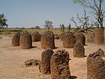 | Central River Division and Kaolack Region, | Budaya: (i), (iii) | 7005100000000000000♠10 (25) | 2006 | The groups of stone circles are among over 1,000 different monuments along the Gambia River. Used as burial grounds, they were erected between the 3rd century BCE and the 16th century CE.[191] |
| Stone Town of Zanzibar |  | Zanzibar, Templat:Country data Tanzania, United Republic of 6°09′47″S 39°11′21″E / 6.163060°S 39.189170°E / -6.163060; 39.189170 (Stone Town of Zanzibar) | Budaya: (ii), (iii), (vi) | 7005960000000000000♠96 (240) | 2000 | A prime example of an East African coastal trading town, its urban fabric and townscape remain intact.[192] |
| Sudanese style mosques in northern Côte d’Ivoire |  Côte d'Ivoire Côte d'Ivoire 10°29′25″N 6°24′37″W / 10.490317°N 6.410167°W / 10.490317; -6.410167 (Sudanese style mosques in northern Côte d’Ivoire) | Budaya:SudMos (ii), (iv) | 7003130000000000000♠0.13 (0.32) | 2021 | [193] | |
| Sukur Budaya Landscape |  | Madagali,
| Budaya:Suk (iii), (v), (vi) | 7006764000000000000♠764 (1,890) | 1999 | The site features the Palace of the Hidi, terraced fields, and the remains of a former iron industry.[194] |
| Taï National Park |  | Guiglo and Sassandra, | Semula Jadi: (vii), (x) | 7009330000000000000♠330,000 (820,000) | 1982 | One of few remaining sections of the West African tropical forest, the park features rich flora as well as eleven species of monkeys.[195] |
| Tassili n'Ajjer |  | Illizi and Tamanrasset, | Mixed:Tas (i), (iii), (vii), (viii) | 7010720000000000000♠7,200,000 (18,000,000) | 1982 | The site is in a landscape with 15,000 cave engravings that record climatic changes, animal migrations, and the evolution of human life, dating from 6,000 BCE to the first centuries CE.[196] |
| Teide National Park | 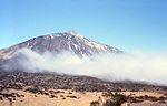 | Province of Santa Cruz de Tenerife,
| Semula Jadi:Tei (vii), (viii) | 7008189900000000000♠18,990 (46,900) | 2007 | The national park features the Teide stratovolcano, which at 3,718 m (12,198 ka) is Spain's tallest mountain and the world's third-tallest volcano.[197] |
| Thimlich Ohinga Archaeological Site |  | Migori County,
| Budaya:Thi (iii), (iv), (v) | 7005210000000000000♠21 (52) | 2018 | Dating back to the 16th century CE, the dry-stone walled settlement is the largest and best-preserved traditional enclosure of its kind.[198] |
| Timbuktu |  | MaliTimbuktu Cercle,
| Budaya:MaliTim (ii), (iv), (v) | — | 1988 | The city was a centre for the propagation of Islam in the 15th and 16th centuries and features three mosques and many madrasahs.[199] The site was deemed endangered in 1990 due to encroaching sand,[200] but was removed from the list in 2005 after successful conservation efforts.[201] The site was once again deemed endangered after the Battle of Gao in June 2012, which followed several weeks of constant threats to the area.[202] Days later, some sites within Timbuktu were destroyed by Ansar Dine, an Islamist group, citing religious reasons.[203] |
| Timgad |  | Batna Province,
| Budaya:Tim (ii), (iii), (iv) | 7005905400000000000♠90.54 (223.7) | 1982 | A military colony built by Emperor Trajan in 100 CE, the site features cardo and decumanus streets, typical of a Roman town.[204] |
| Tipasa | 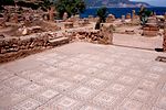 | Tipaza,
| Budaya:Tip (iii), (iv) | 7005520000000000000♠52 (130) | 1982 | First a Carthaginian trading centre, Tipasa was converted into a military base by the Romans. Heavy Christian influences can be seen from the 3rd and 4th centuries, though Tipasa went into steady decline in the Byzantine period.[205] Tipasa was classified as endangered in 2002 due to natural and human-caused deterioration of the archaeological remains,[206] but was removed from the list in 2006 due to improved protection of the site.[207] |
| Tiya | 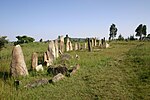 | Southern Nations, Nationalities, and People's Region,
| Budaya:Tiy (i), (iv) | — | 1980 | The archaeological site contains 36 monuments, which includes 32 carved stelae covered with symbols hard to decrypt.[208] |
| Tomb of Askia | 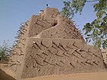 | MaliGao Region,
| Budaya:MaliTom (ii), (iii), (iv) | 7004400000000000000♠4 (9.9) | 2004 | Built in 1495, the pyramid was built as a tomb for Emperor Askia Mohamed. It represents the power of an empire that controlled the trans-Saharan gold trade.[209] The site was deemed endangered after the Battle of Gao in June 2012, which followed several weeks of constant threats to the area.[210] |
| Tombs of Buganda Kings at Kasubi | 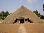 | UgandaKampala District,
| Budaya:UgandaTom (i), (iii), (iv), (vi) | 7005270000000000000♠27 (67) | 2001 | The tombs, built after 1884, are a major example of prime architecture using organic materials, principally wood, thatch, reed, and wattle and daub.[211] The tombs were almost completely destroyed by a fire in March 2010, prompting the World Heritage Committee to reluctantly mark the site as being in danger.[212] The Ugandan government has since called for the reconstruction of the tombs, and UNESCO has agreed to mobilise funds for the project.[213] |
| Tsingy de Bemaraha Strict Nature Reserve | 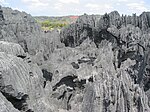 | Melaky,
| Semula Jadi: (vii), (x) | 7009152000000000000♠152,000 (380,000) | 1990 | The canyon of the Manambolo River comprises karstic and limestone landscapes cut into peaks and a forest of limestone needles. It also holds undisturbed forests, lakes, and mangrove swamps, which are the habitat for lemurs and birds.[214] |
| Tsodilo |  | BotNorth-West,
| Budaya:BotTso (i), (iii), (vi) | 7007480000000000000♠4,800 (12,000) | 2001 | The site features more than 4,500 rock art paintings in the Kalahari Desert. Archaeological records provide evidence of human and environmental activities ranging over 100,000 years.[215] |
| Twyfelfontein or /Ui-//aes |  | TwyKunene,
| Budaya:Twy (iii), (v) | 7005570000000000000♠57 (140) | 2007 | The site has one of the largest concentrations of rock engravings in Africa, which range from a period of over 2,000 years.[216] |
| Vallée de Mai Nature Reserve |  | SeyPraslin,
| Semula Jadi:SeyVal (vii), (viii), (ix), (x) | 7005200000000000000♠20 (49) | 1983 | The natural palm forest is preserved in almost its original state.[217] |
| Virunga National Park | 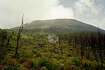 | North Kivu and Orientale, | Semula Jadi:Vir (vii), (viii), (x) | 7009800000000000000♠800,000 (2,000,000) | 1979 | The park comprises swamps, savannas, and snowfields.[218] Virunga was inscribed on the World Heritage Committee's List of World Heritage in Danger in 1994, due to the genocide in Rwanda and the subsequent increase of the refugee population in the park, deforestation, poaching, departure of park staff, and depletion of forests.[219] |
| Vredefort Dome |  | Free State and North West, | Semula Jadi: (viii) | 7008300000000000000♠30,000 (74,000) | 2005 | The crater, with a diameter of 190 km (120 bt), is the largest, oldest, and most deeply eroded astrobleme found on Earth, dating back more than two billion years.[220] |
| W-Arly-Pendjari Complex | 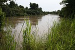 | BurkNig Benin*; Benin*;
| Semula Jadi:WNa (ix), (x) | 7010171483100000000♠1,714,831 (4,237,440) | 1996[o] | The parks are in the zone between savanna and forest lands and are an important ecosystem for the biogeographical area.[221] |
| Wadi Al-Hitan (Whale Valley) |  | Faiyum Governorate,
| Semula Jadi:Wad (viii) | 7008200150000000000♠20,015 (49,460) | 2005 | Located in western Egypt, the site contains fossil remains of the now extinct Archaeoceti, mapping the evolution of the whales from a land-based to an aquatic mammal.[222] |


Prestasi Afrika dalam UNESCO
Negara-negara dibahagikan mengikut wilayah mereka: biru untuk Afrika Utara, jingga untuk Afrika Timur, ungu untuk Afrika Tengah, hijau untuk Afrika Barat, dan merah untuk Afrika Selatan. (Catatan: carta ini tidak termasuk tapak yang terletak di Afrika milik negara Eropah.)

Lihat juga
 Portal Afrika

- Senarai Tapak Warisan Dunia
Catatan
- ^ For purposes of this article, "Africa" includes the entire African continent, along with certain Atlantic and Indian Ocean islands in the geographic vicinity of Africa that remain under the sovereignty of European states. This differs from UNESCO's regional classification which places several North African countries in the "Arab States" region, while World Heritage Sites on the islands are included in the "Europe and North America" region with their respective metropolitan states. Also see the table legend.
- ^ Syria mempunyai 6 tapak dalam senarai Warisan Dunia dalam Bahaya.
- ^ Asmara: A Modernist African City was originally inscribed as Asmara: A Modernist City in Africa. The World Heritage Committee adopted the changed name in 2018.
- ^ Extended in 2015 but retained the same name.
- ^ Extended in 2005 to include Makapan Valley and Taung Skull Fossil Site. The name of the site was later changed accordingly from Fossil Hominid Sites of Sterkfontein, Swartkrans, Kromdraai, and Environs at the time of inscription to the present name in 2013.
- ^ Extended in 2004 to include Inaccessible Island. The name of the site was changed accordingly from Gough Island Wildlife Reserve at the time of inscription to the present name in 2004.
- ^ Historic Cairo was originally inscribed as Islamic Cairo. The World Heritage Committee adopted the changed name in 2007.
- ^ iSimangaliso Wetland Park was originally inscribed as Greater St Lucia Wetland Park. The World Heritage Committee adopted the changed name in 2008.
- ^ Kunta Kinteh Island and Related Sites was originally inscribed as James Island and Related Sites. The World Heritage Committee adopted the changed name in 2011.
- ^ Extended in 2001 to include South Island National Park. The name of the site was changed accordingly from Sibiloi/Central Island National Parks at the time of inscription to the present name in 2001.
- ^ Extended in 2013 to include Lewa Wildlife Conservancy and Ngare Ndare Forest Reserve but retained the same name.
- ^ Extended in 1982 to include the portion of the Reserve in Ivory Coast (in addition to the existing portion in Guinea).
- ^ Ngorongoro Conservation Area was originally inscribed as a Natural site. The World Heritage Committee also insribed it as a Cultural site in 2010 due to Olduvai Gorge.
- ^ Extended in 1986 to include the Necropolis. The name of the site was changed accordingly from Punic Town of Kerkuane at the time of inscription to the present name in 1986.
- ^ Extended in 2017 to include Arli National Park and Pendjari National Park. The name of the site was changed accordingly from W National Park of Niger at the time of inscription to the present name in 2017.
Rujukan
- ^ a b c "World Heritage List". UNESCO. Dicapai pada 11 November 2021..
- ^ "Number of World Heritage properties inscribed each Year". UNESCO. Dicapai pada 8 September 2011.
- ^ Intergovernmental Committee for the Protection of the World Cultural and Natural Heritage, Second Session, Final Report (PDF) (Laporan). Washington, D.C.: UNESCO. 5–8 September 1978. m/s. 7–8. Dicapai pada 8 September 2011.
- ^ Hegarty, Stephanie (20 September 2011). "Sada Mire: Uncovering Somalia's Heritage". BBC. Dicapai pada 19 January 2014.
- ^ a b "The Criteria for Selection". UNESCO. Dicapai pada 10 September 2011.
- ^ a b "Launch of African World Heritage Fund" (Siaran akhbar). UNESCO. 3 May 2006. Dicapai pada 10 September 2011.
- ^ Annual Report 2010 (PDF) (Laporan). African World Heritage Fund. Dicapai pada 10 September 2011.[pautan mati kekal]
- ^ "UNESCO meeting to promote African human origin sites and the World Heritage Convention" (Siaran akhbar). UNESCO. Dicapai pada 10 September 2011.
- ^ "World Heritage in Danger". UNESCO. Dicapai pada 28 May 2010.
- ^ "The World Heritage Committee". UNESCO. Dicapai pada 10 September 2011.
- ^ "Sessions". UNESCO. Dicapai pada 10 September 2011.
- ^ "List of World Heritage in Danger". UNESCO. Dicapai pada 12 November 2021..
- ^ "Kahuzi-Biega National Park – Threats to the Site (1997)". UNESCO. Dicapai pada 10 September 2011.
- ^ "Manovo-Gounda St Floris National Park – Threats to the Site (1997)". UNESCO. Dicapai pada 10 September 2011.
- ^ "Comoé National Park – Threats to the Site (2003)". UNESCO. Dicapai pada 10 September 2011.
- ^ "Air and Ténéré Natural Reserves – Threats to the Site (1992)". UNESCO. Dicapai pada 10 September 2011.
- ^ "Mining threats on the rise in World Heritage Sites" (Siaran akhbar). IUCN. 27 June 2011. Dicapai pada 10 September 2011.
- ^ Concerns Regarding the Protection of the World Cultural and Natural Heritage, Thirty-Fifth Session (PDF) (Laporan). Paris: UNESCO. 19–29 June 2011. m/s. 20–21. Dicapai pada 10 September 2011.
- ^ "Abu Mena – Threats to the Site (2001)". UNESCO. Dicapai pada 10 September 2011.
- ^ "Ngorongoro Conservation Area – History". UNESCO. Dicapai pada 10 September 2011.
- ^ "Rwenzori Mountains National Park – History". UNESCO. Dicapai pada 10 September 2011.
- ^ "Tipasa – History". UNESCO. Dicapai pada 10 September 2011.
- ^ "Garamba National Park – History". UNESCO. Dicapai pada 10 September 2011.
- ^ "Timbuktu – History". UNESCO. Dicapai pada 30 June 2012.
- ^ "Number of World Heritage Properties by region". UNESCO. Dicapai pada 10 September 2011.
- ^ "Aapravasi Ghat". UNESCO. Dicapai pada 28 May 2010.
- ^ "Abu Mena". UNESCO. Dicapai pada 28 May 2010.
- ^ "Abu Mena – Ancaman kepada Tapak (2001)". UNESCO. Dicapai pada 27 August 2010.
- ^ "Air dan Ténéré Natural Reserves". UNESCO. Dicapai pada 28 May 2010.
- ^ "Air dan Ténéré Natural Reserves – Ancaman kepada Tapak (1992)". UNESCO. Dicapai pada 28 August 2010.
- ^ "Keputusan 33COM 7A.10 – Air dan Ténéré Natural Reserves (Niger) (N 573)". UNESCO. Dicapai pada 28 August 2010.
- ^ "Aksum". UNESCO. Dicapai pada 28 May 2010.
- ^ "Al Qal'a dari Beni Hammad". UNESCO. Dicapai pada 28 May 2010.
- ^ "Aldabra Atoll". UNESCO. Dicapai pada 28 May 2010.
- ^ "Amphitheatre of El Jem". UNESCO. Dicapai pada 28 May 2010.
- ^ "Ancient Ferrous Metallurgy Sites of Burkina Faso". UNESCO. Dicapai pada 9 July 2019.
- ^ "Ancient Thebes with its Necropolis". UNESCO. Dicapai pada 28 May 2010.
- ^ "Archaeological Site of Carthage". UNESCO. Dicapai pada 28 May 2010.
- ^ "Libya's five World Heritage sites put on List of World Heritage in Danger". UNESCO. Dicapai pada 7 November 2021.
- ^ "Archaeological Site of Leptis Magna". UNESCO. Dicapai pada 28 May 2010.
- ^ "Libya's five World Heritage sites put on List of World Heritage in Danger". UNESCO. Dicapai pada 7 November 2021.
- ^ "Archaeological Site of Sabratha". UNESCO. Dicapai pada 28 May 2010.
- ^ "Libya's five World Heritage sites put on List of World Heritage in Danger". UNESCO. Dicapai pada 7 November 2021.
- ^ "Archaeological Site of Volubilis". UNESCO. Dicapai pada 28 May 2010.
- ^ "Archaeological Sites of the Island of Meroe". UNESCO. Dicapai pada 17 August 2011.
- ^ "Asante Traditional Buildings". UNESCO. Dicapai pada 28 May 2010.
- ^ "Asmara: a Modernist African City". UNESCO. Dicapai pada 6 November 2021.
- ^ "Barberton Makhonjwa Mountains". UNESCO. Dicapai pada 1 August 2018.
- ^ "Banc d'Arguin National Park". UNESCO. Dicapai pada 28 May 2010.
- ^ "Bassari Country: Bassari, Fula and Bedik Cultural Landscapes". UNESCO. Dicapai pada 4 August 2013.
- ^ "Bwindi Impenetrable National Park". UNESCO. Dicapai pada 28 May 2010.
- ^ "Cape Floral Region Protected Areas". UNESCO. Dicapai pada 28 May 2010.
- ^ "Chongoni Rock-Art Area". UNESCO. Dicapai pada 28 May 2010.
- ^ "Cidade Velha, Historic Centre of Ribeira Grande". UNESCO. Dicapai pada 28 May 2010.
- ^ "Cliff of Bandiagara (Land of the Dogons)". UNESCO. Dicapai pada 28 May 2010.
- ^ "Comoé National Park". UNESCO. Dicapai pada 28 May 2010.
- ^ "Decision – 27 COM 8B.1 – New Incriptions on the List of World Heritage in Danger". UNESCO. Dicapai pada 30 August 2010.
- ^ "The World Heritage site of Comoé National Park in Côte d'Ivoire no longer in danger". UNESCO. Dicapai pada 31 October 2021.
- ^ "Dja Faunal Reserve". UNESCO. Dicapai pada 28 May 2010.
- ^ "Djémila". UNESCO. Dicapai pada 28 May 2010.
- ^ "Djoudj National Bird Sanctuary". UNESCO. Dicapai pada 28 May 2010.
- ^ "Decision – CONF 004 X.26-27 – Inscriptions on the List of World Heritage in Danger". UNESCO. Dicapai pada 9 November 2021.
- ^ "Decision – CONF 001 XIV.C – Removal from the List of World Heritage in Danger: Djoudj National Park (Senegal)". UNESCO. Dicapai pada 9 November 2021.
- ^ "Decision – CONF 204 VIII.22 – Djoudj National Bird Sanctuary (Senegal)". UNESCO. Dicapai pada 9 November 2021.
- ^ "Decision – 30 COM 7A.11 – Djoudj National Bird Sanctuary (Senegal) (N 25)". UNESCO. Dicapai pada 9 November 2021.
- ^ "Dougga / Thugga". UNESCO. Dicapai pada 28 May 2010.
- ^ "Ecosystem and Relict Cultural Landscape of Lopé-Okanda". UNESCO. Dicapai pada 28 May 2010.
- ^ "Ennedi Massif: Natural and Cultural Landscape". UNESCO. Dicapai pada 6 August 2016.
- ^ "Fasil Ghebbi, Gondar Region". UNESCO. Dicapai pada 28 May 2010.
- ^ "Fort Jesus, Mombasa". UNESCO. Dicapai pada 11 July 2011.
- ^ "Forts and Castles, Volta, Greater Accra, Central and Western Regions". UNESCO. Dicapai pada 28 May 2010.
- ^ "Fossil Hominid Sites of South Africa". UNESCO. Dicapai pada 10 November 2021.
- ^ "French Austral Lands and Seas". UNESCO. Dicapai pada 9 July 2019.
- ^ "Garajonay National Park". UNESCO. Dicapai pada 28 May 2010.
- ^ "Garamba National Park". UNESCO. Dicapai pada 28 May 2010.
- ^ "Decision – 08COM X.26–27 – Inscriptions on the List of World Heritage in Danger". UNESCO. Dicapai pada 10 September 2011.
- ^ "Decision – 16COM X.E – Removed from the World Heritage List in Danger: Garamba National Park (Zaire)". UNESCO. Dicapai pada 10 September 2011.
- ^ Convention Concerning the Protection of the World Cultural and Natural Heritage, Eighth Ordinary Session (PDF) (Laporan). Buenos Aires: UNESCO. 29 October – 2 November 1994. Dicapai pada 10 September 2011.
- ^ "VII.37 Garamba National Park (Zaire)". Convention Concerning the Protection of the World Cultural and Natural Heritage, Twentieth Session (Laporan). Merida, Mexico: UNESCO. 2–7 December 1996. Dicapai pada 10 September 2011.
- ^ "Gebel Barkal and the Sites of the Napatan Region". UNESCO. Dicapai pada 28 May 2010.
- ^ "Gough and Inaccessible Islands". UNESCO. Dicapai pada 28 May 2010.
- ^ "Great Zimbabwe National Monument". UNESCO. Dicapai pada 28 May 2010.
- ^ "Harar Jugol, the Fortified Historic Town". UNESCO. Dicapai pada 28 May 2010.
- ^ "Historic Cairo". UNESCO. Dicapai pada 28 May 2010.
- ^ "Historic Centre of Agadez". UNESCO. Dicapai pada 4 August 2013.
- ^ "Historic City of Meknes". UNESCO. Dicapai pada 28 May 2010.
- ^ "Historic Town of Grand-Bassam". UNESCO. Dicapai pada 19 September 2012.
- ^ "Ichkeul National Park". UNESCO. Dicapai pada 28 May 2010.
- ^ "Decision – CONF 201 VII.D.36 – SOC: Ichkeul National Park (Tunisia)". UNESCO. Dicapai pada 11 November 2021.
- ^ "Cologne Cathedral (Germany), Djoudj Bird Sanctuary (Senegal), Ichkeul National Park (Tunisia), and Hampi (India) removed from List of World Heritage in Danger". UNESCO. Dicapai pada 11 November 2021.
- ^ "iSimangaliso Wetland Park". UNESCO. Dicapai pada 28 May 2010.
- ^ "Island of Gorée". UNESCO. Dicapai pada 28 May 2010.
- ^ "Island of Mozambique". UNESCO. Dicapai pada 28 May 2010.
- ^ "Island of Saint-Louis". UNESCO. Dicapai pada 28 May 2010.
- ^ "Ivindo National Park". UNESCO. Dicapai pada 7 November 2021.
- ^ "Kahuzi-Biega National Park". UNESCO. Dicapai pada 28 May 2010.
- ^ "Kahuzi-Biega National Park – Threats to the Site (1997)". UNESCO. Dicapai pada 10 September 2011.
- ^ "Kairouan". UNESCO. Dicapai pada 28 May 2010.
- ^ "Kasbah of Algiers". UNESCO. Dicapai pada 28 May 2010.
- ^ "Kenya Lake System in the Great Rift Valley". UNESCO. Dicapai pada 28 June 2011.
- ^ "Khami Ruins National Monument". UNESCO. Dicapai pada 28 May 2010.
- ^ "ǂKhomani Cultural Landscape". UNESCO. Dicapai pada 16 July 2017.
- ^ "Kilimanjaro National Park". UNESCO. Dicapai pada 28 May 2010.
- ^ "Kondoa Rock-Art Sites". UNESCO. Dicapai pada 28 May 2010.
- ^ "Konso Cultural Landscape". UNESCO. Dicapai pada 17 August 2011.
- ^ "Koutammakou, the Land of the Batammariba". UNESCO. Dicapai pada 28 May 2010.
- ^ "Ksar of Ait-Ben-Haddou". UNESCO. Dicapai pada 28 May 2010.
- ^ "Kunta Kinteh Island and Related Sites". UNESCO. Dicapai pada 6 November 2015.
- ^ "Lake Malawi National Park". UNESCO. Dicapai pada 28 May 2010.
- ^ "Lakes of Ounianga". UNESCO. Dicapai pada 11 July 2013.
- ^ "Lake Turkana National Parks". UNESCO. Dicapai pada 28 May 2010.
- ^ "Lake Turkana National Parks (Kenya) inscribed on List of World Heritage in Danger". UNESCO. Dicapai pada 28 June 2018.
- ^ "Lamu Old Town". UNESCO. Dicapai pada 28 May 2010.
- ^ "Laurisilva of Madeira". UNESCO. Dicapai pada 28 May 2010.
- ^ "Le Morne Cultural Landscape". UNESCO. Dicapai pada 28 May 2010.
- ^ "Lower Valley of the Awash". UNESCO. Dicapai pada 28 May 2010.
- ^ "Lower Valley of the Omo". UNESCO. Dicapai pada 28 May 2010.
- ^ "M'Zab Valley". UNESCO. Dicapai pada 28 May 2010.
- ^ "Maloti-Drakensberg Park". UNESCO. Dicapai pada 4 August 2013.
- ^ "Mana Pools National Park, Sapi and Chewore Safari Areas". UNESCO. Dicapai pada 28 May 2010.
- ^ "Manovo-Gounda St Floris National Park". UNESCO. Dicapai pada 28 May 2010.
- ^ "Manovo-Gounda St Floris National Park – Threats to the Site (1997)". UNESCO. Dicapai pada 10 September 2011.
- ^ "Mapungubwe Cultural Landscape". UNESCO. Dicapai pada 28 May 2010.
- ^ "Matobo Hills". UNESCO. Dicapai pada 28 May 2010.
- ^ "Mbanza Kongo, Vestiges of the Capital of the former Kingdom of Kongo". UNESCO. Dicapai pada 16 July 2017.
- ^ "Medina of Essaouira (formerly Mogador)". UNESCO. Dicapai pada 28 May 2010.
- ^ "Medina of Fez". UNESCO. Dicapai pada 28 May 2010.
- ^ "Medina of Marrakesh". UNESCO. Dicapai pada 28 May 2010.
- ^ "Medina of Sousse". UNESCO. Dicapai pada 28 May 2010.
- ^ "Medina of Tétouan (formerly known as Titawin)". UNESCO. Dicapai pada 28 May 2010.
- ^ "Medina of Tunis". UNESCO. Dicapai pada 28 May 2010.
- ^ "Memphis and its Necropolis – the Pyramid Fields from Giza to Dahshur". UNESCO. Dicapai pada 28 May 2010.
- ^ "Mosi-oa-Tunya / Victoria Falls". UNESCO. Dicapai pada 28 May 2010.
- ^ "Mount Kenya National Park/Natural Forest". UNESCO. Dicapai pada 28 May 2010.
- ^ "Mount Nimba Strict Nature Reserve". UNESCO. Dicapai pada 28 May 2010.
- ^ "Mount Nimba Strict Nature Reserve – Threats to the Site (1992)". UNESCO. Dicapai pada 11 September 2011.
- ^ "Decision – 43 COM 7A.6 – Mount Nimba Strict Nature Reserve (Côte d'Ivoire/Guinea) (N 155bis)". UNESCO. Dicapai pada 4 November 2021.
- ^ "Namib Sand Sea". UNESCO. Dicapai pada 4 August 2013.
- ^ "Ngorongoro Conservation Area". UNESCO. Dicapai pada 28 May 2010.
- ^ "Decision – CONF 004 X.26-27 – Inscriptions on the List of World Heritage in Danger". UNESCO. Dicapai pada 11 November 2021.
- ^ "Decision – CONF 004 XV.D – Removal from the List of World Heritage in Danger: Ngoronaoro Conservation Area (Tanzania)". UNESCO. Dicapai pada 11 November 2021.
- ^ "Niokolo-Koba National Park". UNESCO. Dicapai pada 28 May 2010.
- ^ "Decision – 31COM 7B.1 – State of conservation of World Heritage Properties – Niokolo-Koba National Park". UNESCO. Dicapai pada 11 September 2011.
- ^ "Nubian Monuments from Abu Simbel to Philae". UNESCO. Dicapai pada 28 May 2010.
- ^ "Okapi Wildlife Reserve". UNESCO. Dicapai pada 28 May 2010.
- ^ "Okapi Wildlife Reserve – Threats to the Site (1997)". UNESCO. Dicapai pada 11 September 2011.
- ^ "Okavango Delta". UNESCO. Dicapai pada 6 December 2014.
- ^ "Old Towns of Djenné". UNESCO. Dicapai pada 28 May 2010.
- ^ "Mali's Old Towns of Djenné on List of World Heritage in Danger". UNESCO. Dicapai pada 9 November 2021.
- ^ "Old Town of Ghadamès". UNESCO. Dicapai pada 28 May 2010.
- ^ "Libya's five World Heritage sites put on List of World Heritage in Danger". UNESCO. Dicapai pada 7 November 2021.
- ^ "Osun-Osogbo Sacred Grove". UNESCO. Dicapai pada 28 May 2010.
- ^ "Pitons, cirques and remparts of Reunion Island". UNESCO. Dicapai pada 10 July 2011.
- ^ "Portuguese City of Mazagan (El Jadida)". UNESCO. Dicapai pada 28 May 2010.
- ^ "Punic Town of Kerkuane and its Necropolis". UNESCO. Dicapai pada 28 May 2010.
- ^ "Rabat, Modern Capital and Historic City: a Shared Heritage". UNESCO. Dicapai pada 30 June 2012.
- ^ "Rainforests of the Atsinanana". UNESCO. Dicapai pada 9 November 2021.
- ^ "Decision – 34COM 7B.2 – Rainforests of Atsinanana (Madagascar) (N 1257)". UNESCO. Dicapai pada 11 September 2011.
- ^ "Richtersveld Cultural and Botanical Landscape". UNESCO. Dicapai pada 28 May 2010.
- ^ "Risco Caido and the Sacred Mountains of Gran Canaria Cultural Landscape". UNESCO. Dicapai pada 9 July 2019.
- ^ "Robben Island". UNESCO. Dicapai pada 28 May 2010.
- ^ "Rock-Art Sites of Tadrart Acacus". UNESCO. Dicapai pada 28 May 2010.
- ^ "Libya's five World Heritage sites put on List of World Heritage in Danger". UNESCO. Dicapai pada 7 November 2021.
- ^ "Rock-Hewn Churches, Lalibela". UNESCO. Dicapai pada 28 May 2010.
- ^ "Royal Hill of Ambohimanga". UNESCO. Dicapai pada 28 May 2010.
- ^ "Royal Palaces of Abomey". UNESCO. Dicapai pada 28 May 2010.
- ^ "Inscription on the List of World Heritage in Danger: Royal Palaces of Abomey (Benin)". UNESCO. Dicapai pada 4 November 2021.
- ^ "Update of the list of the World Heritage in danger - removal - Royal Palaces of Abomey, Río Plátano Biosphere Reserve, Kathmandu Valley, Everglades National Park". UNESCO. Dicapai pada 4 November 2021.
- ^ "Ruins of Kilwa Kisiwani and Ruins of Songo Mnara". UNESCO. Dicapai pada 28 May 2010.
- ^ "Decision – 28COM 15B.41 – Ruins of Kilwa Kisiwani and Ruins of Songo Mnara (United Republic of Tanzania)". UNESCO. Dicapai pada 11 September 2011.
- ^ "Tanzania's Ruins of Kilwa Kisiwani and Ruins of Songo Mnara removed from UNESCO List of World Heritage in Danger". UNESCO. Dicapai pada 11 November 2021.
- ^ "Ruins of Loropéni". UNESCO. Dicapai pada 11 November 2015.
- ^ "Rwenzori Mountains National Park". UNESCO. Dicapai pada 28 May 2010.
- ^ "World Heritage Committee Adds Four Sites to the List of World Heritage in Danger". UNESCO. Dicapai pada 12 November 2021.
- ^ "Angkor Among the three Properties Removed from Unesco's List of World Heritage in Danger". UNESCO. Dicapai pada 12 November 2021.
- ^ "Sacred Mijikenda Kaya Forests". UNESCO. Dicapai pada 28 May 2010.
- ^ "Saint Catherine Area". UNESCO. Dicapai pada 28 May 2010.
- ^ "Salonga National Park". UNESCO. Dicapai pada 28 May 2010.
- ^ "Decision – 23COM X.B.21 – SOC: Salonga National Park (Democratic Republic of the Congo (DRC))". UNESCO. Dicapai pada 11 September 2011.
- ^ "Salonga National Park (Democratic Republic of the Congo) removed from the List of World Heritage in Danger". UNESCO. Dicapai pada 5 November 2021.
- ^ "Saloum Delta". UNESCO. Dicapai pada 17 August 2011.
- ^ "Sanganeb Marine National Park and Dungonab Bay – Mukkawar Island Marine National Park". UNESCO. Dicapai pada 6 August 2016.
- ^ "San Cristóbal de la Laguna". UNESCO. Dicapai pada 28 May 2010.
- ^ "Sangha Trinational". UNESCO. Dicapai pada 11 November 2015.
- ^ "Selous Game Reserve". UNESCO. Dicapai pada 28 May 2010.
- ^ "Poaching puts Tanzania's Selous Game Reserve on List of World Heritage in Danger". UNESCO. Dicapai pada 11 November 2021.
- ^ "Serengeti National Park". UNESCO. Dicapai pada 28 May 2010.
- ^ "Simien National Park". UNESCO. Dicapai pada 1 August 2010.
- ^ "Decision – CONF 201 VII.D.32 – SOC: Simien National Park (Ethiopia)". UNESCO. Dicapai pada 7 November 2021.
- ^ "Ethiopian World Heritage site, Simien National Park no longer in danger". UNESCO. Dicapai pada 7 November 2021.
- ^ "Stone Circles of Senegambia". UNESCO. Dicapai pada 28 May 2010.
- ^ "Stone Town of Zanzibar". UNESCO. Dicapai pada 28 May 2010.
- ^ "Sudanese style mosques in northern Côte d'Ivoire". UNESCO. Dicapai pada 31 October 2021.
- ^ "Sukur Cultural Landscape". UNESCO. Dicapai pada 28 May 2010.
- ^ "Taï National Park". UNESCO. Dicapai pada 28 May 2010.
- ^ "Tassili n'Ajjer". UNESCO. Dicapai pada 28 May 2010.
- ^ "Teide National Park". UNESCO. Dicapai pada 28 May 2010.
- ^ "Thimlich Ohinga Archaeological Site". UNESCO. Dicapai pada 1 August 2018.
- ^ "Timbuktu". UNESCO. Dicapai pada 28 May 2010.
- ^ "Decision – CONF 004 VII.C – Inscription on the List of World Heritage in Danger: Timbuktu (Mali)". UNESCO. Dicapai pada 9 November 2021.
- ^ "Decision – 29 COM 7A.14 – Timbuktu (Mali)". UNESCO. Dicapai pada 9 November 2021.
- ^ "Heritage sites in northern Mali placed on List of World Heritage in Danger". UNESCO. Dicapai pada 9 November 2021.
- ^ "Ansar Dine fighters destroy Timbuktu shrines". Al Jazeera. 30 June 2012. Dicapai pada 30 June 2012.
- ^ "Timgad". UNESCO. Dicapai pada 28 May 2010.
- ^ "Tipasa". UNESCO. Dicapai pada 11 January 2011.
- ^ "Tipasa (Algeria) Added to List of World Heritage in Danger". UNESCO. Dicapai pada 4 November 2021.
- ^ "Updates of the World Heritage List in Danger (Removed Properties)". UNESCO. Dicapai pada 4 November 2021.
- ^ "Tiya". UNESCO. Dicapai pada 28 May 2010.
- ^ "Tomb of Askia". UNESCO. Dicapai pada 28 May 2010.
- ^ "Heritage sites in northern Mali placed on List of World Heritage in Danger". UNESCO. 28 June 2012. Dicapai pada 30 June 2012.
- ^ "Tombs of Buganda Kings at Kasubi". UNESCO. Dicapai pada 28 May 2010.
- ^ "Decision – 34COM 7B.53 – Tombs of Buganda Kings at Kasubi (Uganda) (C 1022)". UNESCO. Dicapai pada 11 September 2011.
- ^ "Uganda tombs to be reconstructed". Afrol News. 13 April 2010. Dicapai pada 11 September 2011.
- ^ "Tsingy de Bemaraha Strict Nature Reserve". UNESCO. Dicapai pada 28 May 2010.
- ^ "Tsodilo". UNESCO. Dicapai pada 28 May 2010.
- ^ "Twyfelfontein or /Ui-//aes". UNESCO. Dicapai pada 28 May 2010.
- ^ "Vallée de Mai Nature Reserve". UNESCO. Dicapai pada 28 May 2010.
- ^ "Virunga National Park". UNESCO. Dicapai pada 28 May 2010.
- ^ "Virunga National Park – Threats to the Site (1994)". UNESCO. Dicapai pada 11 September 2011.
- ^ "Vredefort Dome". UNESCO. Dicapai pada 28 May 2010.
- ^ "W-Arly-Pendjari Complex". UNESCO. Dicapai pada 29 September 2017.
- ^ "Wadi Al-Hitan (Whale Valley)". UNESCO. Dicapai pada 28 May 2010.


