Ashland (Missouri)
Plaats in de Verenigde Staten  | |||
|---|---|---|---|
  | |||
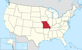 Locatie van Missouri in de VS | |||
| Situering | |||
| County | Boone County | ||
| Type plaats | City | ||
| Staat | Missouri | ||
| Coördinaten | 38° 46′ NB, 92° 15′ WL | ||
| Algemeen | |||
| Oppervlakte | 2,3 km² | ||
| - land | 2,3 km² | ||
| - water | 0,0 km² | ||
| Inwoners (2006) | 2.165 | ||
| Hoogte | 275 m | ||
| Overig | |||
| ZIP-code(s) | 65010 | ||
| FIPS-code | 02242 | ||
| Website | Officiële website | ||
| |||

Ashland is een plaats (city) in de Amerikaanse staat Missouri, en valt bestuurlijk gezien onder Boone County.
Demografie
Bij de volkstelling in 2000 werd het aantal inwoners vastgesteld op 1869.[1] In 2006 is het aantal inwoners door het United States Census Bureau geschat op 2165,[2] een stijging van 296 (15,8%).
Geografie
Volgens het United States Census Bureau beslaat de plaats een oppervlakte van 2,3 km², geheel bestaande uit land. Ashland ligt op ongeveer 275 m boven zeeniveau.[3]
Plaatsen in de nabije omgeving
De onderstaande figuur toont nabijgelegen plaatsen in een straal van 20 km rond Ashland.
 Ashland
 Hartsburg (10 km)
 Holts Summit (19 km)Jamestown (19 km)Lake Mykee Town (17 km)Lupus (19 km)
 New Bloomfield (16 km)
Externe links
- (en) Statistieken, kaarten en andere informatie over Ashland op city-data.com
- City of Ashland
- Daniel Boone Regional Library - Southern Boone County Public Library
- Southern Boone County R-1 School District
Bronnen, noten en/of referenties


