Handikhola
| gaun wikas samiti |
 |
| Państwo |  Nepal Nepal
|
| Strefa | Narajani |
| Dystrykt | Makwanpur |
Populacja (2001)
• liczba ludności |
17770
|
Położenie na mapie Nepalu |
 27°25′N 84°54′E/27,416667 84,900000 27°25′N 84°54′E/27,416667 84,900000 |
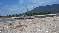
Handikhola – gaun wikas samiti w środkowej części Nepalu w strefie Narajani w dystrykcie Makwanpur[1]. Według nepalskiego spisu powszechnego z 2001 roku liczył on 3155 gospodarstw domowych i 17770 mieszkańców (8900 kobiet i 8870 mężczyzn)[2].
Przypisy
- ↑ Index of Geographical names of Nepal - Central Development Region - Volume II. National Geographic Information Infrastructure Programme. [dostęp 2010-09-27]. (ang.).
- ↑ VDC’s population. National Association of Village Development Committees in Nepal (NAVIN). [dostęp 2020-10-12]. (ang.).
Dystrykt Makwanpur
- Stolica dystryktu: Hetauda
Jednostki
administracyjne
dystryktu | - Agara
- Ambhanjyang
- Bajrabarahi
- Basamadi
- Betini
- Bhaise
- Bharta Pundyadevi
- Bhimfedi
- Budhichaur
- Chitlang
- Churiyamai
- Daman
- Dandakharka
- Dhimal
- Fakhel
- Faparbari
- Gogane
- Handikhola
- Hatiya
- Hetauda
- Hurnamadi
- Ipa Panchakanya
- Kalikatar
- Kankada
- Khairang
- Kogate
- Kulekhani
- Makwanpurgadhi
- Manahari
- Manthali
- Markhu
- Namtar
- Nibuwatar
- Padam Pokhari
- Palung
- Raigaun
- Raksirang
- Sarikhet Palase
- Shikharpur
- Shreepur Chhatiwan
- Sisneri Mahadevsthan
- Sukaura
- Thingan
- Tistung Deurali
|
|---|


 27°25′N 84°54′E/27,416667 84,900000


 Handikhola