Sir Hugh Rose Island
 | |
| Kontynent | |
|---|---|
| Państwo |
|
| Akwen | Ocean Indyjski |
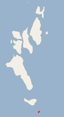
| Archipelag | Ritchie |
| Powierzchnia | 0,6 km² |
Położenie na mapie Andamanów i Nikobarów  | |
Położenie na mapie Indii  | |
 11°46′36″N 93°05′34″E/11,776667 93,092778 11°46′36″N 93°05′34″E/11,776667 93,092778 | |


Sir Hugh Rose Island często nazywana również Hugh Rose Island lub Koichowa-Bar to najbardziej na południe wysunięta wyspa Archipelagu Ritchie w Andamanach.

- p
- d
- e
Wyspy Archipelagu Ritchie
|