Carrollton, Illinois
| Carrollton | |
| city | |
 Domstolsbyggnaden | |
| Land |  USA USA |
|---|---|
| Delstat | Illinois |
| County | Greene County |
| Höjdläge | 189 m ö.h. |
| Koordinater | 39°18′8″N 90°24′25″V / 39.30222°N 90.40694°V / 39.30222; -90.40694 |
| Yta | 4,9 km² (2010) |
| - land | 4,9 km² |
| - vatten | 0,0 km² |
| Folkmängd | 2 484 (2010) |
| Befolkningstäthet | 507 invånare/km² |
| Tidszon | CST (UTC-6) |
| - sommartid | CDT (UTC-5) |
| ZIP-kod | 62016 |
| Riktnummer | 217 |
| FIPS | 1711462 |
| Geonames | 4235288 |
  Ortens läge i Illinois | |
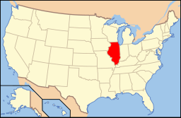 Illinois läge i USA | |
Carrollton är administrativ huvudort i Greene County i Illinois.[1][2] Vid 2010 års folkräkning hade Carrollton 2 484 invånare.[3]
Källor
- ^ Illinois County Map with County Seat Cities. Geology.com Geoscience News and Information. Läst 15 augusti 2017.
- ^ Carrollton, IL. Map Quest. Läst 15 augusti 2017.
- ^ 2010 Census Population of Carrollton, Illinois Arkiverad 15 augusti 2017 hämtat från the Wayback Machine.. Census Viewer. Läst 15 augusti 2017.
Bilder & media
|


