Darlington, Wisconsin
| Darlington | |
| city | |
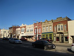 Main Street | |
| Land |  USA USA |
|---|---|
| Delstat | Wisconsin |
| County | Lafayette County |
| Höjdläge | 265 m ö.h. |
| Koordinater | 42°40′59″N 90°7′3″V / 42.68306°N 90.11750°V / 42.68306; -90.11750 |
| Yta | 9 km² (2010) |
| - land | 5 km² |
| - vatten | 4 km² |
| Folkmängd | 2 451 (2010) |
| Befolkningstäthet | 490 invånare/km² |
| Tidszon | CST (UTC-6) |
| - sommartid | CDT (UTC-5) |
| ZIP-kod | 53530 |
| Riktnummer | 608 |
| FIPS | 5518875 |
| Geonames | 5250121 |
  Ortens läge i Wisconsin | |
 Wisconsins läge i USA | |
Darlington är administrativ huvudort i Lafayette County i Wisconsin i USA.[1][2] Vid 2010 års folkräkning hade Darlington 2 451 invånare.[3]
Källor
- ^ Wisconsin County Map with County Seat Cities. Geology.com Geoscience News and Information. Läst 7 november 2017.
- ^ Darlington, WI. Map Quest. Läst 7 november 2017.
- ^ 2010 Census Population of Darlington, Wisconsin Arkiverad 7 november 2017 hämtat från the Wayback Machine.. Census Viewer. Läst 7 november 2017.
Bilder & media


